


- Distance
- 1.63km
- Total Ascent
- 157m
- Time
- 40-60min to summit
- Grade
- Easy
- Access
- On Summit Road, midway between Okains Bay Road and Le Bons Valley Road
- Map
- BX25
- Notes & Map
- otepatotu-reserve-banks-peninsula (pdf, 562 KB)
- GPX File
- otepatotu-reserve-banks-peninsula (gpx, yo 8 KB)
- Your device does not support GPX files. Please try a different device.
Where fairies reside
If a relatively easy and short hike through a remnant forest, typical of the forests that once covered 90 per cent of Bank Peninsula, is to your liking, then you mustn’t pass up the opportunity to wander the trails of Otepatotu Reserve.
Loosely translated as ‘Place of the Fairies’, this, and the reserve’s scenic wonders, should be enough to attract children and adults for a look-see when traversing the Summit Road between Hilltop and Akaroa.
It stands above the highway just north of the road to Le Bons Bay and offers the complete package when it comes to the tick-list for a family outing – excellent picnic area, fantastic views, a good track (sometimes muddy), and a rapidly changing forest mosaic that will keep all comers entranced with its beauty and diversity.
We covered the bases when we visited recently and rapidly ascended the windy trail to the summit at Lavericks Peak (755m), just 150m higher than the roadside car park.
It’s a toss-up between two superlatives when you visit here; is it the views or the forest diversity which claim first prize? I can’t make a decision, even though I have been here more than once.
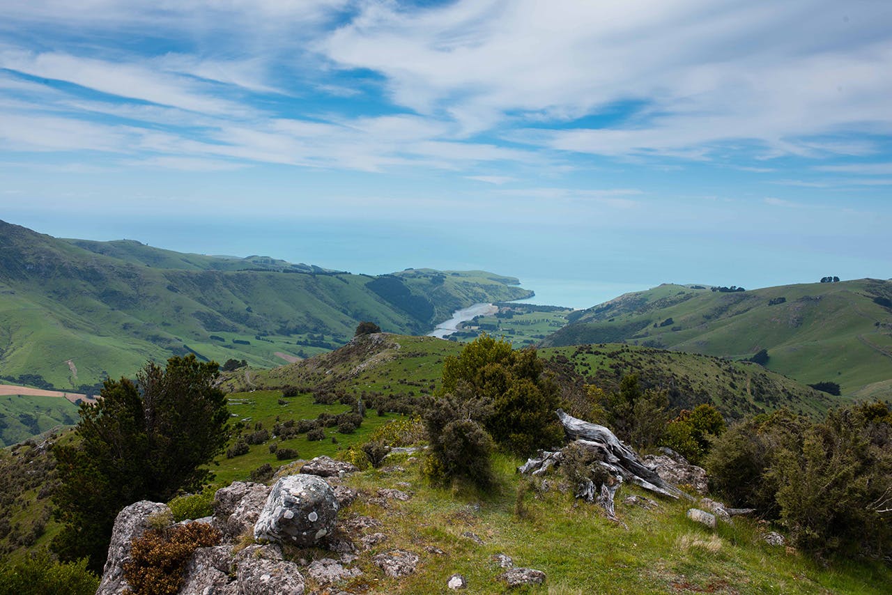
View from the summit. Photo: Pat Barrett
The view just improves beyond all expectation. At the flat summit, which is encircled by columns of basalt cliffs and presents a formidable aspect when seen from the road, there is a complete 360-degree panorama of rocky tors, steep farmland, vegetated gullies, beach, bay, and ocean. There’s even room on the summit for a second lunch stop, so long as the wind isn’t howling.
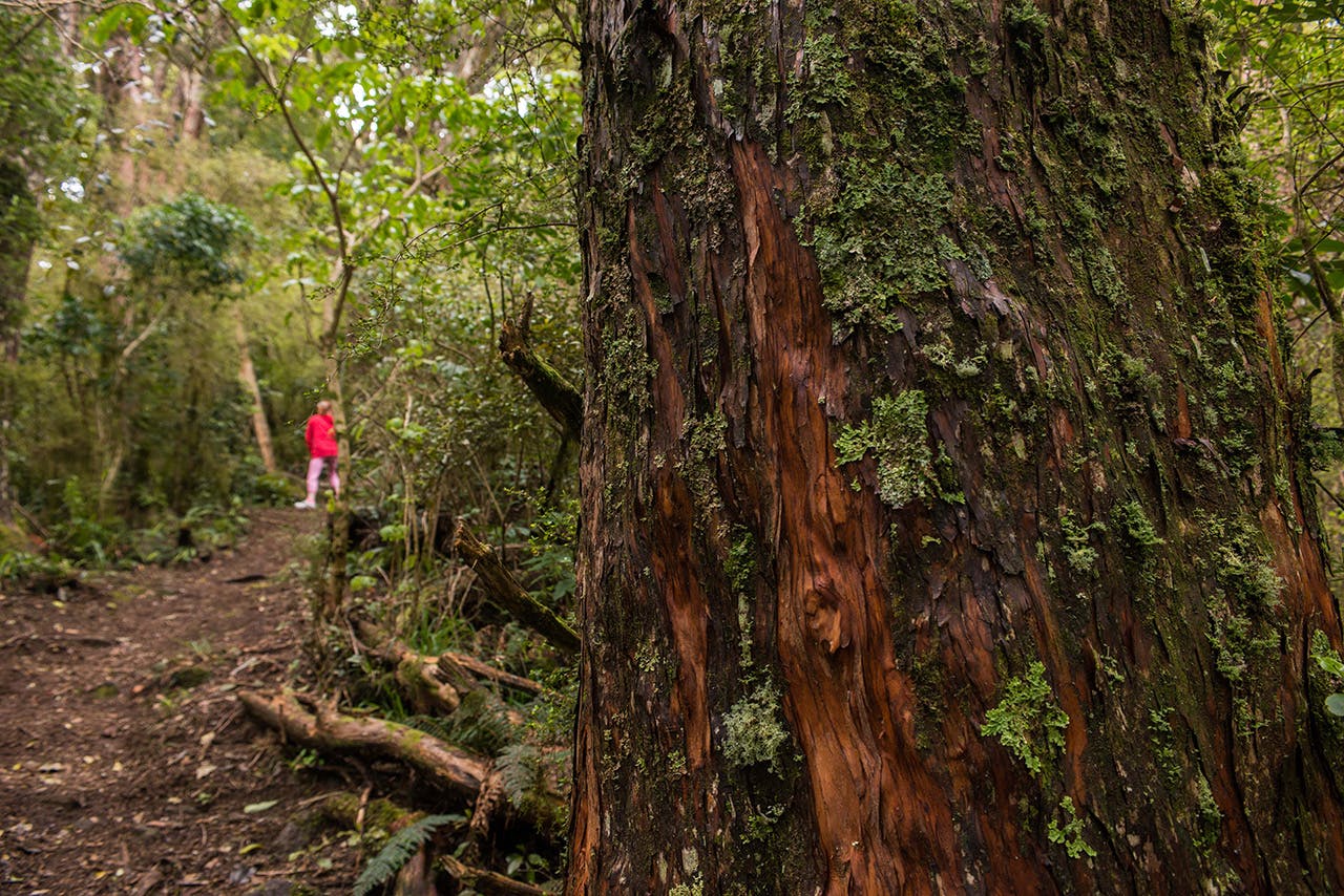
Then there’s the forest. Dry and shrubby down low, it morphs into a full immersion in the cloud forest as you reach the bluffs and quickly realise that it’s now very damp both underfoot and around you where mosses, ferns, and lichen predominate. Straight-trunked totara guard the path like a pack of loose forwards, hemming in the trail and marking out the way ahead. Wands of ferns hang from branches and, if it’s a cool and cloudy day, mist will be drifting through the trees, a spectre of gloom coating all with moisture. Great ambiance I can guarantee, where fairies may reside – if you fancy.
Beyond the summit, the track continues east along and then down a fenceline, steeply at first. It then enters the canopy forest on the south side of Lavericks Peak where broadleaf, fuschia, mountain holly, and five finger compete for space. The track angles off into a shallower decline farther down and then intersects with the upward trail which returns to the car park.
Once into it, our kids loved the walk and especially the sense of discovery at every bend. They raced on ahead, while I was taking pictures, so I had to hoof-it up the track to find them before they were claimed by some forest goblins which seem to go with the territory here. We didn’t see any, but you might….
