Traverse Sanctuary Mountain, look and listen for native birds, and immerse yourself in a conservation success story.
Maungatautari (797m) is one of a cluster of extinct volcanoes, including Pirongia, Karioi and Kakepuku, whose outlines define the Waikato skyline. The mountain sits to the south-east of Cambridge, tucked into a kink in the Waikato River.
Thanks to the vision and collaboration of the local community, landowners, iwi and council, Maungatautari has become a large ecosanctuary (roughly 34kmᒾ) enclosed by 47km of predator-proof fence. The bush has regenerated rapidly and native forest birds have returned to the area either naturally, or through successive reintroduction efforts that include North Island brown kiwi, North Island kōkako, the hihi stitchbird and the titipounamu rifleman. The Over the Mountain Track (OTM) provides access to a thriving ancient ecosystem and a conservation success story.
To approach the track from the south, start from the Manu Tīoriori Visitor Centre car park. Look for the stepped entrance in the punga fence just to the right of the check-in sign. Keep left, and after 50m pass through the double-doored access gate and boot-cleaning station. Follow the 4WD road for about 550m, keeping the predator-proof fence of the southern enclosure on your right. Once you reach two gates, take the left-hand route to join Wairere Traverse, a metalled quad-bike track, which enters the bush.
At the 1.5km mark you will reach a junction. Take the signposted Te Tonga Track on your right. This marks the start of the OTM track, which crosses three named high points: Rocky Outcrop (660m), Pukeatua (753m) and finally Maungatautari. The track is clearly marked with firm footing, although there are some steep sections and plenty of tree roots to navigate throughout.
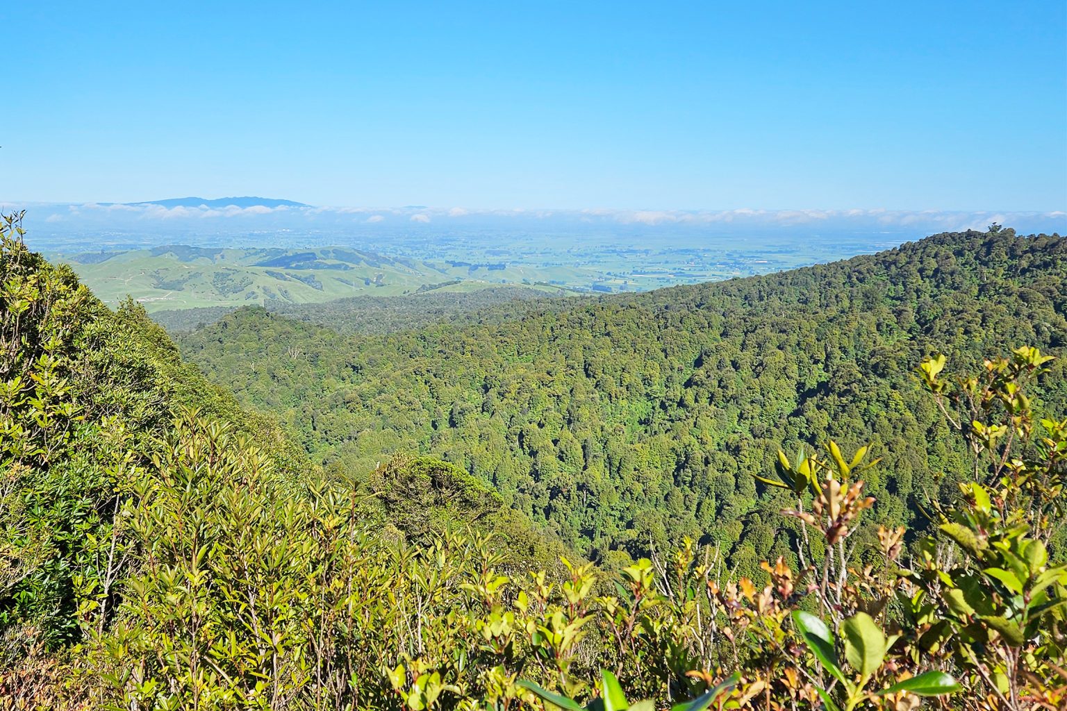
Rocky Outcrop is at the 3.2km mark. Take a moment to enjoy the unobscured views, the best on the track, with Hamilton and Pirongia visible to the west and Arapuni, Ruapehu and Ngāuruhoe to the south. A short scramble down the far side is followed immediately by a steep 120m ascent of Pukeatua, the top of which can be reached by a short side trail.
After Pukeatua, continue north through uninterrupted bush. There is an abundance of tūī, and curious tīeke saddlebacks, toutouwai robins and pīwakawaka are never far from the trail. From time to time you may see clusters of popokatea whiteheads and, if you are lucky, hear the haunting call of a North Island kōkako.
At 6.1km, the track ascends to a ridgeline before emerging into a small bush-enclosed clearing with a picnic table at the summit of Maungatautari.
An extensive boardwalk section follows, then the track veers right to join stepped Te Raki Track. This descends steeply for about 1.5km before rejoining the 4WD road and predator-proof fence on the northern side of the mountain.
For the return trip to the southern car park, follow the road for about 650m before turning left to reconnect with Wairere Traverse, which is a 4WD track leading to the car park. It ascends close to the summit of Maungatautari before taking a gentler undulating route for the remainder of the journey.
For those wishing to walk one way (southbound), the visitor centre operates a weekend shuttle service to the northern access point on Hicks Road.