

Despite the popularity of the name, a search of New Zealand Gazetteer had drawn a blank, and any recorded history about this particular Mt Alexander is sparse and relates mainly to its reputation as a hard-won West Coast tramping objective.
More recently, the Herseys featured the peak’s northwest ridge route in their guidebook as a climb suitable for beginner mountaineers and those who climb only infrequently.
We had started from the trailhead car park about 19km south of Moana township on the northern shore of Moana Lake Brunner. The trail up Camp Creek was well worn, and although the topo map indicated all travel to be on the true right of Camp Creek, at one point after losing sight of the next orange triangle we found ourselves boulder hopping for several hundred metres, swapping sides several times before eventually spotting a triangle again on the true right.
(Returning the following afternoon, we would discover that our boulder hop had gone on a lot longer than necessary, but a plunge into the creek is still required. If the creek was up this would be a showstopper – or at least require a spell of nasty bush-bashing.)
Back on track, after two and a half hours that included an arduous up-and-down sidle just before the junction, we reached Camp Creek Hut.
At 750m, the hut offers a base from which to make the 1200m climb to the summit with light day packs, as well as a place to break the monster descent, which we planned to do the following day. When ups and downs along the route are taken into account, the descent from summit to car park is nearly 2300m.
A climbing friend had told me the ridgetop terrain was worth the effort and several tarns had lovely camping spots, so, with a good weather forecast, we continued lugging our packs upwards.
From the junction below the hut the trail climbed a narrow spur steeply. As we breached the treeline into the sun, the gradient only seemed to increase, leaving us struggling through dense scrub. It was a relief to make the ridge crest, reached after a bouldery sidle.
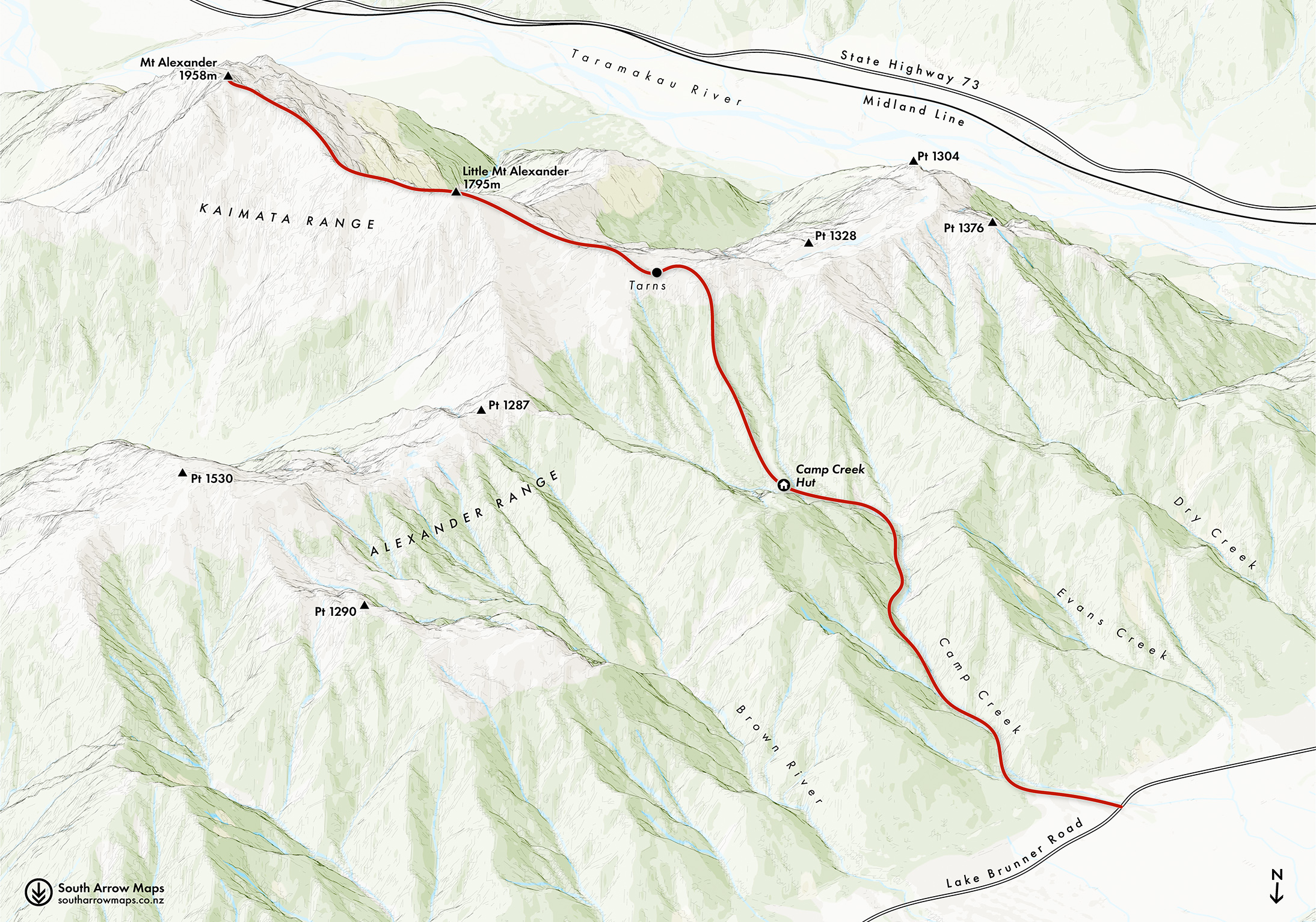
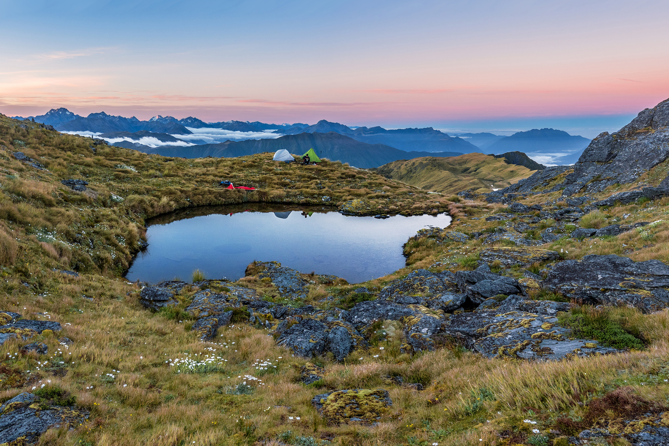
As we moved onto the broad ridge top, a tarn that is not shown on the topo map came into view, nestled in comfy-looking tussock at 1410m. With a superb view northwest, it was tempting to stop right there. Before we had set off, however, Bruce had explored satnav images that showed another tarn at about 1500m. This could only offer even better views and was 100m vertically closer to our objective.
Five and a half hours after leaving the car park we reached this tarn, less than 1km west of Pt1795 (‘Little Alexander’). What a spot: the water was clear and pure and home to a community of frogs who sang us to sleep later that evening.
With plenty of options for tents and bivvies, we were soon set up in a shallow hollow on the south side of the ridge, ready to enjoy dinner and the approaching sunset. With more time it would have been tempting to spend a second night on the tops, relocating to these larger tarns to enjoy another perspective. To reach them requires picking a route through photogenic rocky tors, which ultimately become the entire landscape beyond Pt1795.
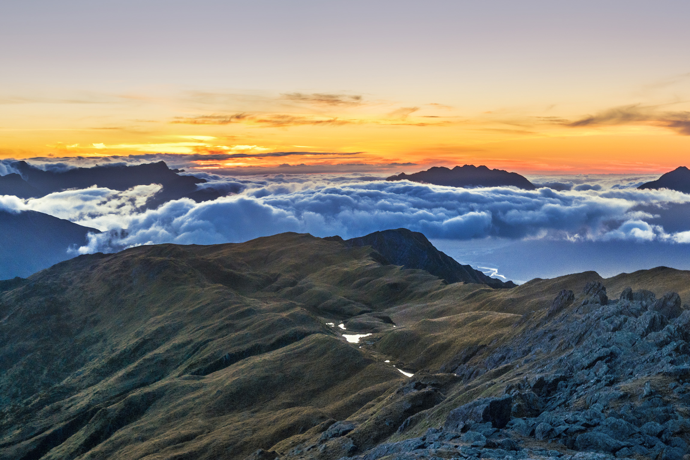
From just above our tarn camp we enjoyed views north along the Alexander Range, which branches north from Pt1795. It was hard to put our cameras down as the fading light kept offering new photographic compositions. The same was true of the dawn, which compelled us to set off on our climb the next morning a little later than planned.
We knew we had a big day ahead to reach the summit and to descend all the way back to our car. To regain a little time we decided to leave our tents up. A couple of kea had squawked nearby the previous day but had taken no interest in us, and as we set off we crossed our fingers that we wouldn’t find any holes in tents on our return.
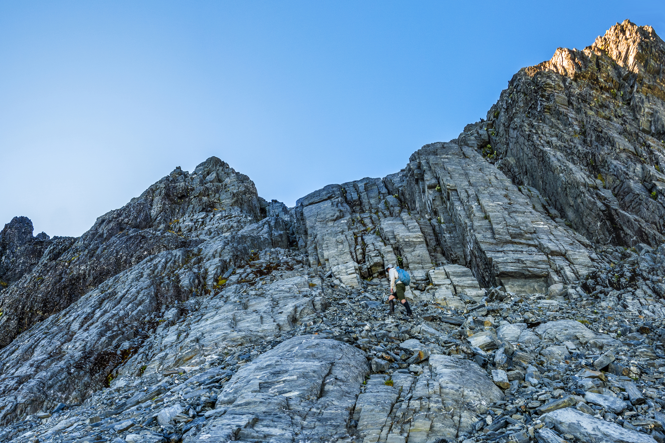
The 300m climb to Pt1795 follows an easy poled route. On top, we watched the sun rising behind ‘Alexander the Great’, an impressive and somewhat formidable sight, especially as it was time for the business end of our trip.Between Pt1795 and the summit is a narrow and often exposed rocky ridge punctuated by gendarmes that are straightforward to pass using short enjoyable sidles for the first kilometre. After that, still at 1800m, the ridge rears up more steeply. On the south side are vertical cliffs offering no sidling possibilities, but to the north lies a system of steep scree slopes punctuated by downward sloping rock slabs. This is where we opted to leave the ridge and pick our way across, angling upwards to the rocky chute at about 1900m. The chute offered many hand- and footholds and led to less-steep scree and boulders and onto a surprisingly broad summit area. We had made it.
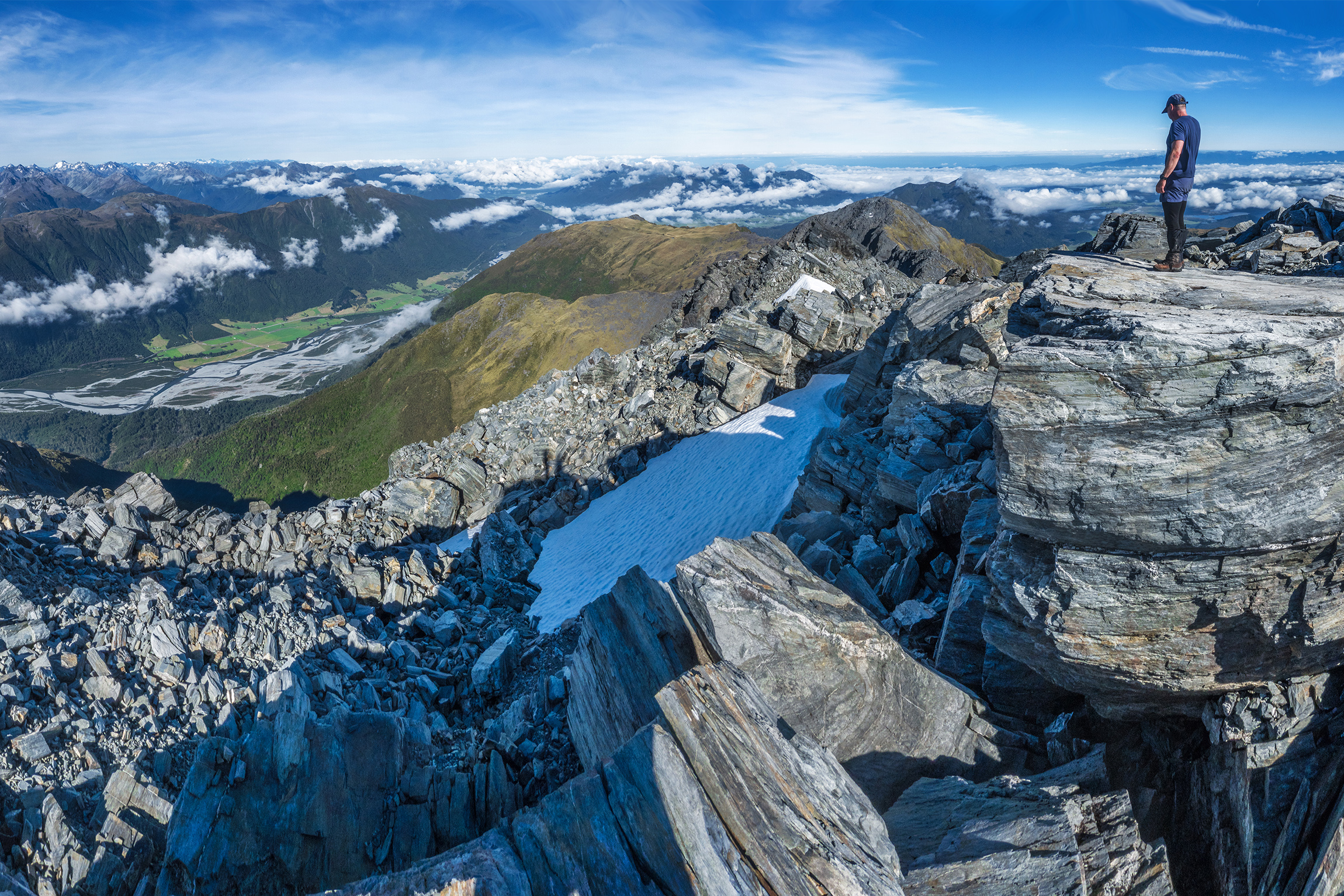
We did a quick recce, rock-hopping from west to east and taking photos in every direction, but couldn’t linger for long with the huge descent ahead of us. At 10.30am Seb led off, retracing our steps to the rock chute where he’d thoughtfully built a small cairn. Without it we might have struggled to spot the entry point.
As we descended, West Coast ‘jungle mist’ began rising from Crooked River to the northeast, and by the time we had climbed the final slope back to Pt1795 the mist was swirling along the ridgeline and around the now-distant summit, adding a sense of mystical wonder to the scene.
Back at camp we were relieved to find no signs of parrot visitation. It was hard to find the motivation to pack up and leave, but some food and cooling tarn water helped get us on the move again at 1pm. I was not looking forward to the steep descent along the scrubby spur, but by taking it slow but steady I was pleasantly surprised by how quickly the metres fell behind us. We were back at the car park at 4pm.
Considering the vertical ascent and the brutal yet accessible West Coast mountain terrain, we all agreed: climbing the tallest of New Zealand’s Alexanders had indeed been ‘great’.



