


(Listen to Anna read her story with a follow-up Q&A about the trip with our editor.)
Wild tales chase on the heels of any account of tramping on Rakiura Stewart Island: kiwi as big as cats, thigh-deep mud and sinking sand that will suck you to the depths of Doughboy Bay. These tales wind their way around the island’s three main tramping tracks – the Rakiura, North West and Southern circuits. They don’t even touch the southernmost third of the island.
For many years, whenever I gazed at the map of Rakiura my eye would be dragged past Whaka a Te Wera Paterson Inlet to those southern reaches. Remote, rugged and thickly shrouded in bush, it is practically untouched by tracks and huts. In fact, after having first been proposed in 1981, the south is currently being gazetted as a wilderness area.
The Tin Range marches down the spine of southern Rakiura to Pikihatiti Port Pegasus. On the topo map, it seems to beckon with an inviting finger. But as I started to read into routes on the range, it became clear that wild tales only grew wings down there. I read of tents whipped away by wicked winds in the night. More than one account told of sub-Antarctic mists gathering as thick as any insurmountable wall. Almost everyone agreed that to drop off the tops of the Tin Range is to resign oneself to swimming uselessly through interminable bush. A true challenge, then. I was hooked on the idea.
As I read more, I also learned scraps of the history of the southern reaches of Rakiura. The bush to the east of the Tin Range was the last refuge for kākāpō before they were moved to Whenua Hou to escape the claws of feral cats. A hardy knot of pukunui southern dotterel stubbornly continues to breed on the alpine tops. The southern tips of the range contain remnants of a doomed ‘tin rush’. What an intriguing place.
Last summer,I at last gathered a group of four friends to attempt our hīkoi south. We set aside seven days and could do little more than pray to Tāwhirimātea for good weather. Almost all trip reports mentioned chartering a boat to Port Pegasus to save on an out-and-back along the Tin Range, but a mulish part of me felt this would be cheating.
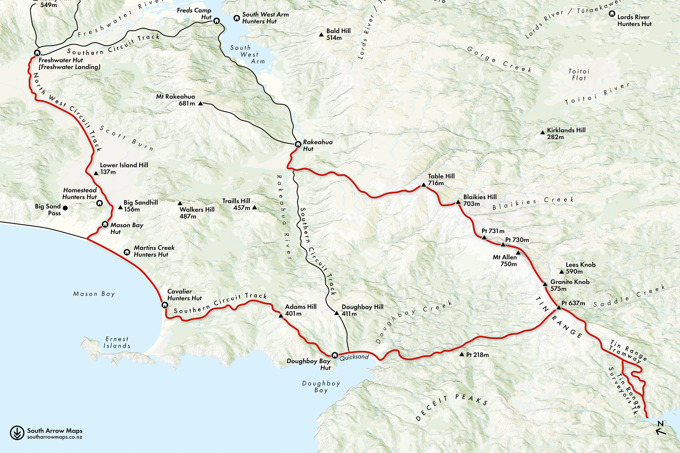
We decided to start at Rakeahua Hut, ascend the Tin Range and make our way south to Port Pegasus. We would then fashion a return loop by dropping off the range for a bush bash to Doughboy Bay, where we would rejoin the Southern Circuit to Mason Bay and finally Freshwater Hut.

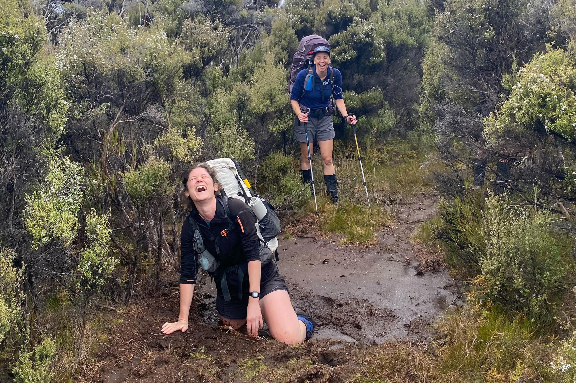
Our friend and local water taxi captain, Raki, dropped at us at Rakeahua Landing on a still, grey day. Almost immediately, Selena stepped right into one of the infamous Rakiura bogs, which sucked her in almost to the hips before she managed to haul herself out. The sticky, smelly mud clung to her for hours.
Fifteen minutes down the track we arrived at the turnoff to the Tin Range, marked by an ancient DOC sign warning hikers that the route is unmaintained.
We hauled ourselves up the light trail through the bush and pushed out into the open a couple of hours later. Having read numerous warnings about the scarcity of water on the tops, James had generously lugged a six-litre water bladder up the 400m climb, only to find a perfectly clear stream just beyond the bushline. Go figure.
In 2012 DOC drafted a Rakiura National Park Management Plan. Its descriptions of southern Rakiura are arrestingly poetic. It describes the Tin Range as ‘etched in the horizon, arising mysteriously in the distance above Paterson Inlet Whaka a Te Wera’. We made camp that night perched on the bushline just above the inlet, feeling like we’d ascended onto the ‘wild southern core’ of peace and solitude. The tops around us were broad and rolling, the ground underfoot springy and dotted with delicate white alpine flowers. We sipped celebratory bush-style margaritas to celebrate Tom’s birthday and watched as the view north towards Hananui Mt Anglem was slowly swallowed by an advancing mist.
Sure enough, when we awoke on day two, our world had shrunk. The forecast had promised a cool breeze and little to no precipitation. Instead, mist lay heavily on the hills we needed to walk over.
We set off towards Table Hill using a mix of map, compass and the topo app to keep on track. Long ago, someone had hunted down a treasure trove of obelisks, and these narrow, whitish stones, and sometimes a sturdy stick, were planted in the ground at irregular intervals.
As we climbed Blaikies Hill, the mist swelled and thickened until we seemed to be in the heart of a rain cloud. The temperature dropped and visibility shrank to less than 50m. The Tin Range was testing our mettle. By mid-morning we were cold and soaking wet. We squeezed into a leatherwood bush in the saddle between Blaikies and Mt Allen to regroup. I was wearing every item of clothing I’d packed for walking, and still my teeth chattered. We were only at 480m elevation; how was it so cold?
Over a hot brew we debated our options. No flat ground to camp here. We would have to get moving soon. Did we dare push on to the tarn in this unrelenting weather? Return to last night’s campsite and wait out this icy rain?
We decided to stay close together and push on. Tāwhirimātea was feeling generous, and within an hour the clag started to lift. We caught glimpses of piercing blue ocean to the west.
As we made our way up the swampy slopes of Mt Allen, a tiny bird zoomed in front of us then scuttled sharply to the left. A pukunui! We picked our way carefully along the route, watching our feet and allowing the bird to draw us away from its nesting ground. In the course of the day we would see 10 pukunui, roughly 10 per cent of the entire population.
By lunch, we were enjoying scraps of sunshine by the unnamed tarn beneath Mt Allen. By late afternoon I had gone from having numb fingers to a sunburnt nose. We found a campsite just beyond Granite Knob, overlooking the swathe of bush gliding towards the eastern coast of Rakiura. A scattering of huge mounds rose out of the land below, each bearing a magnificent cap of granite that, at some point long ago, had cracked into dragon scales.
We were within half a day’s walk of the southern end of the Tin Range. All going to plan, we would set up camp at the old McArthurs Creek dam before lunch the following day. Bearing out that bitterly cold weather six hours earlier had been worth it.
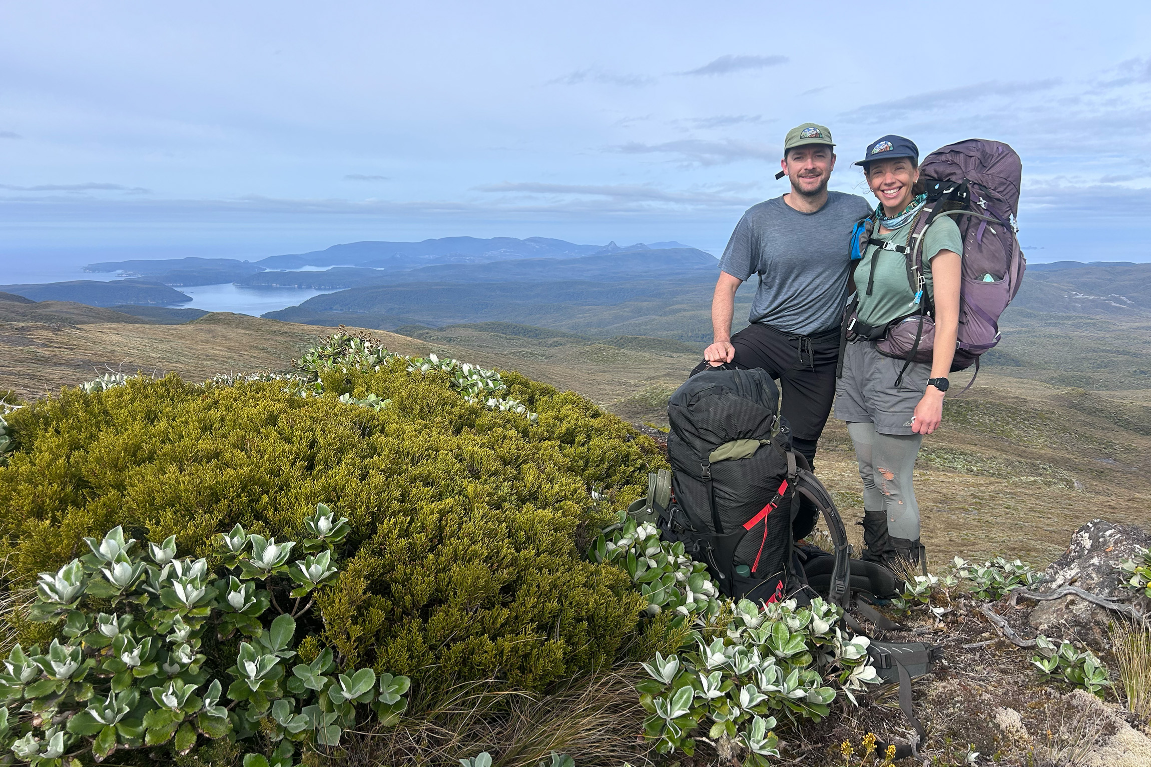
Our final leg of the Tin Range got off to an excellent start when Anni startled a kiwi nosing around the flat tops high above the headwaters of McArthurs Creek. I spared a thought for the miners as we made our way down Tin Range Surveyors Track. When it was cut, incessant rain combined with the peaty ground had made the track a veritable mud slide, but here we were, stripping off layers as we descended excitedly to the coastline. The day was bright, with blue overhead and barely a whisper through the rimu surrounding us.
When we reached the bush-clad shore I spied the perfect little swimming cove, but reared back in shock as a sea lion suddenly appeared in the very spot I was eyeing up, giving me a stern look before sinking beneath the surface again. We settled for lunch on the bank and admired the dappled water through the trees.
As I munched a tuna wrap I contemplated the view. To our south-west were the Fraser Peaks and the two granite majesties of the range, Kaka-kura and Tu-pouri (commonly known as Gog and Magog). We resolved to return with more time or a packraft.
After two nights of questionable camping sites, the dam at McArthurs Creek felt like a palace. We bathed in the creek and had a leisurely dinner in the level clearing. We had achieved our main objective, to tramp the Tin Range, but we knew the next two days could well prove the most challenging.
We had found just one account of a route to Doughboy Bay, and it was hardly encouraging, grimly stating ‘good luck’ to those foolhardy enough to attempt to make their way through 15km of dense bush.
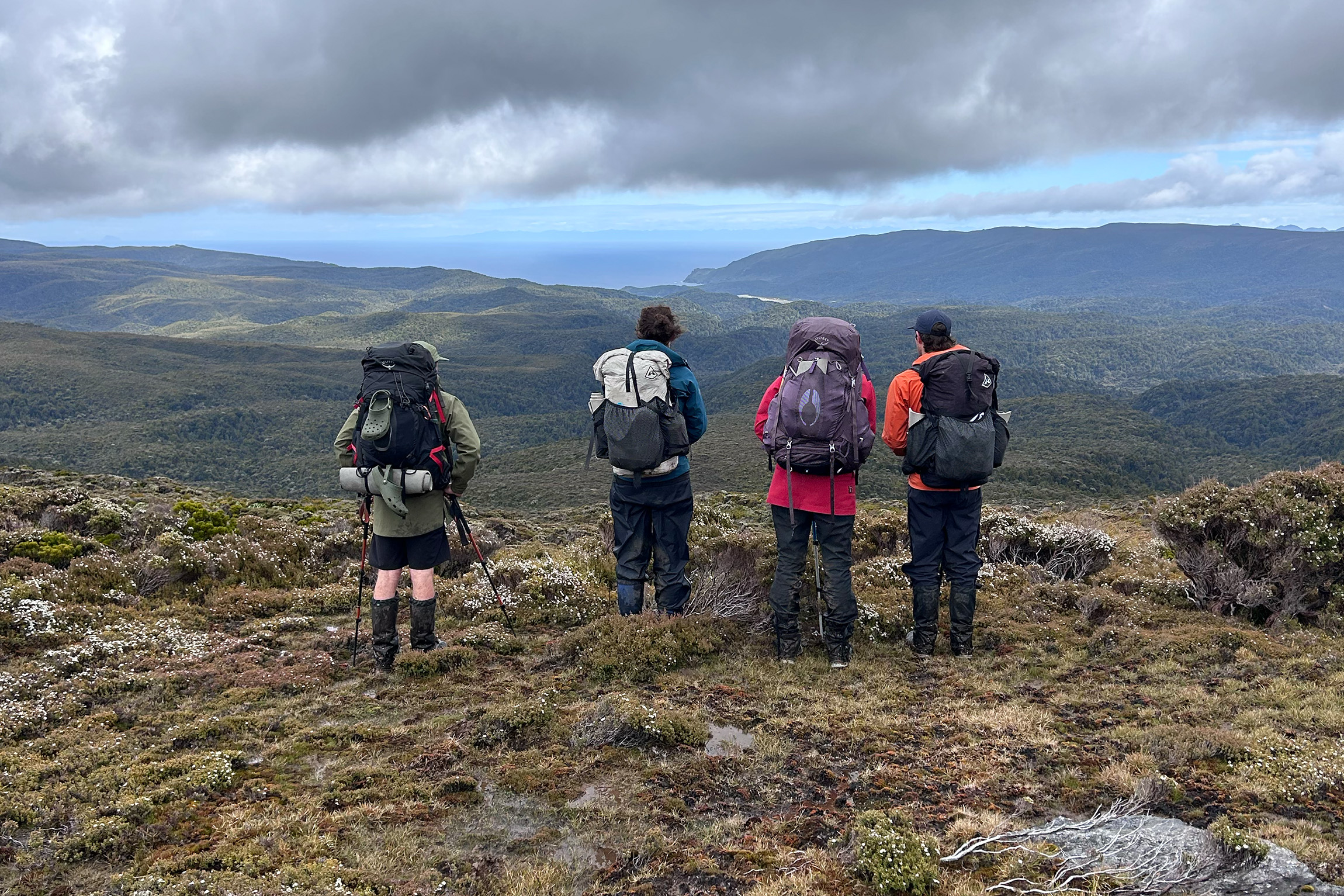
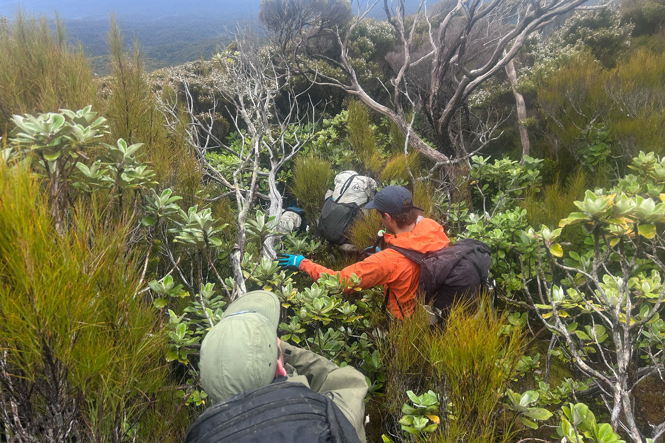
Our first taste of Rakiura bush-bashing started mid-morning the following day. We’d trudged back up to Pt637 on the Tin Range, and as we dropped a couple of contours towards the west we popped out of the swirling clag. The views opened up to a riot of valleys below with no easy way out to the coast. We braced ourselves and pushed into the alpine scrub. It required full commitment: eyes scrunched up, feet scrabbling, shoving our way through the leatherwood.
Somehow, we managed to find a rhythm. Although that first band of bush was definitely the worst, the forest remained largely implacable. We delighted in finding occasional ancient trail markers – never enough to rely on, but sufficient to feel validated in our route choices. They came in all sorts: green rope, strips of blue plastic, fishing net, orange twine, the tiniest scraps of pink tape. On occasion in particularly thick bush we followed blazes. It became a treasure hunt, triumph rippling through all of us when someone found the next mark.
It took two full days to reach Doughboy Bay. We arrived weary, bruised and bubbling with pride, and broke out onto the sand dunes, whooping with delight. We’d tramped an epic five days without seeing a soul. A kiwi scampered under our feet in the broad afternoon sunlight, at first perturbed and then rather carefree as we stalked behind it. We trudged along the crescent bay towards Doughboy Hut, skirting the infamous patch of sinking sand.
The hut was crammed with herpetologists on holiday, hoping to spot the rare harlequin gecko, tukutuku rakiurae. We devoured dinner al fresco, cheerfully ignoring the rain dripping through the trees overhead.
Doughboy Bay was the warm-up, I thought to myself, as we made a start along Mason Bay on day six. The bay spans 14km in total, although thankfully the Southern Circuit travels less than half of that. The hard sand was unforgiving, as was the wind that whipped grit into our eyes.
Māori call it Te Oneroa, the long beach. They’ve been coming here for eons. An intricately carved tauihu (canoe prow) discovered at Mason Bay is thought to be pre-European, and The Gutter, a spectacular inlet at the southern end of Te Oneroa, has yielded discoveries of buried waka, middens and other evidence that point to this beach being one of the southernmost prehistoric Māori settlements in Aotearoa.
On our hīkoi, all we saw was ocean trash. Bits of green rope and strips of pale blue packing plastic caught my eye. They looked familiar, and we realised the trail markers we had followed for the past couple of days must have been salvaged from this beach.
We eventually made it to Mason Bay Hut. It felt fitting that on our last night we would get to sleep in bunks. Our final day would be a mere three hours on the boardwalks of Chocolate Swamp and through mānuka flats to Freshwater Landing.
As we passed the historic buildings of Island Hill Homestead the next morning, I took stock of our trip. We had walked more than 80km, much of it through formidable mud or gloriously deep bush. We’d enjoyed the improbable experience of spotting kiwi and pukunui on the inhospitable tops of the Tin Range, and we’d sighted the mystical granite figures of Kaka-kura and Tu-pouri rising above the southern reaches of Pikihatiti Port Pegasus. As promised by all the tales I’d collected over the years, it had been a journey through time; a glimpse of Aotearoa through the ages.
In 1882, gold was found in Pegasus Creek – not much, but enough to entice some hardy souls over the rugged ranges to try their luck. The ‘tin rush’ started in 1888 when two locals from Halfmoon Bay, George Swain and James Thomson, found a handful of ‘miners rubies’ – black grains of tin mixed with red garnets. Samples sent off for examination were declared promising, parties started pegging out claims, and word spread.
The valleys folded between Pegasus and the Tin Range were harsh. The dense bush pushed back on all efforts to cut tracks, the weather was reliably awful and the location seriously remote. Some prospectors arrived by boat, others dragged themselves through the leatherwood via the overland route.
The lure of fortune proved enough for 240 men to set up camp at the heady height of the rush. Louis Rodgers built a general store, a post office and a hotel. By late 1890 – just two years later – most miners had abandoned the site and Rodgers was bankrupt.
There were a couple more flutters of excitement over the next few years, including a ludicrous venture to erect hydraulic sluicing infrastructure in 1912, but to no avail.
All in all, the Tin Range yielded about one tonne of the tin oxide mineral cassiterite, a measly amount compared to the effort it demanded of those who dared to dream.
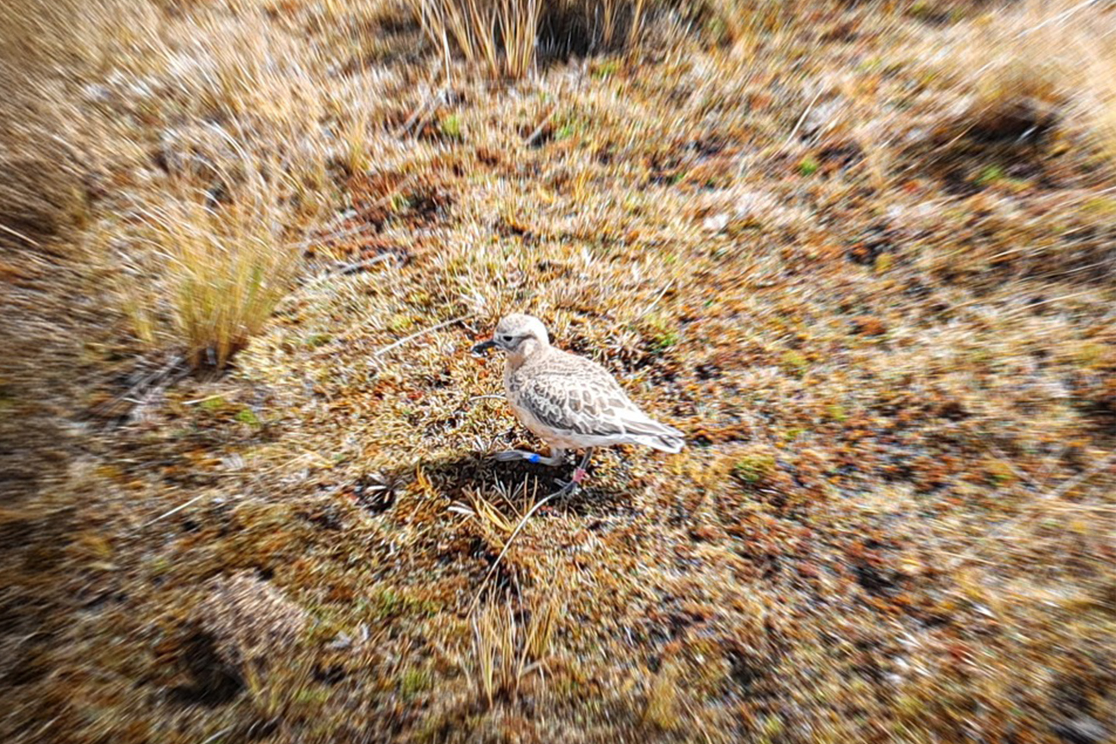
Over the last two decades, DOC has operated a campaign to save the critically endangered pukunui southern dotterel.
Once widespread across Te Waipounamu and Rakiura, in 2024 only about 100 birds remained. In pre-colonial times pukunui would breed as high as 2500m in the Southern Alps; they have now settled on the Tin Range as a breeding ground. They spend the breeding season nesting in cushy alpine moss or rocky hollows, their breasts fading from a rosy reddish-orange to pale white.
Feral cats continue to decimate this tiny cluster of pukunui, and were estimated to have killed up to 50 birds in the 2023 breeding season alone. Whitetail deer too, typically seen within 400m of the shore, have been caught on camera on the alpine tops of the range, snacking on dotterel eggs.
During breeding, pukunui keep a sharp eye out for predators (including humans). When one approaches, the birds often fake a broken wing and limp away in an effort to lure the threat away from the nest. If you witness this yourself, the advice is to step carefully to avoid trampling on any nests and to exit the area.
DOC’s efforts to save the pukunui are ongoing and aim to boost the population to 300 by 2035. The most effective tool to do so is through predator control, with a focus on feral cats. If you’d like to support the Pukunui Recovery Project donate at nznaturefund.org.



