


(Listen to Matthew read his story with a follow-up Q&A about the trip with our editor.)
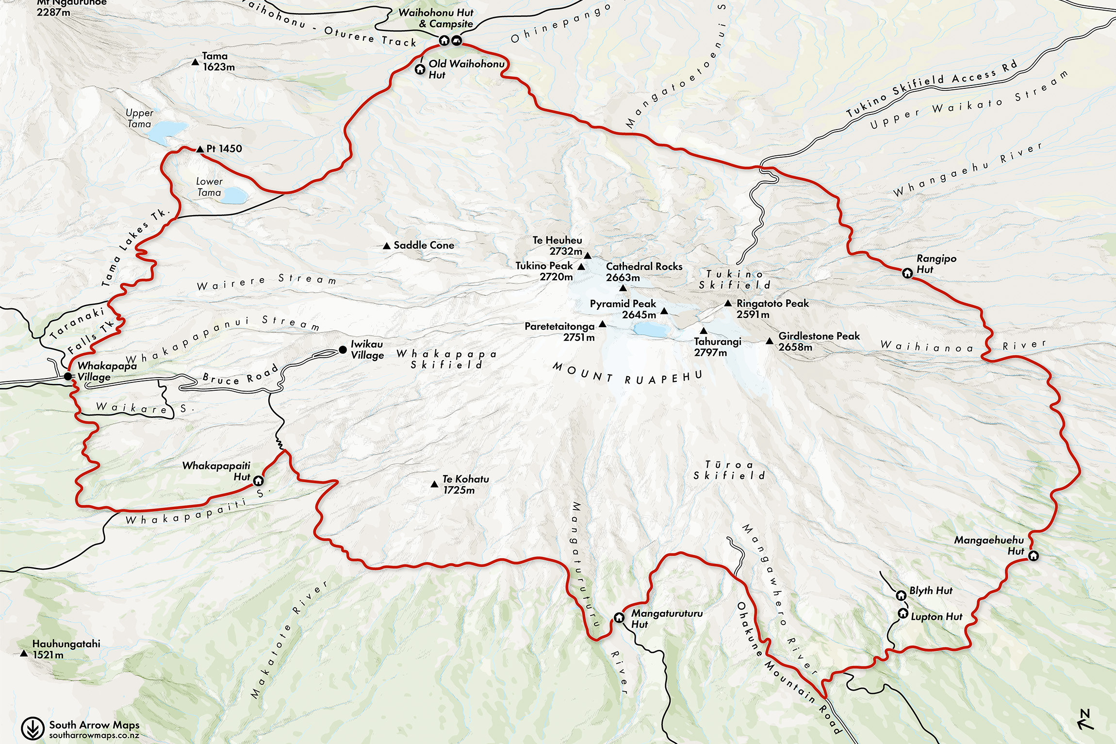
’Tis a trail of two halves. East and west, sunrise and sunset, a circumnavigation of the North Island’s mightiest maunga. Round the Mountain has long been on my list. It’s the more challenging of Tongariro National Park’s multi-day routes, the lower, larger half of the figure-eight track network surrounding the iconic trio of volcanoes.
As the first leaves of autumn begin to fall, my wife Agustina and I set off south, lured by an outstanding forecast and the promise of solitude in the mountains. It’s our first getaway together since our wedding in January, and we joke that our ‘honeymoon hike’ will involve massive days, dehydrated meals and sharing our room with dozens of strangers. Oh, the romance.
It’s a 2.5hr walk to Whakapapaiti Hut, and in the soft light of afternoon I’m already entranced as we ascend the valley’s sweeping boardwalks. Ruapehu, known affectionately as ‘Koro’ to its people, hides beneath a hat of cloud, its tussock slopes clad in pockets of beech. We reach Whakapapaiti Stream and follow it to the hut, which is full of walkers rustling, boiling and bantering. We eat dinner outside as the mountain fades from bronze to crimson to midnight blue. The mournful cry of a ruru announces an early bedtime for all.
In anticipation of a 10hr day, we depart at dawn. A fog has ensnared the lower slopes, but sunlight on the ridges calls us onward and upward. The sunrise side of the maunga is lush and green while the west is cast in a rain shadow: dry and barren, with only the hardiest vegetation.
It’s several hours before we round a bend and gasp as we spy Lake Surprise. We begin to descend through an enchanting forest of moss and stunted beech, so lovely that its short embrace becomes one of our highlights of the hike.
After skirting the pristine lake we descend sharply to Mangaturuturu Hut. It’s taken us five hours with few pauses, so we enjoy a cooked lunch and fresh mango before pushing on.
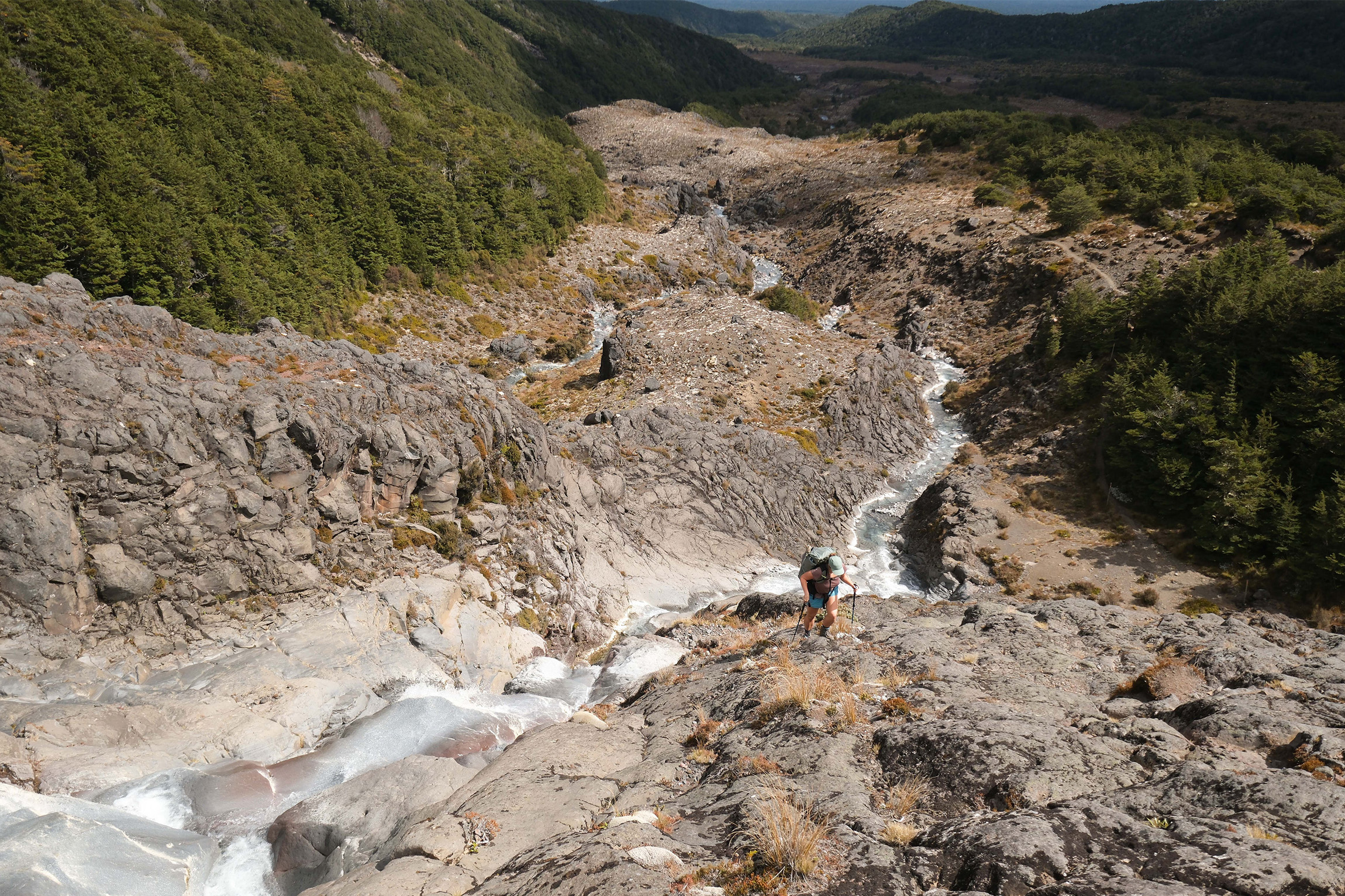
The topo warns of a sharp incline, and in the heat of the afternoon I’m dreading what’s to come. In hindsight, my fear was unfounded. The next section, known as The Cascades, is among the best of the circuit. It ascends the face of a spectacular series of waterfalls that tumble over silica-bleached rock into dreamy plunge pools. We barely feel the incline, so inspired are we by the beauty of our surroundings. But it doesn’t last. The remainder of the scramble leaves exhilarating falls behind for a baking lava field that climbs to meet tarseal, and we are deposited unceremoniously onto Ohakune Mountain Road.
Roadwalking is an experience both of us can live without, but we are grateful to be descending. We stick left, hoping to win a ride to our trailhead 3.5km down the road. Within minutes we are picked up by a couple who deliver us to the car park minutes later.
Buoyed by our good fortunes, we enjoy a short and pleasant walk that takes in the lovely Waitonga Falls and an open boardwalk section past reflective tarns. We pause for a plunge in a stream before the final push.
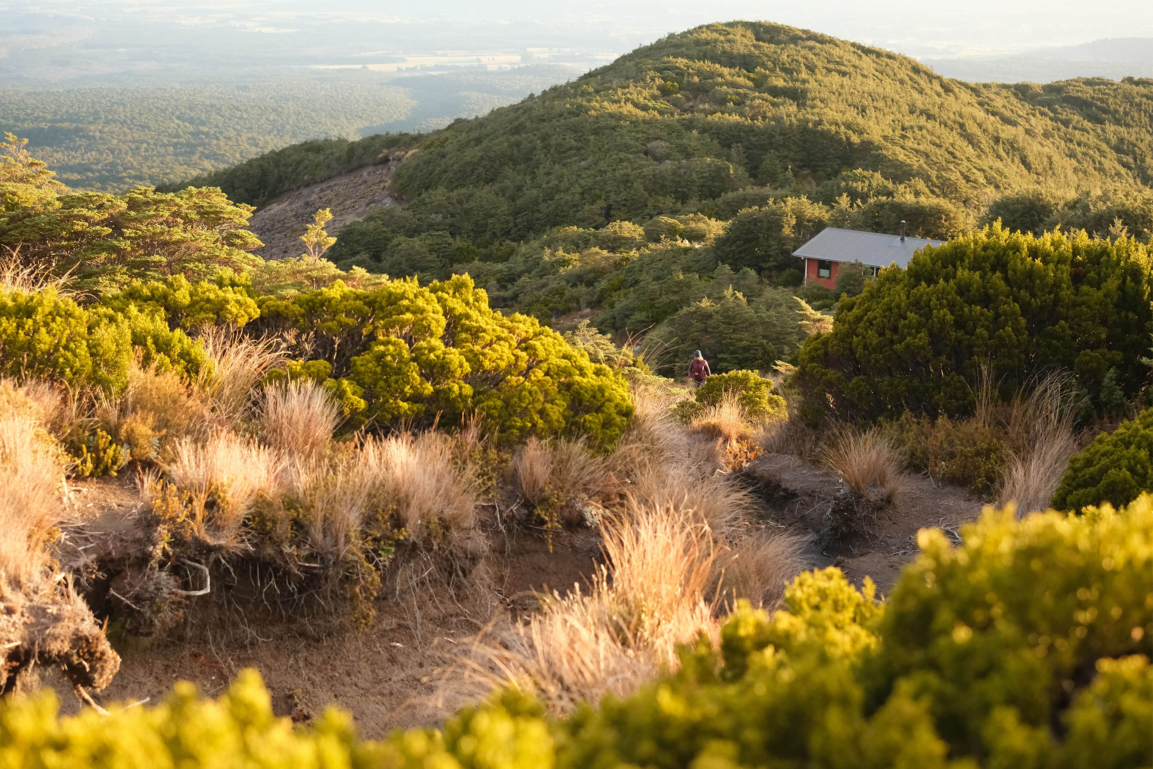
Blyth Hut, tucked below the bushline, is bustling. After dinner Agustina and I climb beyond the hut with a Danish hiker to enjoy the day’s end. In the west stands Taranaki Maunga who, after losing his beloved Ruapehu to romantic rival Tongariro, fled towards the sinking sun – red tonight as it retreats behind the volcano like a great closing eye.
Expecting another long day, we descend as Ruapehu’s morning shadow diminishes in the west and make quick time to the junction with the track that leads around the mountain’s southern flank. Boardwalks and bridges ease our passage beneath the chattering tītitipounamu, and we soon break above the golden heads of the trees to the tussockland beneath Girdlestone Peak, Ruapehu’s so-called Little Matterhorn.
It’s two hours to Whangaehuehu Hut, where we pause to snack and meet a group of teenagers from a school in Hawai`i. Walking the circuit clockwise, they are bandaging blisters and packing for their day – a short one to Blyth Hut. Having planned the trip months in advance and flown across the world, they’ve won first division in the weather lottery. The teens warn of significant ups and downs en route to Rangipo Hut, so we continue our undulating ascent, first through forest and later across arid and increasingly steep country, the beginnings of the misnomered Rangipo Desert.
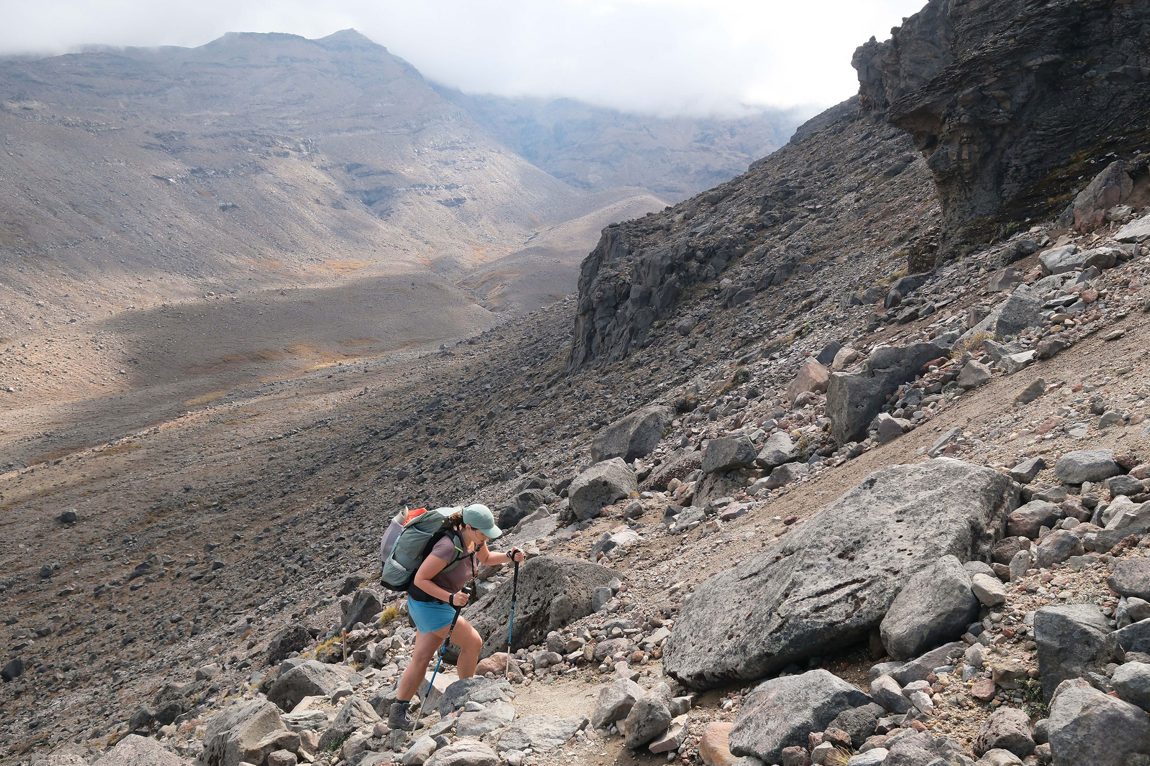
Rangipo – in te reo Māori ‘darkened sky’ – receives as much annual rainfall as Auckland, so although not a desert geologically speaking, the bleak and barren landscape certainly resembles one. The soil of scoria, pumice and ash retains minimal water and only the staunchest flora survive. The area was green and forested prior to the devastating Taupō eruption of 186AD, and what clawed through the ash and remains today are stunted hardy shrubs of tussock and raoulia, which sprout in scattered clumps like the boulders spewed from the volcano’s maw.
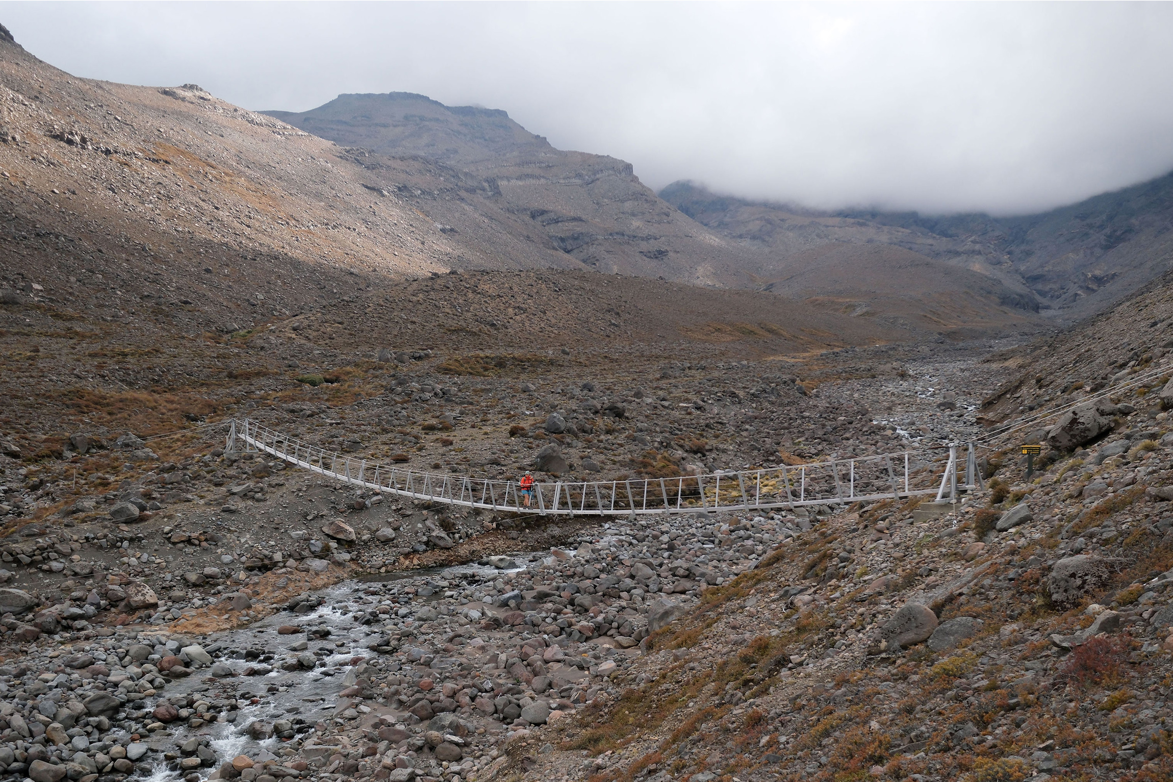
In the early afternoon we reach Waihianoa River, which is more imposing than I anticipated. Standing at the brink of the broad U-shaped valley, I’m reminded of Aoraki’s grandiose glacial landscape, where relentless freight trains of ice have left grey wastelands of defeated earth in their wake. Far below, the swingbridge spanning Waihianoa River is dwarfed by the landscape. Beyond this miniature infrastructure, our eyes follow the track that scars the face of the opposite wall, which appears vertical from our perspective. An insectile tramper puffs his pack over the rim of the broad bowl a kilometre across the void. Are these the notorious ups and downs of married life we were warned of?
The descent isn’t as steep or sketchy as earlier ones, and within 20 minutes we arrive at the bridge. Ideas of a swim are blown away by a tenacious breeze, so after lunch in the shelter of a boulder we are quickly on our hooves to mountain goat our way up and over the valley wall. It is not nearly as death-defying as it appeared, but sheer enough to suck the oxygen from my lungs.
At the top I’m breathless, dehydrated and sick of this wannabe desert. Three kilometres stand between us and Rangipo Hut. Littered with fist-sized rocks, the track demands vigilance, and as I will my body north Agustina distracts me with ‘would you rather’ questions. She’s my rock among rocks.
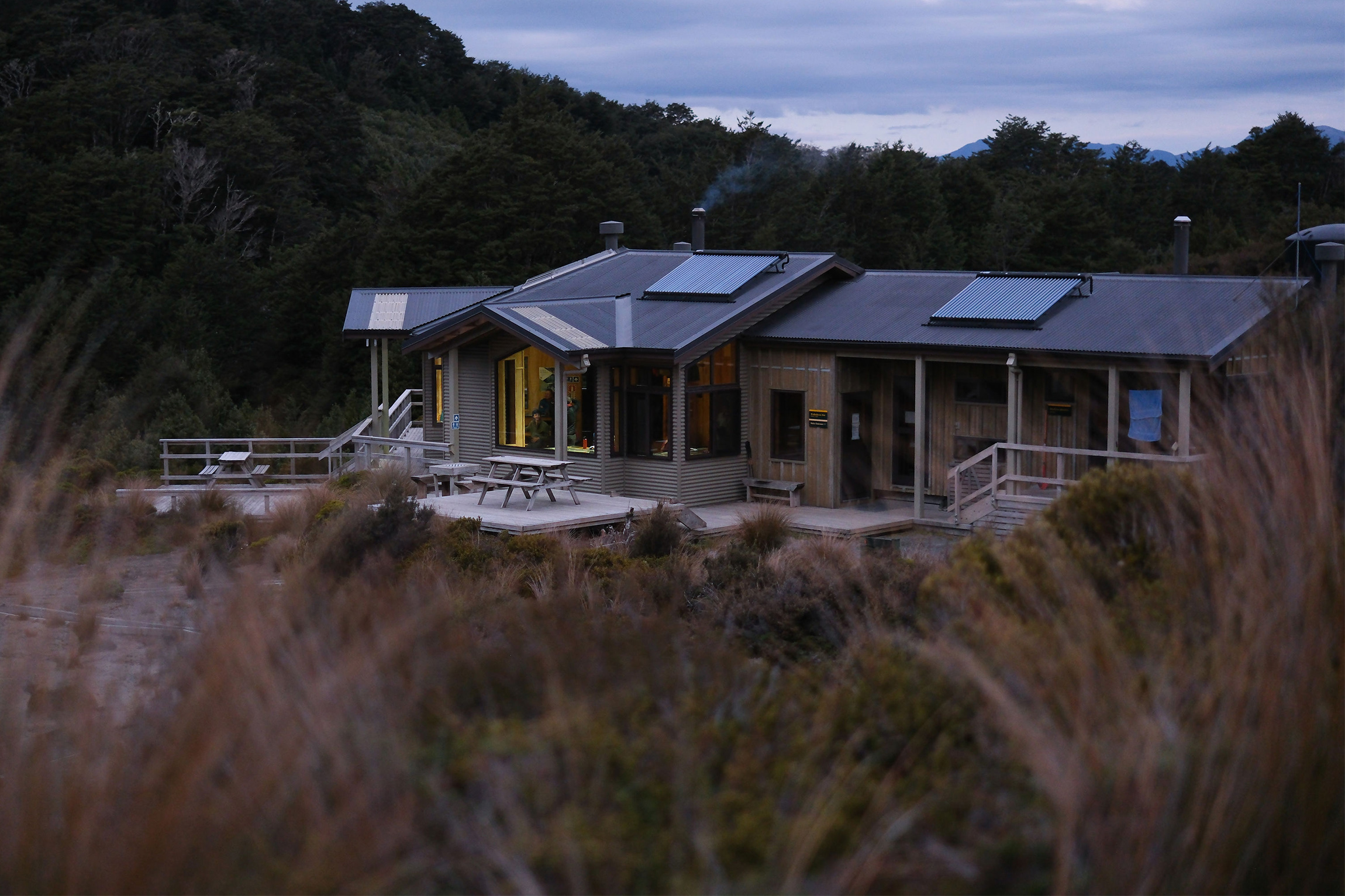
The hut finally emerges around a bend, lazy chimney smoke enticing us on. We collapse for a time on the bunks. Later, from the hut porch, the distant Kaimanawa Range is bathed in bronze as the sun ducks behind Ruapehu. Traffic inches across the Desert Road, silent and slow from our peaceful observatory, and the clouds soon draw back to reveal another star-spangled night, quiet save for ferocious snores in the bunkroom.
First light breaches the Kaimanawa peaks and sets the hut windows aflame. We have noticed a weather pattern wherein the mountain likes to attract clouds to cover its crown by noon, and there is a mass exodus of trampers keen to get moving while the sunlight lasts.
Our destination, Waihohonu Hut, lies 12.5km to the northeast, and the vast landscape ahead is awash with growing golden haze. It’s a perfect day in the mountains. Te Heuheu (2732m) is cloudless as we descend scree into Whangaehu’s lahar zone.
Infamous for its part in the 1953 Tangiwai rail disaster, Whangaehu River drains Ruapehu’s Crater Lake and has a history of violent lahars, several of which have destroyed previous iterations of the bridge we now approach. I can’t contain whoops of exhilaration when it comes into view. Strung precariously between rock faces, the swingbridge traverses inky shadows of a chasm not yet touched by the sun. Sulfur tingles our nostrils, and a light steam lifts off the grey water rushing below on its journey to the Tasman. Bouncing over the bridge causes an unnerving rush for the senses.
We exit the lahar zone and climb gradually north towards intersecting Tukino Mountain Road, where we learn that a fellow tramper turned to follow pole markers for 1.5hr off track and uphill before realising his error.
The Round the Mountain track was originally conceived and developed as a safety net of sorts, a ring of visible markers surrounding the dangerous alpine environment. This came after the 1931 death of Warwick Stanton, whose tramping group became lost in a blizzard when descending from the summit.
A sharp descent from the ski field access road reveals our path before us, stretching into the distance across desolate flatlands, Ngāuruhoe and Tongariro beyond. We start plodding, pleased to have the hard yards behind us and relatively gentle hours in front.
After so much desert it’s a relief to be reunited with scrub, which gives way to increasingly taller flora as we approach Ohinepango Springs. Emerging from an ancient lava flow, the crystal springs are an excellent short detour, and a welcome change in our drink bottles from the smoke-tinged water collected at Rangipo Hut. Several trampers we met had seen a pair of whio here, but no such luck for us.
We arrive at the hut by 2pm and bask in its luxury. With mountain views, a spacious living space and a woodburner ready to go, Waihohonu Hut is about as flash as they come. We wile away the hours until dinner as the hut fills with tramping groups and northbound Te Araroa walkers.
With the weather set to deteriorate and red-level warnings expected later in the week, we accept that our luck has finally run out when we wake to fog and cloud. We leave in the pre-dawn chill, and to our delight, the fog lifts within minutes to reveal pale blue above, pastel pinks in the east, and Ruapehu and Ngāuruhoe basking in the glow of sunrise. It seems there is a little luck left in the tank.
Bearing west towards Whakapapa, we make quick work of flat tussockland, admiring the colours and textures of the subalpine species. Blooming heather, so famous in Scottish folk songs, is particularly radiant in the dawn glow, though I later learn the invasive species has been a growing problem since its introduction to the park in 1912. We’re thrilled to see a pair of whio flying fast and low along the river highway.
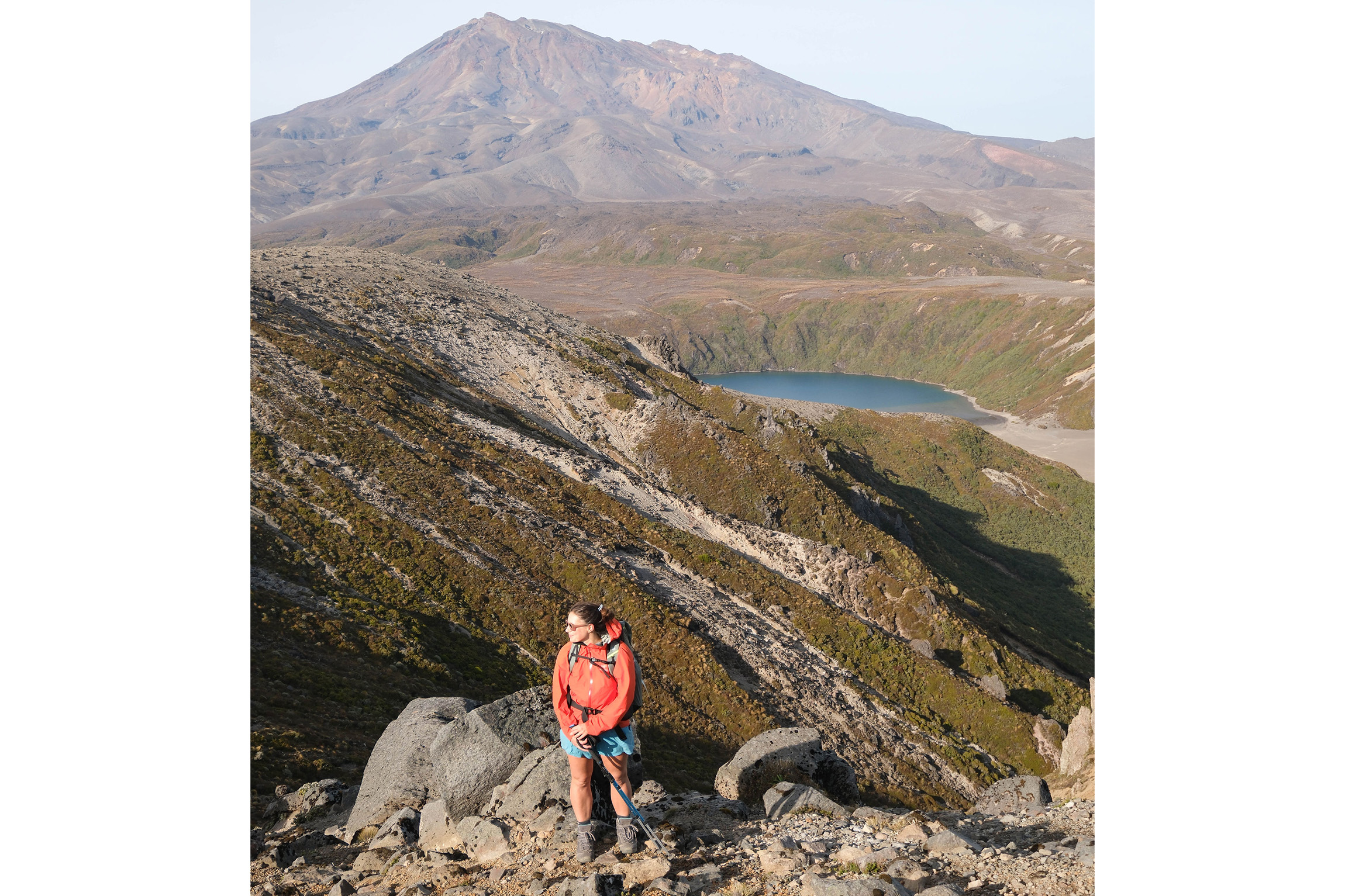
Roughly 2km before the Tama Lakes Track detour we leave the Great Walk behind and strike north to climb the ridgeline east of Lower Tama, a route I have taken before. As we round the sapphire Lower Tama Lake, we navigate an undulating and exciting ridgeline that soon delivers us to the final pole markers of the official sidetrack. From here both lakes are visible with volcanoes beyond – truly an essential detour.
We return to the main track and wind our way to Taranaki Falls where we encounter many clean and noticeably perfumed day-walkers. Having visited the falls many times, and not keen on the crowds, we opt for the upper track for the final push to Whakapapa.
My body is tired, blisters have eaten my heels, and as vengeful clouds roll in to close a perfect weather window, we start the drive home with the immense satisfaction of having finally knocked off another North Island classic – and survived a hiking honeymoon of sorts. The mountain has been good to us, and we can’t wait to return.



