Enjoy breathtaking views from precipitous cliffs and a taste of the area’s rich history.
Metalled Log Race Road leads to a car park that is often overflowing at weekends. The walks in the area draw the crowds for good reasons: sweeping views, well-formed tracks and proximity to Piha.
This walk combines Mercer Bay Loop (2.2km) with Comans and Ahu Ahu tracks. It offers elevation and a variety of terrain and vegetation, and includes northern Karekare’s quieter Union Bay.
Before setting off it’s worth browsing the interpretive panels positioned alongside remnants of the Piha Radar Station, constructed during WWII to detect any enemy aircraft or vessels that might approach the coast. The old photos give a real impression of what life was like for the men and women who lived and worked at what was an isolated outpost. Look for the plaque on a rock that marks the spot where ‘The Cosmic Noise Expedition’ of 1948 took place, when visiting astronomers determined for the first time the source of radio waves outside our solar system.
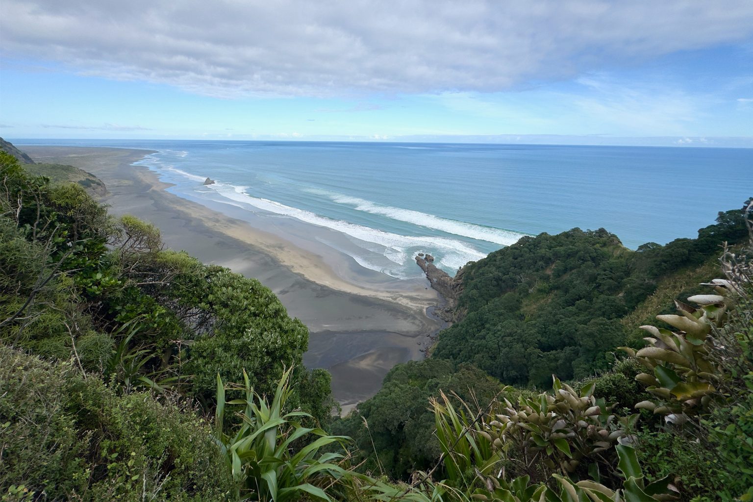
There are two entry points to the walk. This option favours the north-west that hugs the cliffs for spectacular views of the coastline for much of the descent. In good visibility you may spot Kaipara Head to the north and the dunes off Pararaha Valley and Whatipū to the south. The first vantage point that overlooks Piha is just metres past the cleaning station. The track is wide, gravelled and stepped all the way to the Karekare exit point at Union Bay.
At 940m from the trailhead, take the path to the right that leads to windswept Te Ahua Point. A short distance from the intersection is a view of the near-vertical cliffs of weathered volcanic rock that are a feature of the coastline from here to Whatipū. At over 60m, they are some of the tallest in the Auckland region.
Continue to the site of Te Ahua pā, an important stronghold and settlement for the tūpuna of today’s mana whenua Te Kawerau ā Maki. Archaeological investigation suggests the site was first occupied more than five centuries ago. A wooden pou of tūpuna wāhine rangatira Hinerangi, carved by Sunnah Thompson, faces the Tasman Sea, and an information panel tells her story.
Retrace your steps and head downhill to the start of Comans Track, named long ago after a fern that was wrongly identified as Pteris comans. It has since been found to be the common Pteris carsei, but the track name has stuck.
Enjoy dramatic views of Mercer Bay on the descent. At 2.3km there’s a chain to aid a short scramble up rocks. The regenerating bush is thickening, but it will hundreds of years before kauri reach the size of those that were felled in the early 1900s – some up to 3m in diameter. The timber from Piha Mill was dragged up the steep hill by a hauler engine and lowered down an incline to Karekare, where a beach tramway transported it to Whatipū wharf for shipping.
At 3km a log seat offers views north to Mercer Bay, and in another 200m Te Matua The Watchman emerges – a jagged 80m volcanic dome on which a fortified pā once stood.
There are some steep drop-offs as you work your way down to the cleaning station and dune track to Tāhoro Union Bay (3.8km), where there’s a perfect lunch stop next to a prominent rock on the beach.
To return, head inland and veer left up Ahu Ahu Track, a wide bridle path that climbs gradually through lush lowland forest where nīkau palms abound, then under a canopy of wind-sculpted kānuka to rejoin Mercer Bay Loop (6.71km). From here it’s 30min to the car park on the more exposed inland arm of the loop. Glance back frequently for expansive views as you go.