Mt Aurum, Mt Aurum Recreation Reserve
With a couple of midweek days to spare and no tramping partners available I need an interesting but safe solo trip. After looking at a couple of maps I settled on watching the sunrise from Mt Aurum, a 2200m peak near Queenstown.
The trip starts with the stunning drive along a narrow dirt track snaking round the hillside from Queenstown to Skippers. The track cuts deep clefts in the rock and defies gravity across the face of a vertical bluff. Rock outcrops stand sentinel above the road and water races and sluicing fields scar the hillsides.
From Skippers I walk past the ruins of the Otago Hotel down to the river. Progress is easy up Skippers Creek for a couple of hours past twisted and rusty metal which lies everywhere. An old dam blocks the river, but sluicing upstream has filled the lake. Frying Pan Creek is randomly marked by a sign attached to a bluff and leaves glisten like gold nuggets in the pools.
Eventually it’s out of the streambed and on a road constructed to bring in hardware for New Zealand’s first hydro power station. Some days the horse teams made just a few metres progress, but the large pieces of machinery at Dynamo Flat give an indication of the tenacity of the original miners.
The trail continues, rising gently through open tussock to an old water race, followed by a forest of snow tussock and giant speargrass with flowers rising to two-metres. Eventually I reach Archie’s Hut (labelled on the map as Aurum Basin Hut), a tiny four bunk hut made from flattened sluice pipe iron.
A couple of kilometres on there is good camping at the foot of Mt Aurum. I pitch my tent and settle in for an early night, only to be woken at dusk by the screech of a kea right beside the tent.
It seems just moments later that the alarm goes off at 2am. I have planned a climbing time of 300m per hour to allow for route finding in the dark and reckon the summit should be reached by 6am.
A tussock ridge at the head of the valley is followed by a sidle to the right into a gently rising gut. This tops out at 1800m on the ridge with Ballarat Stream where I put on more clothes because the night breeze is cutting straight through.
Climbing keep me warm though as I backtrack around bluffs and pick a way through herb fields and scree. There are dozens of insects, mainly moths and beetles, but even a weta. How do they manage to thrive in this cold environment?
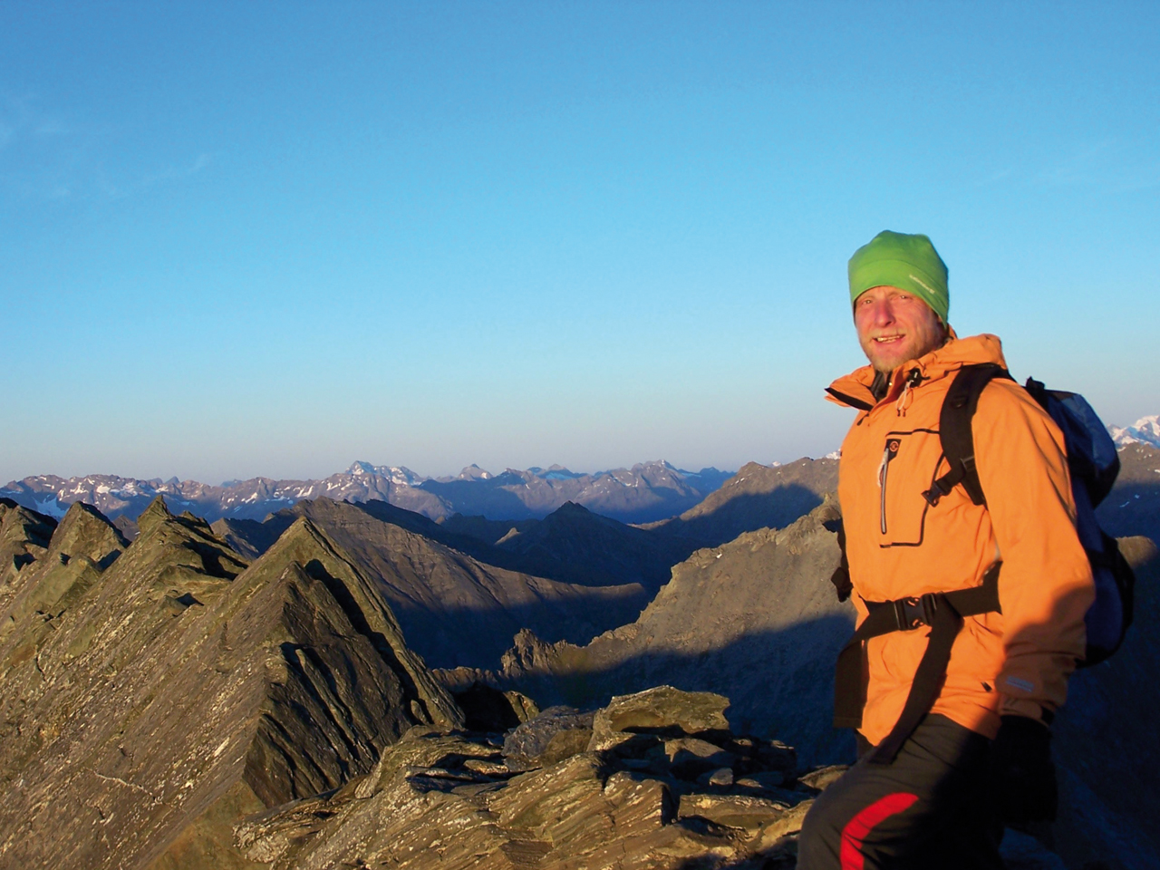
Before long the rock bluffs of the top ridge are reached and, as pre-dawn light filters through, the last 100m are easy. At the top, there is a light but chilling breeze and as the day brightens, outstanding views with white peaks to the west and north. The Remarkables and Lake Wakatipu lie to the south-east and I can see my campsite in the valley below. The air rapidly warms as I descend to camp. It is just 9am, but I have been on the go for almost seven hours.
There is now all day to do the four hour walk out. The sun is shining and the surroundings are beautiful. From Dynamo Flat to Skippers I enjoy a succession of accidental treats left by the miners: fields of mint that scent the air; gooseberries, ripe and sweet; wild strawberries, tiny but tasty; and a patch of juicy raspberries.
– Don Frengley

34 years of inspiring New Zealanders to explore the outdoors. Don’t miss out — subscribe today.

Questions? Contact us


