Trig M, Porters Pass
On a whim I decide to head for the hills on a late evening sortie round the foothill summits near Porters Pass.
It’s one of those last minute end-of-summer-trips that I wanted to enjoy before all the daylight saving evenings are gone and there is no more golden weather left in the barrel.
It has been a big day of chores at home – lawn, windows, fish tank, oven top, and over and above that, our neighbours, a Samoan family, invite us to share in their granddaughter’s first birthday party.
This is no ordinary affair, there’s a seemingly endless supply of cooked meats, including a complete roast pig together with fruit drinks and salads and a giant mud cake from which they give us two over-sized portions for later. Their welcome and generosity are heart warming, but I am feeling over-burdened by the lunch and in need of exercise. The hills look good.
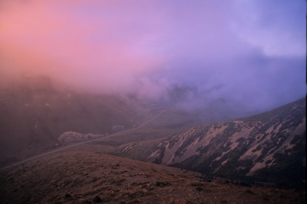
It’s raining slightly as I drive out, low mist obscuring all points of the compass, no matter, do it anyway I tell myself. Beyond Porters’ the weather is clear and there are grand views of the Craigieburns yet something compels me to head back to the mist shrouded summits of the Ben More Range, I really want to trek these tops, they are new to me and there’s a graded 4WD trail to ascend from the road. This last component is important when you are feeling a little burdened, shall we say.
The grind up the first hill is slow and I am beginning to regret the heavy food but the top of the ridge comes soon enough and I can romp off over the undulating ridgeline with a keen, moist southerly wind for company. It’s cold, there’s zero view, and it’s well after 6pm, but who’s counting? I can see enough of the ridge ahead to make my way unimpeded and navigate the ridge between the poles with ease, at least until Trig M where the poles cease.
Trig M has a sign warning that the remainder of the ridge to Rabbit Hill, some three kilometres south west of here, is unmarked and should only be attempted by the experienced. The mist, although obscuring the view, hasn’t thickened, and there are ample escape routes off the tops down to the shore of Lake Lyndon should I choose, and quite simply I’m enjoying this walk and easy tops, so I continue, carefully, checking the map as I go.
The truncated viewing options focus my attention on the ridgetop vegetation and rock outcroppings, later I descend into a tussock saddle where I spy a New Zealand falcon. It vanishes into the mist as I approach.
Rabbit Hill is my last climb this evening, a short steep tussock mound sporting a rudimentary trig station where I rest and orientate the map for the best descent route to the lakeside road below. With the temperature dropping I am soon on my way, descending through clearing mist, ripped away by the wind to reveal the lake basin and nearby hills. I’m on target for a quick descent and gain the road before dark. I pack away my map and camera and march off toward SH73 thinking that Trig M followed by mud cake will make a nice combination.