Sudden Valley Bivouac, Arthur’s Pass National Park
Deep in the hills of Arthur’s Pass National Park, south of the village near where the Waimakariri River flows powerfully beneath the Mt White access bridge is the secluded post glacial Sudden Valley.
This is a hanging valley, so named as it ‘hangs’ at a higher elevation above the course of its lower reaches and that of the Hawdon River into which it flows. The sudden change in altitude is marked by a waterfall, Barrier Falls, trapped between the walls of the gorge that twists its way down from the park-like flats of the upper valley where once a moderately large glacier resided.
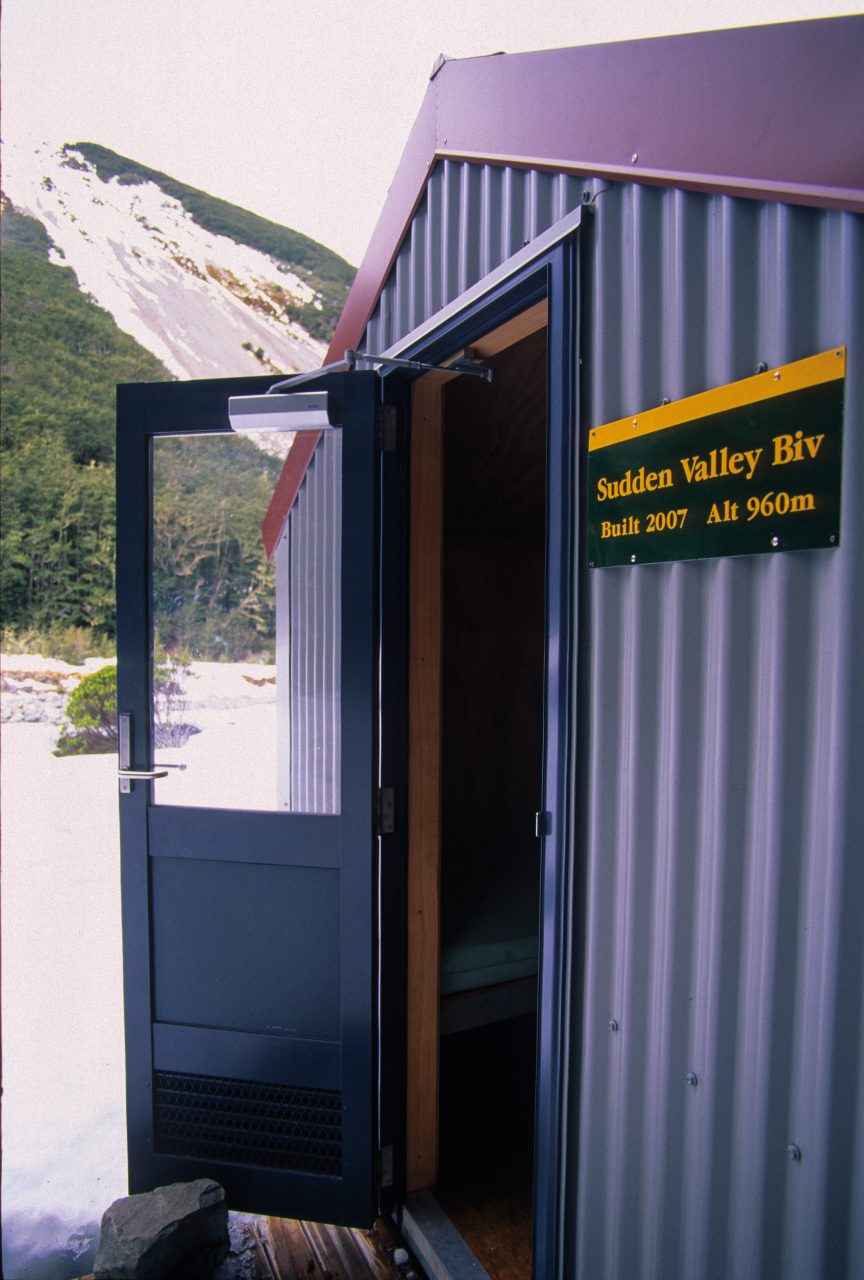
The valley head is beautiful and its relative isolation lends it a special character not found in many of the more open neighbouring watersheds. It also boasts a rough route and a two-bunk bivouac near the bush edge in the upper flats. This small structure has replaced the dilapidated and leaking ex-Forest Service bivvy which stood in more or less the same location for many years but was seldom used by the reasonably frequent tramping parties who venture here each year.
Winter is not the best time to visit the valley, as snow often lies thickly throughout this catchment, including the valley floor as it sees little sun and the full beauty of the area is hidden beneath a white carpet. Undeterred and with time to spend on a day outing I ventured into the mouth of the valley, wishing to visit the new bivvy and familiarise myself again with the upper valley.
I struck snow almost immediately as I headed into the gorge. It was boot-deep on the flats but, thankfully, almost non-existent along the forest track that climbs the valley sides and fords the cold flow of the river at various junctures en-route to the falls. Once in the gorge, the light is reduced, the sound of water amplified and the sky barely visible through the narrow slot above. It’s mildly oppressive, but there is plenty to observe along the way and I need to keep focussed on the trail so I don’t plunge into the gullies surrounding the route.
Half-way through, The Chute enters the canyon, a steep, stony gully that allows access to the waterfall by-pass track 150m above the gorge to the north-east. It’s imperative that this egress route is located and followed carefully as very difficult terrain awaits those who wander off-route.
This route is the key to the upper valley and once above the gorge the trail becomes steadily easier until, gaining the lip of the valley, almost flat walking ensues albeit with the odd river crossing.
The bivvy lies almost 2.5km up valley from here and although the snow underfoot continues I make quick progress, skirting a few large avalanches that have reached the river edge, to gain the hut in time for a late lunch.
It’s cold here, I couldn’t have expected much else, snow lies deep around the small hut and I take lunch quickly, shivering inside on one of the benches. Outside, the sun is trying to make an appearance, weakly penetrating the high overcast with faint shadows on the forest floor.
I’ve done my dash for the day, there’s little to linger for here, but the walk and new discoveries have been energising enough for a quick romp home.