‘I’m like a baby in the water,’ David exclaimed cautiously to the small crew gathered. My younger brother was referring to our morning plan to climb Mt Ngauruhoe, his first time attacking snow and ice with an axe. The bottle of port was passed around for everyone to swig from as we discussed our narrow weather window for the relatively easy ascent in the morning.
A 55km/h and rising to gale force nor’wester was forecasted, with snow lowering to 900m by the end of the next day. We assured David this wasn’t a last rites performance and that we wouldn’t let him drown.
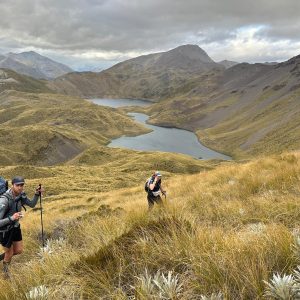
Under the glow of head torches we left the warmth of Mangatepopo Hut and headed up the popular Tongariro Alpine Crossing Track into the heart of the Tongariro National Park. I couldn’t see the stars through the cloaking cloud that enveloped the broad valley and hoped the front hadn’t beaten us to the top.
When we reached South Crater I punched a waypoint into the GPS, just in case of a desperate retreat – even straight-forward mountains shouldn’t be underestimated. David strode confidently up the steepening snow slope as we gradually ascended the side of Ngauruhoe through thick cloud. He was following in the footsteps of Frodo on a quest to the summit; although rather than defeating the forces of evil he was conquering his first winter mountain.
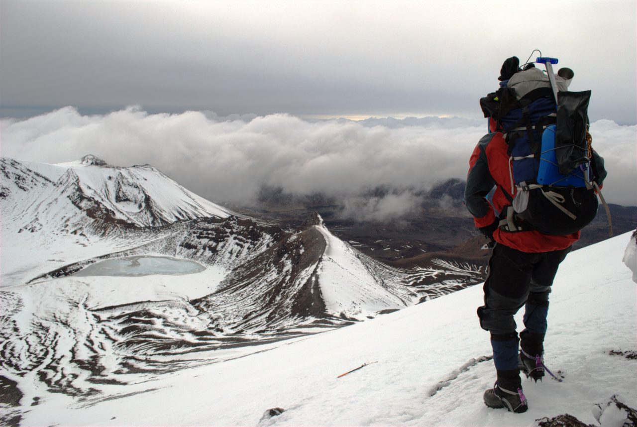
In the light of dawn our colorful jackets and packs glowed against a barren and inhospitable white and grey backdrop. The wind screamed over the icy slope blowing sharp ice particles into our faces, occasionally I’d have to stop cutting or kicking steps to hunch over my ice axe for stability.
We paused for shelter behind a stray rock and I checked the GPS, only 200m to go – we were almost at the 2287m summit. The clouds which had constantly veiled our view suddenly parted around us. In an instant ‘Mt Doom’ was transformed into a huge ship and we were high up on the bridge. Mt Tongariro plowed into a dark and tumultuous front leaving the windswept white expanse of South Crater visible on the foredeck. A squally sea slid around Mt Ngauruhoe and rejoined in its wake.
At the top we flattened ourselves over the crater rim to peer into the depths of the volcano. Its icy, craggy cliff-line circled a deep brown pit, not quite molten lava but remarkable nonetheless.
When John C Bidwill, a botanist from Sydney became the first European to gaze into its depths, he exclaimed that the crater was the ‘most terrible abyss he had ever looked into or imagined’. Now, 171 years later, David thought it was the most impressive thing he had ever seen.
We opted for the humble bum slide descent and when we reached South Crater built a narrow four person snow cave to shelter from the sleet and relentless wind. We ate a frigid lunch inside cave before continuing on through the rain and wind to Mangatepopo Hut.
We stayed another night sheltered from the elements and listened to David as he enthusiastically recounted his first winter swimming lesson.
– Jacob Saathof

34 years of inspiring New Zealanders to explore the outdoors. Don’t miss out — subscribe today.

Questions? Contact us