


- Distance
- 8.84km to hut
- Total Ascent
- 789m to hut
- Time
- Car Park to Eastern Hutt Hut, 4hr
- Grade
- Moderate
- Accom.
- Eastern Hutt Hut is in a water catchment area and is not for overnight stay
- Access
- From Kaitoke Waterworks Road end
- Map
- BP33
- GPX File
- eastern-hutt-hut-wellington (gpx, yo 28 KB)
- Your device does not support GPX files. Please try a different device.
A rock’n-hopping day trip
A day trip to Eastern Hutt Hut is perfect for those occasions when the Tararua tops are clagged in. But because the tramp involves river travel, it’s enjoyable on a hot day, too.
Eastern Hutt Hut (marked only as ‘hut’ on the map), lies in the Eastern Hutt River and is for emergency use only because it is in a water catchment area, the idea being that by only allowing day trippers the risk of water contamination is reduced.
We parked our cars at the Kaitoke Waterworks Road end, but left them just outside the gate, as this is closed at 8pm each day and we weren’t sure if we would be out by then.
It was a mildly drizzly day and we were slightly unsure if the river had risen too much to travel through. Because of this, we also considered travelling up either Marchant Ridge or Quoin Ridge and dropping down to the hut, or doing a loop including both of these options.
Our day began by following a 4WD track along some farmland up and over a large hill. The track makes what would otherwise be quite a grunt, a bit more of a graded ascent. Towards the end of the descent, a smaller track comes off the 4WD track and leads down to the Eastern Hutt River. We crossed the swingbridge and then had one more grunt up and over a spur. At this point, the marked track ends and the route simply follows the river. There are, however, sections of track on both sides of the river which can be walked at times.
The river was slightly swollen, but still safe to cross. We linked up a couple of times to cross in especially swift sections, but at normal river levels this probably wouldn’t be necessary. It was pleasant and easy rock-hopping up the river.
After about four hours, we came across a couple of pink markers which led us to the hut. It pays to watch the terrain here, it’s not uncommon for people to completely miss the hut, as it’s located out of sight of the river. There is a distinctive spur that drops to the river from Marchant Ridge, a few hundred metres past the hut. This would be the way down from the ridge if you chose to come that way. Quoin Stream, which joins the Eastern Hutt River near the hut would provide access to or from Quoin Ridge.
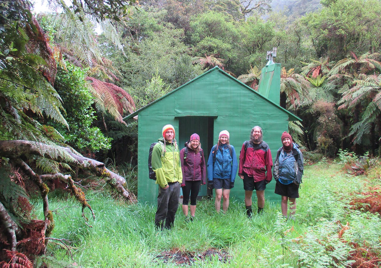
The hut was unlocked and has six bunks, a small pot belly stove and a small red hut book (the hut is managed by the Greater Wellington Regional Council rather than DOC). It was warm, dry and well maintained.
We returned the same way we had come and got back to the car in about seven hours.
– Sarah Miller
