

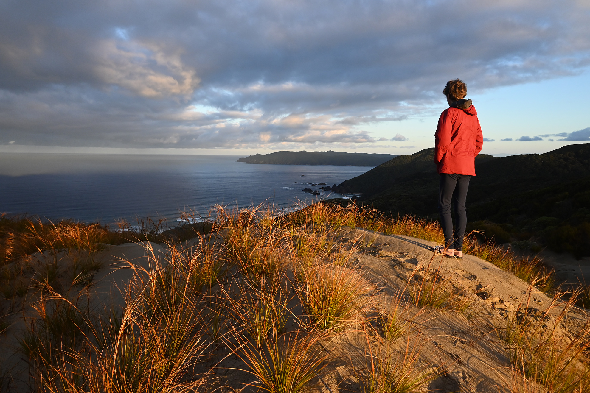
We met Jo who recalled the track from Benson Peak across Ruggedy Flat to Freshwater Hut, which she had done some time back – swimming where the bridges had rotted. I caught a cod for lunch with a handline from the granite headland as the forecasted easterly began to build. That night we met Ollie and Jake from Wellington walking counter-clockwise. We suggested they take a water taxi down Freshwater River, skipping North Arm Hut, and they grappled with whether to be or not to be completers.
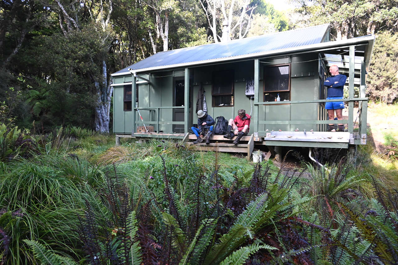
It rained on our day to Yankee River Hut. Tidal bores drove up the estuary as we watched from the porch. It is the same design as Bungaree Hut with two six-bunk rooms, and a central kitchen area featuring a dart board. I lost fish off the rocks and watched a ray glide by in the drizzle. The name here may come from Burr Osborn, aka ‘Yankee Jack’, who deserted from the whaler Tenedos in 1845 upon learning that his master’s destination was the remote Iles Crozet in the subantarctic Indian Ocean.
Lucky Beach, on the way to Christmas Village Hut the next day, was named for the finder of a cask of rum in 1857. I’m fascinated by the history of people in wild places; was I becoming a bore? This coast is littered with middens, caves, kaiks, urupā and pā sites. Christmas Village was named when a departing group gifted clothes to those remaining, for whom ‘it was just like Christmas’.
In spring 1869, having failed to find gold at the quartz reef at Red Head at the south end of West Ruggedy Beach, six prospectors, led by a man called Irvine, cut a track eastward. ‘The difficulty of cutting a track through hitherto terra incognita is very great. For miles we cut through scrubby bush as tough as horn as hard as ironwood and so close that one mile of progress a day taxed our utmost efforts. We reached the coast exhausted, our clothing torn to rags… weak and suffering from the effects of eating mutton-fish (pāua) …’.
Sergeant Morton of Port William became worried when they were overdue and finally spotted their smoke around Christmas Village. Morton had earlier axed a trail from Halfmoon Bay to Port William, which Irvine had hoped to link with. ‘The track is a good one, and if completed will render communication between the east and west coasts by land easy.’ The bush swallowed it.
In his seminal 1940 work Rakiura, historian Basil Howard noted tracks had been cut to most vantage points (mostly by the island’s first ranger, Roy Traill), ‘and in the north-eastern corner … there remains ample area of forest where huts and hostels may be erected on new routes whose length will daunt all but the professional tramper’. He even envisaged linking up to Freshwater River.
Lands and Survey and the NZFS picked up the mantle, building Freshwater (1964), Mason Bay (1968) and Yankee River huts (1970). Bigger huts added to a motley crew of bivs, such as the fuselage of a plane that crashed at the south end of West Ruggedy in the 60s.
Tom Ryan’s was a two-bunk tarp on Māori land at East Ruggedy. It was a tin-roofed shanty sporting a hard-packed dirt floor. Tom would occasionally drop a match, torching the mānuka headlands above the old pā at Putatara to keep the country open. He would hunt and boats would take out the deer carcasses. He’d gather pāua shells and sell them to the RSA in Bluff. When Paul Caffyn and Max Reynolds, the first pair to sea kayak around the island, hauled ashore at Ruggedy Stream estuary in 1979, ‘Jacko’ the possumer in residence had rigged a flying fox to bring food and driftwood up from the beach. Sadly, Tom Ryan’s burnt down in the early 90s, before our time.
And among the dunes was East Ruggedy Biv. During the Deep South Basin exploration days, Max Kershaw of the NZFS persuaded the oil company to fly an ex-railway single man’s hut across Foveaux Strait beneath its Sikorsky S-58 helicopter. With two bunks and a sand floor, it featured a switch that noted ‘last one out please turn off the light’, and a golf club and balls allowed bunker shot practice. It was torched when East Ruggedy Hut (12 bunks) was built in 1992
We caught up to Dimitri and Dylan at Christmas Village Hut. Like us, they were thinking of climbing Hananui Mt Anglem (960m). The brutal easterly saw us demur, but they donned budgie smugglers under their shorts for a swim in the tarn. Earlier, in the 90s, snow had stopped us.
Our new notion of two nights at Bungaree Hut was harpooned by resident hunters who had landed their gear through big waves a few nights earlier. The Bungaree of my memory was a millpond where I prised pāua off the rocks at low tide. In these big swells, it was the domain of the wetsuit clad. Port William – a failed Utopian Shetland Island settlement and today a Great Walks hut – was packed, so we cancelled the following day’s taxi and organised a tent hire at the Oban backpackers that night.
The past may be a foreign country, yet we didn’t do things that differently. We still walked the road to the South Sea Hotel where Emersons is now on tap. As tītī (muttonbird) was no longer on the menu, Craig had blue cod. Dimitri and Dylan passed us in a taxi from Lee Bay (deservedly so after skipping two huts) – and sheepishly admitted they had kept their speedos dry. And the Wellington boys were there, courtesy of the water taxi.
Nostalgia is a dangerous dish; the possibilities in your twenties are intoxicating as it all yawns before you. In youth you’re developing the main character. In middle age the plot (and waist) has thickened, you may have spawned new characters and many just aren’t around anymore. In my sons and hunters, pāua divers and trampers, I saw a younger self, and in the older hunters perhaps a future one coming in by boat.
Yearning for a lost youth is futile – as the aphorism has it: wherever you go there you are. While I wasn’t exactly haunted by past shores, there was a certain wistfulness.
An insight of age was realising that a quarter of a century was far too long between drinks. But I knew that already.


