


The tramp to Barlow Hut offers a chance to experience historical sites, enjoy a swim in any number of swimming holes and view the varied vegetation of Ruahine Forest Park.
Here’s a chance to experience historical sites, enjoy a summer swim in some of the deeper pools of the Makaroro River, and enjoy the varied vegetation of Ruahine Forest Park.
The old Yeoman’s Mill Site, the centre of a thriving native timber milling community from the 1920’s to late 1940s, marks the start of this trip into Ruahine Forest Park.
Follow a poled route for 500m along a farm fence line and through a paddock down to the Makaroro River. Head upstream on the shingle riverbed for 2.5km, or about an hour, to where Gold Creek intersects on the true right and where two tracks meet: Gold Creek Ridge and Sparrowhawk. The route to Barlow Hut continues up the Makaroro where the pools become deeper and slightly more difficult to cross.
After 90-minutes of crisscrossing the river (there are 44 crossings of the Makaroro to contend with – none deeper than mid-calf in low flow during the summer months. Deeper pools can be avoided by scrambling over the rocks on the true left), the Colenso Spur Track is reached. This is a steep, rocky ascent to the top of the Ruahine Range. A couple of minutes up the track is a stone cairn with a plaque attached commemorating missionary William Colenso’s journeys in these parts, which he first undertook in early 1845.
In the next hour, there are hillsides of large kowhai trees with mixed forest of beech and podocarp inhabiting both sides of the narrowing river bed. Recent and past storm damage has led to erosion slashes on the steeper hillsides, leading to a massive amount of shingle in the riverbed. Despite this, the entire trip can be done in the riverbed but there are a few low terraces that have unmarked tracks going through them that can add variety to the trip.
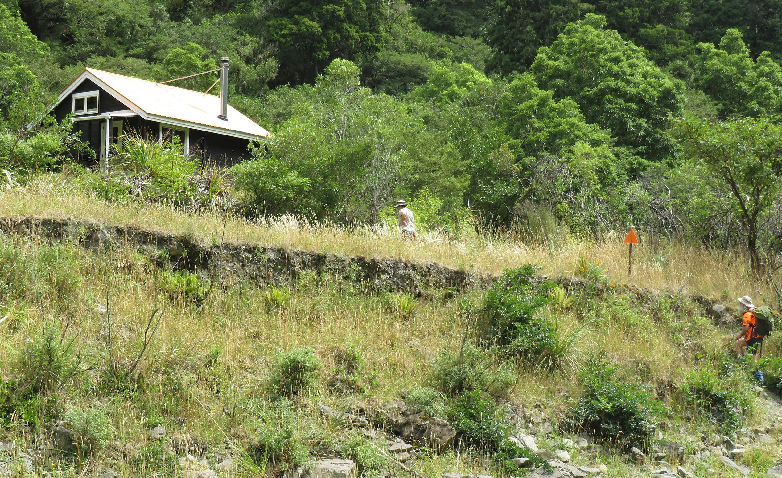
The orange roof of the hut is sighted shortly after an unnamed creek joins the main flow on the true right.
Barlow Hut was built in 1983 by the Forest Service and is named after the Barlow family, who were early settlers in the area. It’s a Lockwood-designed eight-bunker with a wood burner and platform bunks. Water is available from the nearby stream.
For the energetic, there are two alternative routes back to the car park. One involves a steep climb on the Barlow Track from behind the hut to meet the Colenso Spur Track before descending back to the river. The other choice is a sparsely-marked route 50m upriver on the true left. This track climbs approximately 600m to the Parks Peak Track where a right-hand turn eventually leads back to Yeoman’s Mill.
- Distance
- 7.6km
- Total Ascent
- 335m
- Grade
- Easy
- Time
- 3.5hr
- Accom.
- Barlow Hut ($5, eight bunks)
- Access
- From the end of Wakarara Road, near the historic mill site
- Map
- BK36, BK37
GPX File
- Barlow Hut (gpx, 6 KB)
GPX File
- Your device does not support GPX files. Please try a different device.
