
Heading south from Hokitika
On leaving Hokitika and heading south, there is always a great sense of adventure and anticipation. I’ve done this trip dozens of times and still feel like I’m driving into the unknown and unexpected.
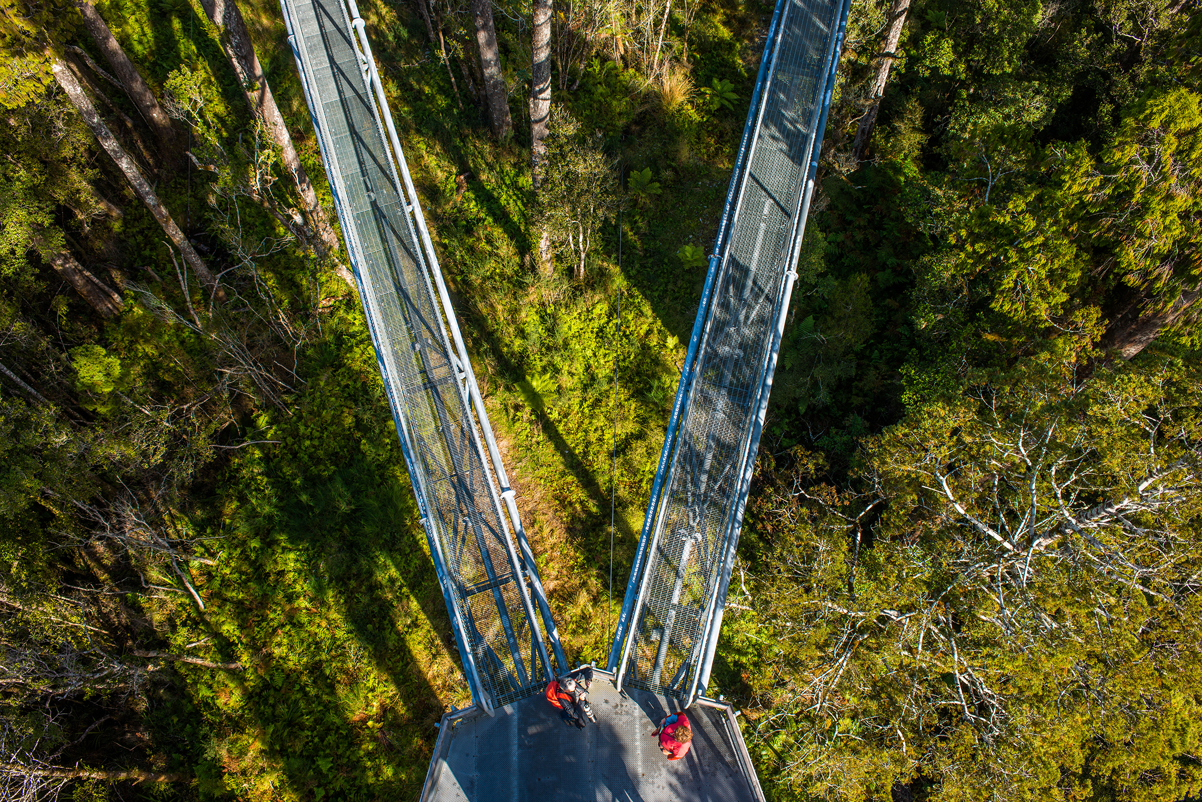
Just a few kilometres out of Hokitika, drivers reach one of the large bush-fringed lakes of this region – Lake Mahinapua. It’s set just off the highway and has walking tracks and a camping area with views of the Alps. Just to the south of the lake is the West Coast Treetop venture where visitors can walk through the forest canopy up to 30m above the ground. The tall kahikatea and rimu forest is a stunning spectacle, well worth a visit.
Inland from here is the Hokitika Gorge Walkway, a short forest walk beside the turquoise blue waters of the river. Beyond these diversions, the highway passes first through the historic gold mining town of Ross, and its numerous short mining trails, before entering the long forest-fringed swathes of road that pass by Lake Ianthe, the Wanganui, Poerua and Whataroa rivers.
Along the way are several offerings for short adventures; Harihari Coastal Walkway, north of Harihari on the Wanganui River, gold mining, forest walks, and scenic flights on the Whataroa River just upstream from the highway bridge, and a longer diversion to the wild seaside village of Okarito, south of Whataroa, where a feast of walks and canoeing adventures are possible.
However, the standout guided adventure along this section of road is the White Heron Sanctuary Tour, based at Whataroa. It’s New Zealand’s only white heron (kōtuku) nesting site and is only accessible by jet boat on the Waitangitaona River – a thrilling adventure in itself.
Fox and Franz
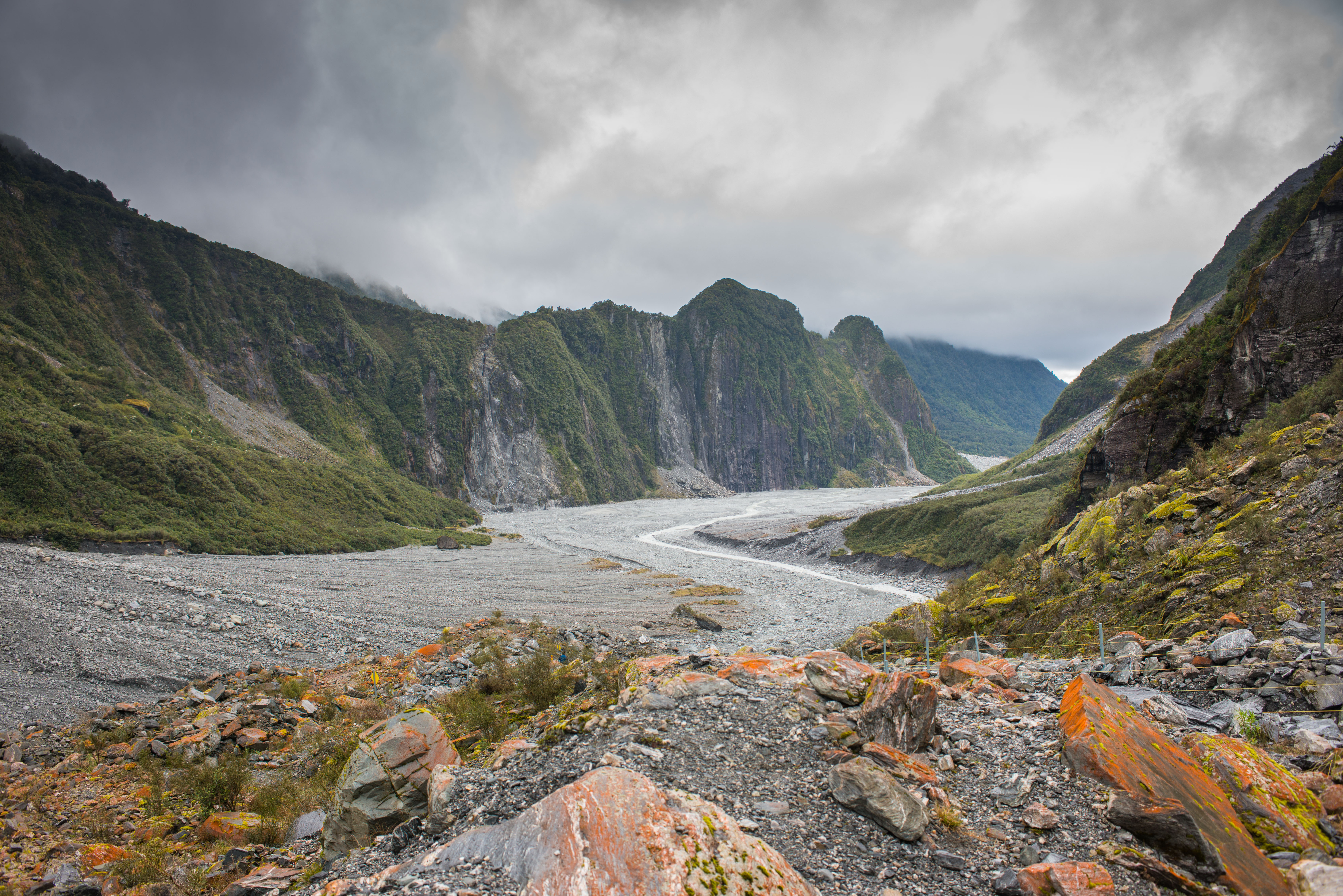
These two tourist towns are virtual clichés for adventure in South Westland and are internationally acclaimed by merit of the two glaciers, the Franz Josef and Fox, which reach the lowest altitude level for any temperate region on earth.
At least two days are required to adequately see some of the many exciting options, and as the towns are separated by 40 minutes driving time, a night spent in each is the best plan.
The range of excursions is huge. Lakes, peaks, glaciers, kettle holes, swingbridges, gorges, mine sites, river and coastal walkways, glacier hikes and heli trips all vie for attention.
Take your pick, but don’t miss the valley hike to Franz Josef Glacier, Peters Pool viewpoint and forest walk back to the road, and Roberts Point Track (allow a half-day for this one as it is quite a climb).
At Fox Glacier, the main road access on the north side has been permanently destroyed, but it is still possible to walk up the south bank road to get a view of the glacier. However, it is not possible to approach the glacier from this side. Heli access is now the only option.
Two other walks deserve special mention; the beautiful forest and lake walk around Lake Matheson, west of Fox Glacier township, to capture the unique reflection of Mts Cook and Tasman in the lake waters, and wild and wonderful Gillespies Beach where a marked track heads north past the wreckage of an old gold dredge to a serene lagoon.
In clear weather, the views of the Main Divide from Gillespies Beach are outstanding.
For the fit, a full day hike up Mt Fox, south of the township provides outstanding views of the glacier, mountains and sea.
The deep south
South of Fox is an all-pervading sweep of forest and mountain.
The dominance of nature is made more obvious here due to the complete lack of any townships: between here and Haast there is only scattered farms and houses amidst the forest.
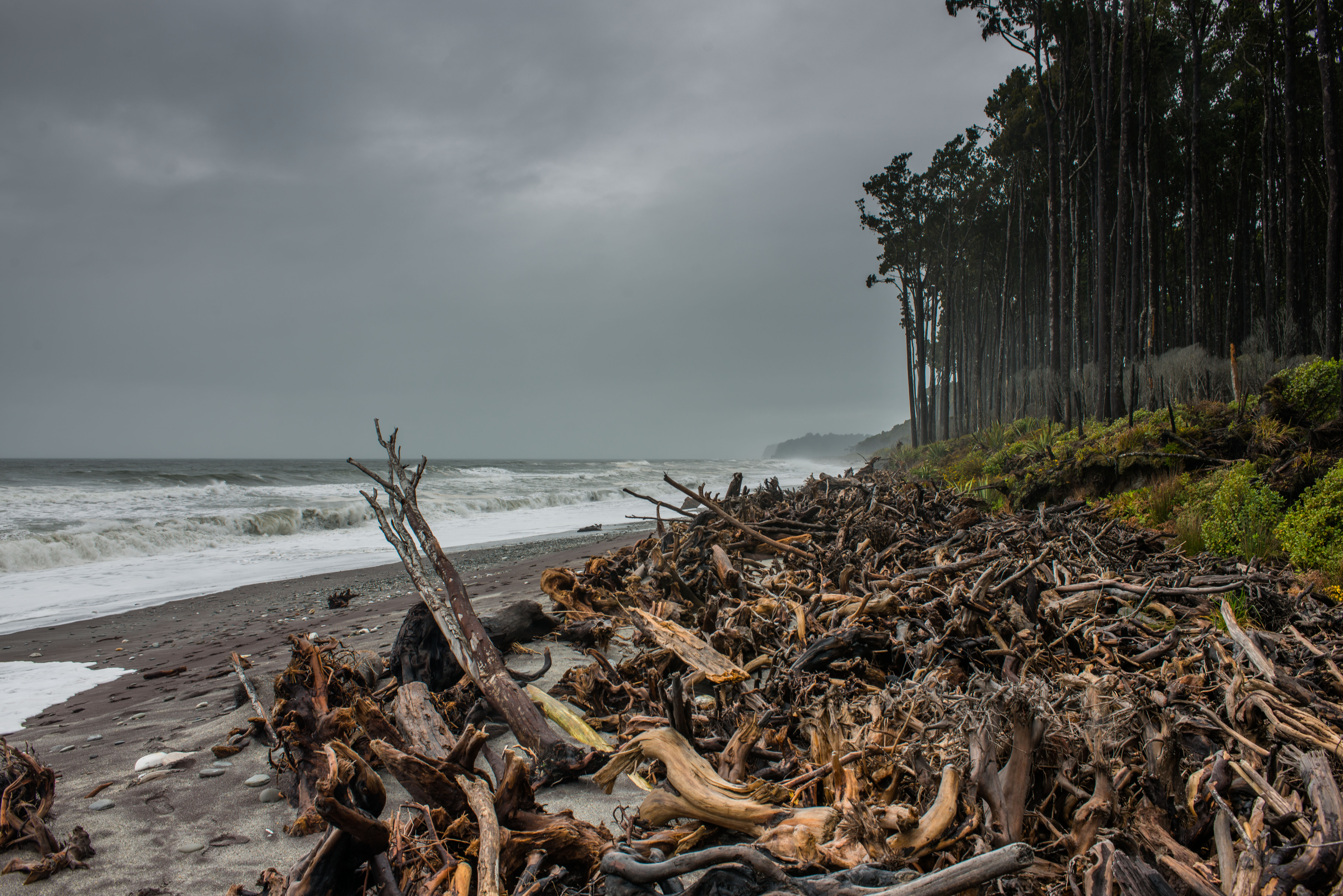
This is my favourite part of South Westland where the stately rimu forest marches right onto the beach, like at Bruce Bay where you can observe the massed bodies of ancient trees washed into a fortress-like dam on the sands by storm surges and raging rivers.
At low tide, the mouth of the Jacob River and its lagoon can be reached by walking north along the beach. Yet for all the wildness of the region, there are enclaves of peace and beauty like at Lakes Paringa and Moeraki – two moderately-sized lakes perfect for exploration by canoe.
At Lake Moeraki you could see Fiordland crested penguins by taking a short hike to Monro Beach where the penguins come ashore late in the day.
Beyond the lakes, the highway climbs away from the coast over Knights Point, where there is a viewpoint and picnic spot.
At the coast south of here is Ships Creek Walkway, a wonderful place to savour the beauty and diversity of South Westland. There are two walks here, one into the swamp forest on a boardwalk and the other through the dunes. Both are recommended. It is also one of the places where you can often see Hector’s dolphin, the world’s smallest, surfing in the clear green faces of the waves.
The approach to Haast Pass
Haast Village, ensconced on the west bank of the Haast River, is the first major town south of Fox Glacier. There is an excellent visitor centre here and refuelling stop.
Travelling up the main highway to Haast Pass is a special part of the journey. The valley is massive and is dominated by giant peaks at its head, some of which are heavily glaciated like Mt Hooker, viewed up the Clarke River from the Pleasant Flat picnic site. There are also several waterfalls along the roadside; Imp Grotto and Roaring Billy Falls are two.
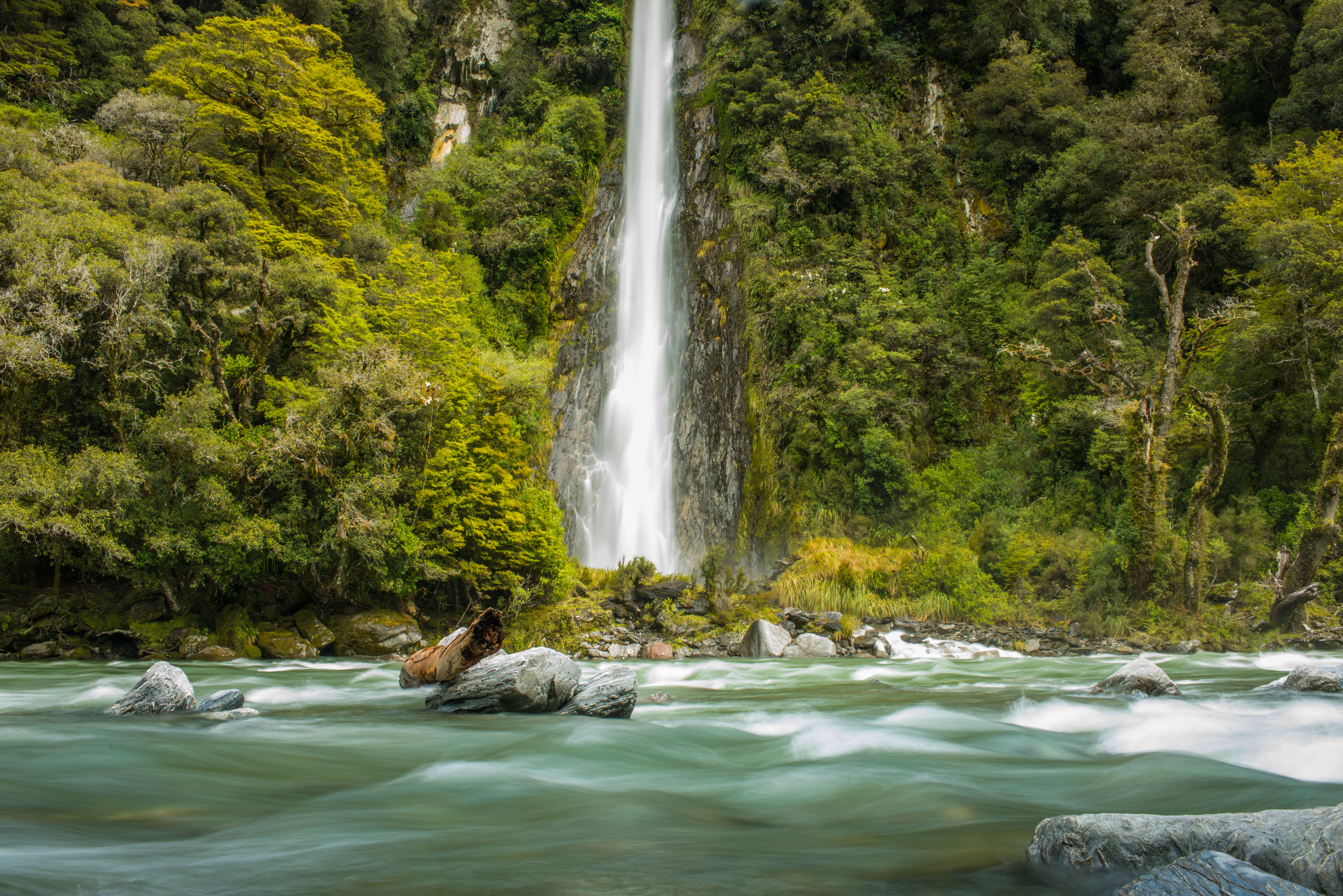
From Pleasant Flat, the road climbs steadily to Haast Pass, reaching spectacular Thunder Creek Falls, 96m, where there is one of the highway’s best short walks. It’s just five minutes to a platform above the river and the captivating sight of the falls catapulting out of a hanging valley.
Gates of Haast is just a little further along the road – a dramatic cut in the bluffs where a steel bridge spans the Haast River above massive boulders and a powerful torrent of cascading blue water.
The road then steepens further, levelling off at Fantail Falls where there’s a short track leading to the falls and the much longer Brewster Track which leads in 3-4hr to Brewster Hut.
Haast Pass is not a true alpine pass as it straddles the Main Divide at one of its lowest points – 562m – and is enclosed by vigorous red beech forest. There is a memorial here and the old Bridle Track which can be followed to Davis Flat picnic area on the other side of the Southern Alps.
Across the Alps
Though SH6 continues south all the way to Invercargill, the final section of the road trip finishes at Makarora, where there are several short hikes, the most notable being to Blue Pools which is reached on a short and easy trail leading off the highway two kilometres south of Cameron Flat.
The trail passes beneath tall red beech to a series of deep river pools. The round trip takes about an hour.
Another option is the fly-walk-jet boat excursion operated out of Makarora into Siberia Valley.
Or for the very fit, Mt Shrimpton – a high, steep 2002m summit – can be reached on a track beginning behind the motor camp. It involves some moderately exposed scrambling along the McKerrow Range to the north to reach the summit. Don’t try it when there is snow on the route.
There is also a popular and exciting option to jet boat the Wilkin River from Makarora Village. It’s a stunning mountain valley with huge peaks and large valley flats. It’s great tramping country.


