


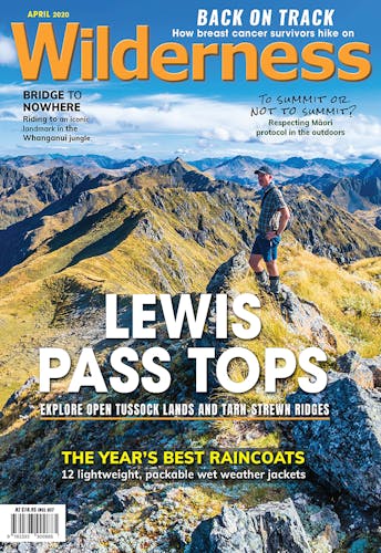
Exploring the Lewis Pass tops.
Reliving past memories and making new ones is surely one of the joys of tramping. It was 16 years since I’d last visited Brass Monkey Bivouac, on a solo trip that included a climb of Mt Technical and a visit to Nina Hut – at the time one of DOC’s newest huts.
My tales of the diminutive bivouac, the modest but challenging mountains, and the chance of seeing fresh terrain had been enough to encourage Wellington climber Peter Laurenson along on a four-day excursion. We packed a rope, harnesses and helmets, thinking we might get an opportunity to climb the north ridge of Mt Technical (1870m), and maybe an ascent of the Grand Duchess (1703m), too.
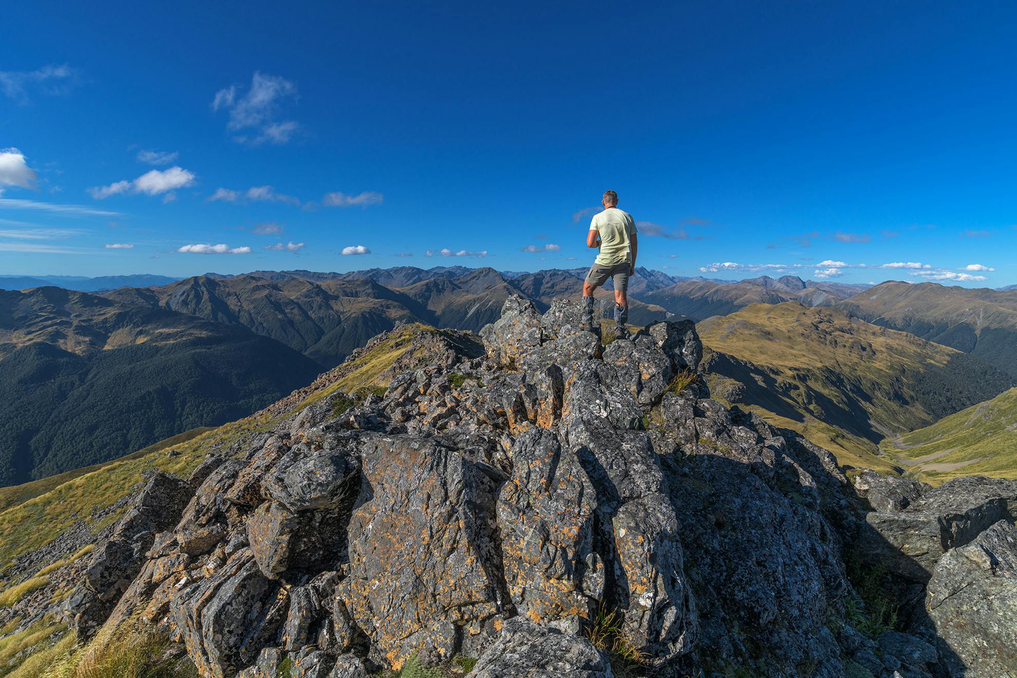
The weather played the game, at first, and in high temperatures we tackled the brief ascent through the stunted beech forest above Lewis Pass. After breaching the bushline, and reaching the first knoll, range after range came into view, revealing more peaks than you could point an ice-axe at. The Spenser Mountains, the Victoria Range, Travers Peak, the Opera Range and Philosophers Knob.
Philosophers Knob: what a name, I thought, so typically Kiwi. Grand enough to call it after those who ponder life’s meaning, but then brought down to earth by calling it not a spire, nor mountain, nor peak, but simply ‘knob’. Navel-gazing chopped off at the knees.
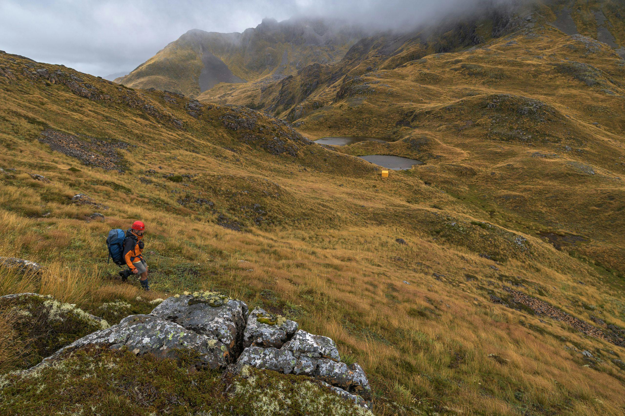
Views taken in, we tramped on. I was surprised how much the trail had become a worn groove; obviously far more people now walk the Lewis Pass Tops than 16 years ago. Poles guided us along the pleasantly undulating terrain; not that we needed them under a cerulean sky with visibility stretching to the far horizons.
Tussock – despite looking similar from a distance – comes in all sorts of varieties. Thick, wavy stuff, waist-high that gathers moisture like a sponge and hides clumps, holes and even speargrass aplenty. It can be quite hard work pushing through that sort of tussock, like a series of traps for the unwary. In sublime contrast are the short, carpet-like tussocks of the Lewis Pass tops, which brush your ankles daintily, and don’t hide nasty surprises. In more sheltered spots we saw brown mountain daisies (Celmisia traversii), which have a curious distribution that includes the mountains of the northern South Island, then a long gap, before appearing again in Fiordland. Daisies whose ancestors once existed together geographically now divided by the slow sliding of the Main Divide along the alpine fault over millions of years. Time can achieve incredible things.
We’d underestimated the time needed, too, and found the hours sifting past as we strolled along the tops, passing tarns ranging in size from paddling pools to Olympic oblongs. We could see the bony north ridge of Mt Technical, pointing an accusing finger at us.
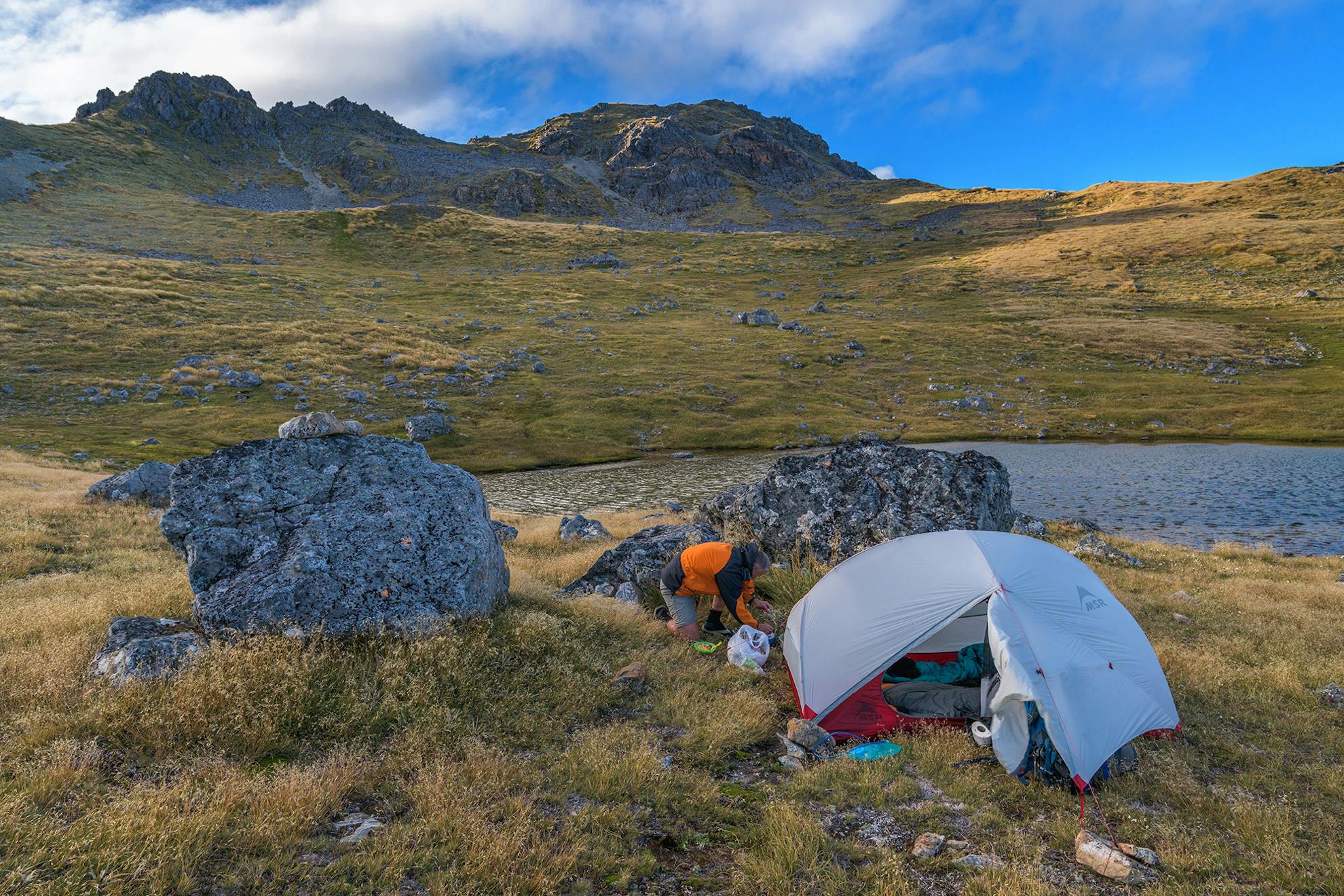
The ground trail petered out, but sporadic cairns led onwards and we followed them on a sidle beneath bluffs and up to The Apprentice. Below lay glistening tarns in the headwaters of Lucretia Stream, where we set up camp as the wind picked up and scudding clouds came racing over. A sudden gust just about snatched the tent from our hands, and we had to shelter the burner behind boulders to cook dinner.
During the night, drizzle drifted over the tent and we woke to find low cloud obscuring Mt Technical. After abandoning the idea of climbing, the rope and gear now seemed all so much unnecessary ballast. I stuffed the wet tent in my pack, and we set off in poor visibility. So much for February being a fine month.
Ahead lay Lucretia, a modest but narrow summit of 1643m. We followed a ground trail, and stayed on route until losing it in a boulder-field, a textured mass of littered rocks lichened in orange, white and grey. Back to the ridge, we sidled, having nicely avoided a bluff, but the ridges narrowed further, then from the knoll of 1605m, disappeared steeply into mist. I couldn’t remember much from my last trip along here, which was deceptively easy in fine conditions. It’s straightforward terrain when you can see, but will quickly become treacherous if you stuff-up.
In such situations, I often ask myself: ‘What would Geoff Spearpoint do?’ Drop his pack and scout ahead. Sensible advice, but it’s exasperatingly hard to follow sometimes, with that nagging notion of having to retrace wasted steps.
I dropped my pack.
“Be back soon,” I told Peter as I headed into the murk, compass swinging around my neck, map in my pocket. (For the record: go over Lucretia, but then sidle south-west over boulder ledges, and avoid Pt1605m).
I found a steep gully and descended it far enough to see that it did indeed ‘go’ into easier terrain, then climbed back to tell Peter. We had climbing helmets, so wore them; no sense having the skid-lid in your pack when a rock scones you.
With packs on, the gully took a bit of care; the rocks greasy-wet and unstable. At its base, the cloud lifted enough for us to get our bearings. After a sidle and climb onto a low knoll, we were overlooking Brass Monkey Biv, situated in a saddle beside twin tarns, and straddling the divide between Canterbury and the West Coast.
“That’s a welcome sight,” said Peter.
“Every bit as good as I remember,” I replied, then told him about the first time I stayed here in the winter of 1991 when the tarns were frozen solid.
It was even better to find the biv empty. With two of us inside, there wasn’t room to swing a stoat.
The bivouac was in reasonable nick, although it suffers from dampness in this harsh, high habitat. Christchurch mountaineers Sandy and Jennifer Sandblom deserve much of the credit for keeping it in good condition. They painted it last in 2015 and someone has nailed a small keepsake onto the cooking bench: closer inspection revealed it to be a brass monkey.
After a brew and bite, we braved the breeze outside.
The Brass Monkey basin is a veritable haven for alpine flowers, and I relished naming those I could recognise. Tussock, flowering profusely, danced in ripples according to a choreography of breezes, clumps of close-growing Donatia novae-zelandiae produced tiny, perfect white flowers like small stars, South Island edelweiss was still in flower but just past its peak, Gentians were out in force, looking especially attractive where they grew out of encircling tussock, and there was a large green-leaved Celmisia that I couldn’t name, possibly verbascifolia. I wished nature guides weren’t so heavy, then I might have brought one.
We took our cameras and looked down the bluffs into the head of Duchess Stream, a tributary of the Nina River. The rain eased, the wind strengthened, and we decided to climb the narrow ridge to an unnamed summit, Pt1674m. Although not apparent on the map, this ridge has an impressive line of bluffs, blunt and cold. From the top, we could make out the distinctive topography of the Victoria Range, granite country, with its more angular shapes. Mt Haast is its most recognisable summit, shaped like a flat-topped volcano. Nature mimicking form. There are no volcanoes here.
Back at Brass Monkey, Peter and I canvassed the usual subjects; the pros and cons of religious thought, the merits of various gear, the flaws and strengths of Ed Hillary. Flawed, like all of us, we concluded, but great too. Peter has seen first-hand many of the projects accomplished by Hillary’s Himalayan Trust in Nepal.
We were hopeful of a good dawn but hadn’t heard the slow patter of nor’west rain that must have started some time in the night. No climbing today for these boys. The Grand Duchess sulked beneath bulky cloud, of the sort that Scottish climbers might have thought suitable, but no one else.
Over a slow, luxurious breakfast we dawdled, hoping against hope that the weather might clear.
Eventually, bored by our own inertia, we packed up and moved on, but left our chances open by a high sidle above Duchess Stream. Working our way over ledges south-west of the biv, following sporadic cairns, we descended only when we had to, just in case a window opened.
It stayed closed, firmly. While the gloomy mountains exuded a certain wild charm, the weather lacked any allure. The wind blew, the rain fell in fat, heavy drops, and the engorged tussock soon soaked us. We resigned ourselves to a wet day in the valley below, and weaved through ledges, around small blunt bluffs, and down to Duchess Stream, which was rapidly gathering waters into her flow.
In the forest, we followed intermittent animal trails, pushing through vegetation typical of many Canterbury valleys – a mix of prickly shield fern, clumps of Gahnia cutty grass and pole beech.
We didn’t move fast, but we did move steadily, with barely any stops, and the kilometres passed step by stumbling step. Each time we lost the animal trail, we faced the usual navigational decision-making of bush-bashing. Where is the trail most likely to go? Short-term pain to push through that tight scrub for the possibility of better travel beyond? Or avoid the immediate obstacles, such as windfall, and chance it getting worse further down-valley? We won some, lost some. Swore some, laughed some.
On the true left, as the valley closed in, we sidled high to avoid a small gorge, pushing through tight clumps of mingimingi and mountain toatoa. Occasional branches slapped our faces as if to reprimand our temerity to be here. After a few hours, Peter admitted that he’d “had a gutsful of it” but remained his usual calm self. I was ready for a track, too. I managed to stuff-up the navigation in the valley where Duchess Stream meets the Nina River, but worked out my error and eventually we were following the track from the old Nina Hut site, up to the new.
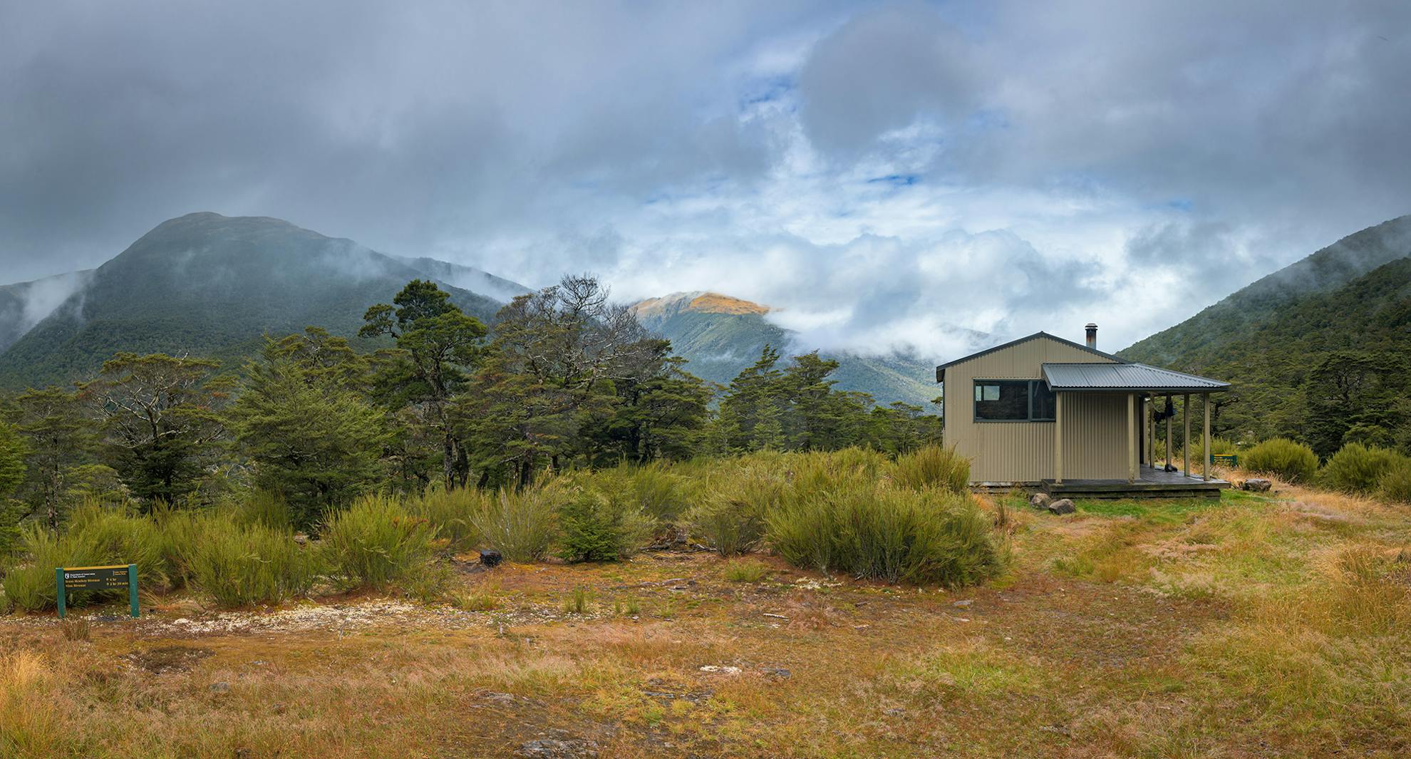
DOC has made few more inspired decisions than selecting the new Nina Hut site back in 2002.
Unlike the old site, it chose the sunny side of the valley, one with views, and situated the 10-bunk hut amongst an exquisite grove of stunted mountain beech, almost bonsai-like, with a carpet of moss and wispy lichens. Titipounamu, riflemen, flitted through the branches; small ping-pong sized balls of feathery fluff, with no tail to speak of. We also heard robins, bellbirds, fantails, kākā and kea, and that night a great spotted kiwi. The stunning birdlife is thanks to the trapping efforts of DOC and a local conservation group run by Hurunui College, at Hawarden.
After the confines of Brass Monkey, Nina felt like a palace, and we could hang our dripping garments under the covered verandah. Two trampers arrived, with a fresh forecast of more rain, which dampened our enthusiasm for walking out over Devilskin Saddle and the Sylvia Tops. The rope lay on the bunk, useless and heavy.
Oh well, there are worse things than an easy stroll in a pretty valley, drinking from chuckling creeks and swimming in blue-green pools. We reached the road opposite Palmer Lodge, and our two hut companions kindly gave us a ride back to our vehicle at Lewis Pass – just the sort of generosity that an evening together in a backcountry hut can generate.
Despite straddling the Main Divide of the Southern Alps, Lewis Pass lacks the impressive summits of Nelson Lakes or Arthur’s Pass. But the country here has its own distinctive charm, and is good terrain for a marginal forecast.
I thought of the alpine flowers, the blue tarns, the waving tussocks, the bobbing riflemen, a biv called Brass Monkey, a hut called Nina, an excellent companion and could not feel anything but content.
- Distance
- 23.8km
- Total Ascent
- 1534m
- Time
- Lewis Pass to Brass Monkey Biv, 6-9hr; To Nina Hut via Duchess Stream, 4.5-6hr; Nina Hut to SH7, 3hr
- Accom.
- Brass Monkey Bivouac (free, two bunks), Nina Hut ($5, 10 bunks)
- Access
- From SH7 at Lewis Pass
- Map
- BT23
GPX File
- Lewis Pass Tops Track (gpx, 9 KB)
GPX File
- Your device does not support GPX files. Please try a different device.
