Image of the September 2015 Wilderness Magazine Cover Read more from the
September 2015 Issue
Home / Articles / Waypoints

5 ways to Brass Monkey Bivouac

Brass Monkey Biv surrounded by tarns and mountains. Photo: Tim Niven
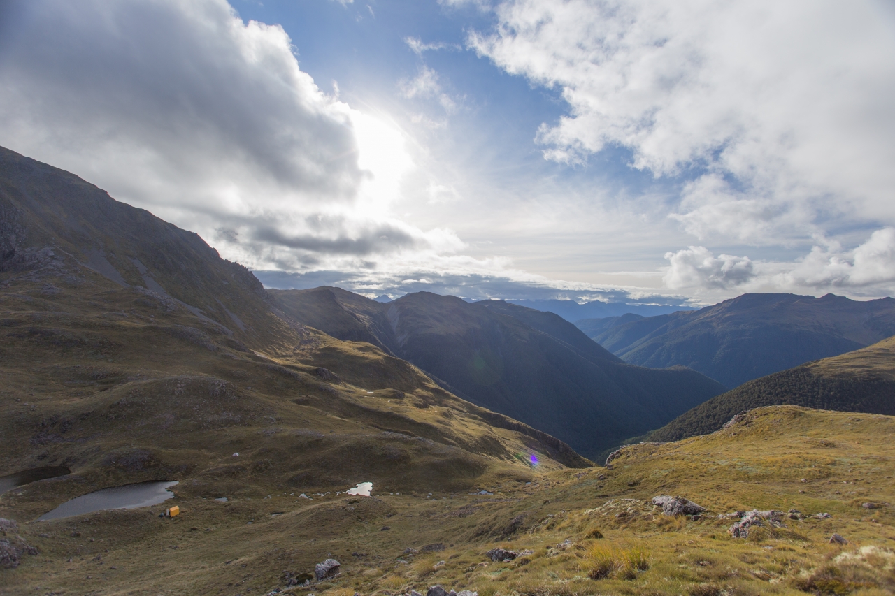
Located in a tussock basin with numerous tarns glittering in hollows and mountains rearing up from the landscape at every vantage, the two bunk Brass Monkey Bivouac in Lewis Pass National Reserve is a place to savour.

For many, the very mention of the bivvy’s name is enough to stir an interest in reaching it, or at the very least finding where it is on a map. Once discovered, the hunt is on for the best route.

There are no tracks directly to the bivvy, although there are four that head in more or less in the right direction, a direction which will ultimately entail some kilometres of open untracked ridge top amid startling scenery.

Here are five different routes to the biv.

1. Lewis Pass via Main Divide

This is the classic route to the biv as it travels from the bush edge track above Lewis Pass, south-west along the ridge, passing over The Apprentice and Lucretia to reach the bivvy basin. Lucretia can be challenging to traverse under snow and even in summer needs care.
Grade Moderate-difficult Time 5-7 hours.

2. Rough Creek

Farther west along SH7 from the Lewis Pass summit, Rough Creek enters the Maruia River. A marked tracked leaves the highway here and climbs steadily through bush and later into a steep tussock basin. The upper section is poled and leads over to Lake Christabel Hut, however, from the ridge top the crest can be followed east and then south to Brass Monkey Biv, traversing slopes above One Mile Stream at about the 1350m contour to reach the bivvy basin.
Grade Moderate Time 4-5 hours

3. Duchess Stream

One of the easier approaches is on the excellent track up the Nina River, with a stopover at Nina Hut. The Duchess route requires low river levels because this feeder stream to the Nina is unbridged and requires multiple crossings on the way to the bivvy which sits on the pass at its head.

The route at the head of the Duchess is steep and requires a climb to the west from the valley to avoid bluffs.
Grade Moderate Time 5-6 hours

4. Lucretia Stream

Another option involving access via the Nina River is into the basin at the head of Lucretia Stream. Lucretia Hut is located mid-valley with an overgrown track leading to it from the Nina. If the weather makes tops travel difficult or unsafe, this is perhaps the most direct route to the bivvy.

Careful route finding is required at the head of the badly bluffed, avalanche prone stream. A leading bush spur to the west accesses the easy tops south-west of Lucretia and very near the bivvy basin.
Grade Difficult Time 4-5 hours in good conditions

5. One Mile Stream

For purists, this valley on the northern side and accessed from SH7 halfway between Maruia Springs and Rough Creek, offers a more challenging route. It is easier to descend this route than climb it, heading down the stream draining the basin to the north into the forest and then traversing the 800m contour on the true right of the valley to avoid a gorgy section.
Grade Difficult Time 6-7 hours