You don’t get to see Sir Robert Hut until you’re practically at its door. It’s tiny, surrounded by bush, nestled deep in the middle of one of New Zealand’s most remote valleys.
It’s a challenging four-day walk to get there, up and over the rugged valleys of Westland. Heading up, the tracks barely leave the rivers, streams and cascades. The tussock fields are steep, and vertiginous swing-bridges take you high over narrow gorges and rushing torrents.
But to catch your breath you can soak in hot water pools or swim in swift pools of turquoise water. If it rains – as inevitably it will – you can hole up in one of the picturesque huts along the way and read about the history and humour of the deer cullers who built them.
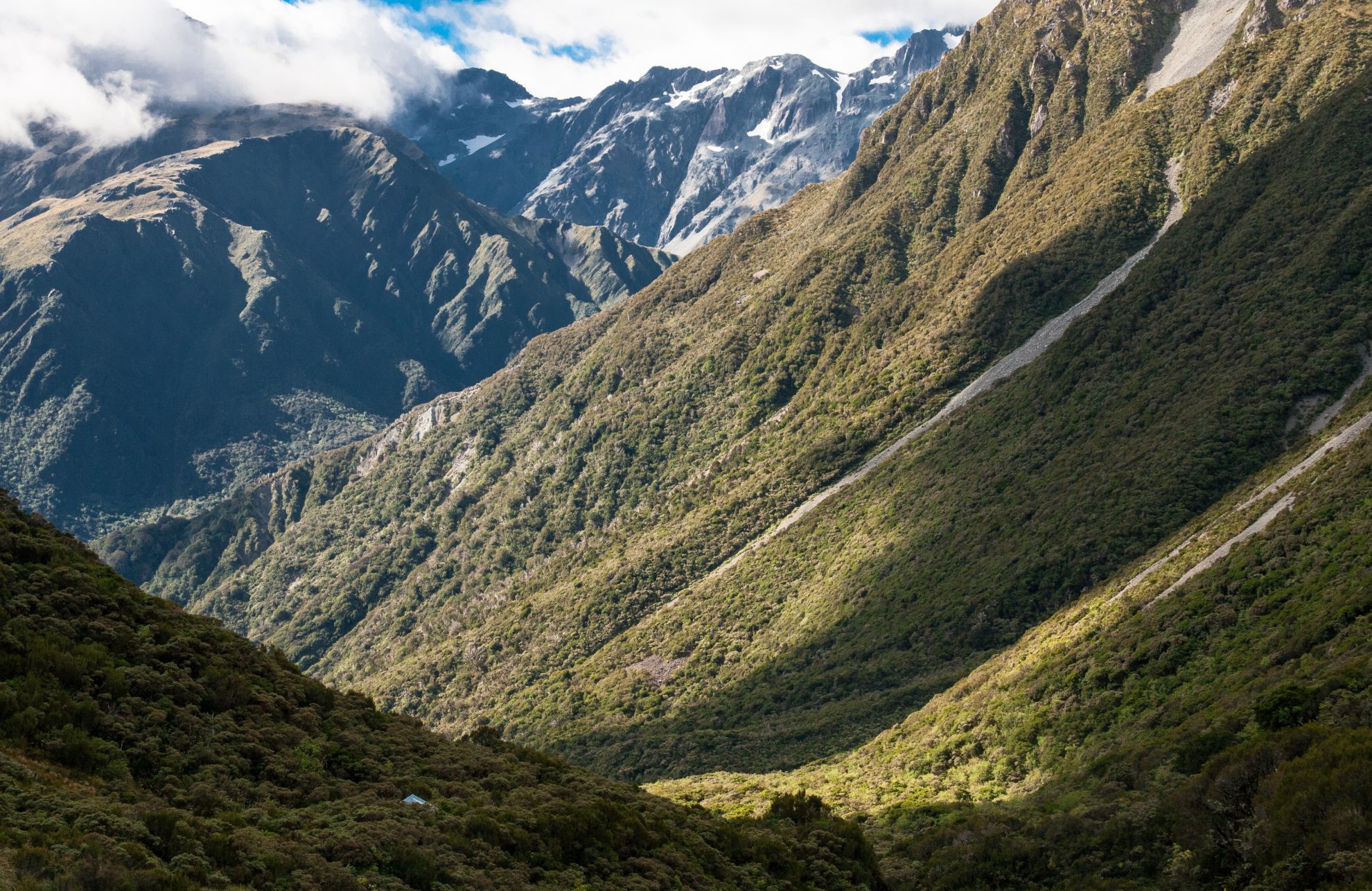
With a bit of luck, you’ll get to push on: over Toaroha Saddle, with its grandstand view of the snow-capped mountains of the Main Divide, then down to the mighty Mungo River, through forests of Dr Seuss-like mountain nei nei.
The final approach to the hut is an overgrown track onto Homeward Ridge then a steep 700m drop off a side spur. When you get there, lie back on the large boulder next to the hut, take in the steep flanks of the valley and the towering peaks above. You’re a very small dot on the landscape.
Don’t forget to sign the hut book – you’ll be one of only a handful of people to do so.
– Justine Sanderson

34 years of inspiring New Zealanders to explore the outdoors. Don’t miss out — subscribe today.

Questions? Contact us


