The track zigzags countless times; first through farmland and then through a fence that marks the start of The Stack Conservation Area.
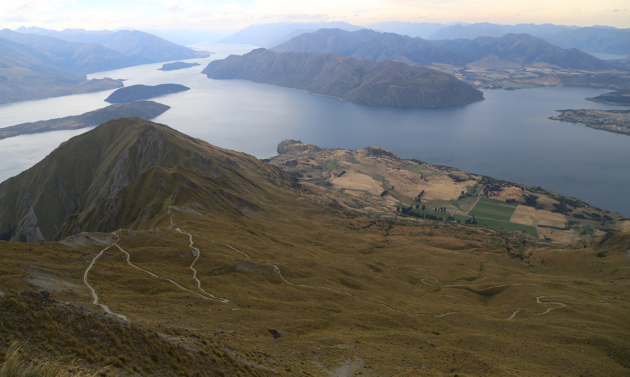
These continue and when you brush the ridge for the first time, there’s a spectacular photo opportunity with the undulating ridge in the foreground and the northern arm of Lake Wanaka stretching into the distance behind.
The track returns to the north-east face again before hitting the ridge once more.
It then heads around the back of the hill and to the summit (though heading straight up along the ridge is more fun).
At the top is the marvellous sight of Wanaka and its namesake lake spreading in all directions.
Lake Hawea peeks out in the distance and, to the left, Mt Aspiring National Park summits jut out handsomely.


34 years of inspiring New Zealanders to explore the outdoors. Don’t miss out — subscribe today.

Questions? Contact us


