West Auckland gold
Walking options in the Waitakere Ranges may still be limited due to track closures to protect kauri from dieback disease, but a quick drive to the hills west of Waitakere township will reveal Goldie Bush.
The scenic reserve was closed by DOC for the better part of a year due to kauri dieback control, but was reopened late in 2018 after extensive upgrades. With three varied tracks combining to form a 3-4hr loop, it is now the most extensive network of bush walks available in west Auckland.
Many visitors choose to enter the reserve from the northern side at Constable Road, however, the south entrance at the end of Horsman Road is more accessible for those coming from the city. Here, the Mokoroa Falls Track starts by passing through the newly installed walk-through footwear cleaning station before gently sloping down through the quiet bush. It soon passes the left-hand turn-off to the return leg of the loop – Goldie Bush Track – which can also be done first if attempting the loop clockwise.
The track surface, clearly upgraded with new stone chips, is excellent and makes for easy walking. Extra dense layers of gravel packed onto jack mat mesh can be seen adjacent to kauri stands, adding protection against the movement of soil – a mandatory requirement for the track’s open status under the Ministry of Primary Industry’s controlled area notice. Enforced by the biosecurity act, the notice makes it mandatory for every visitor to clean and spray their shoes. Neglecting to do so can result in a hefty fine.
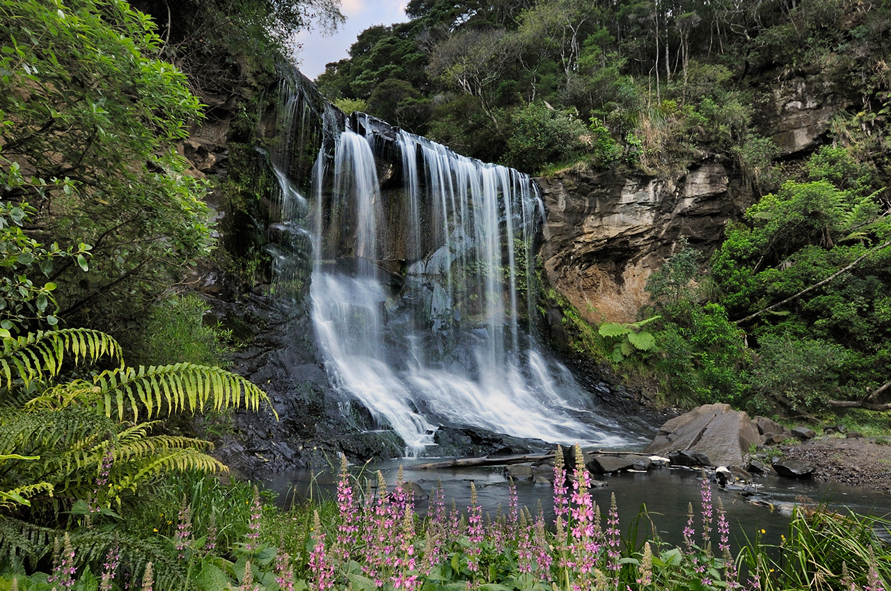
After a 30 minute descent, the track reaches a viewing platform offering a fantastic outlook over the reserve’s main attraction – Mokoroa Falls. Once the site of a driving dam to transport kauri logs downstream, the 11m waterfall cascades into a picturesque clearing and a series of terraced pools.
The clearing can be accessed by descending the stairs near the platform and then walking up the Mokoroa Stream for a few minutes. From here, the route continues downstream following its true left bank. While the initial segment to the falls was quite accessible, this next leg is a marked tramping route only and becomes considerably more difficult with multiple stream crossings throughout.
Our outing featured a dry track and low water levels which made the first cluster of crossings a case of simple rock hopping or wading the ankle-deep water, but, it can be dangerous in wet weather.
The stream crosses to the right bank and continues uninterrupted for some time before connecting with Goldie Bush Track near the swingbridge. It’s 35 minutes to the northern exit at Constable Road, but the loop continues across the swingbridge and along Goldie Bush Walkway. A steep ascent up a set of newly-constructed steps is followed by a gradual incline through the kauri forest.
Like the first section, this track has been upgraded with aggregate and boardwalks, mostly where vulnerable kauri stand. The track connects with Mokoroa Falls Track from which point it’s just a few minutes to the end of the loop at Horsman Road.