One of the best views of the Ruapehu massif is from Castle Rock, a fortress-like outcrop along the Kaimanawa Forest Park Walkway.
The name is quite likely locally bestowed as it is not marked on a map. However, finding Castle Rock is relatively easy.
A 4WD track heading north-east leads up to a poled route branching off to the right, then beginning a short but steady climb in a south-easterly direction to the hinterland.
From here it’s just a case of following this undulating route which parallels the park’s boundary with land occupied by the New Zealand Defence Force.
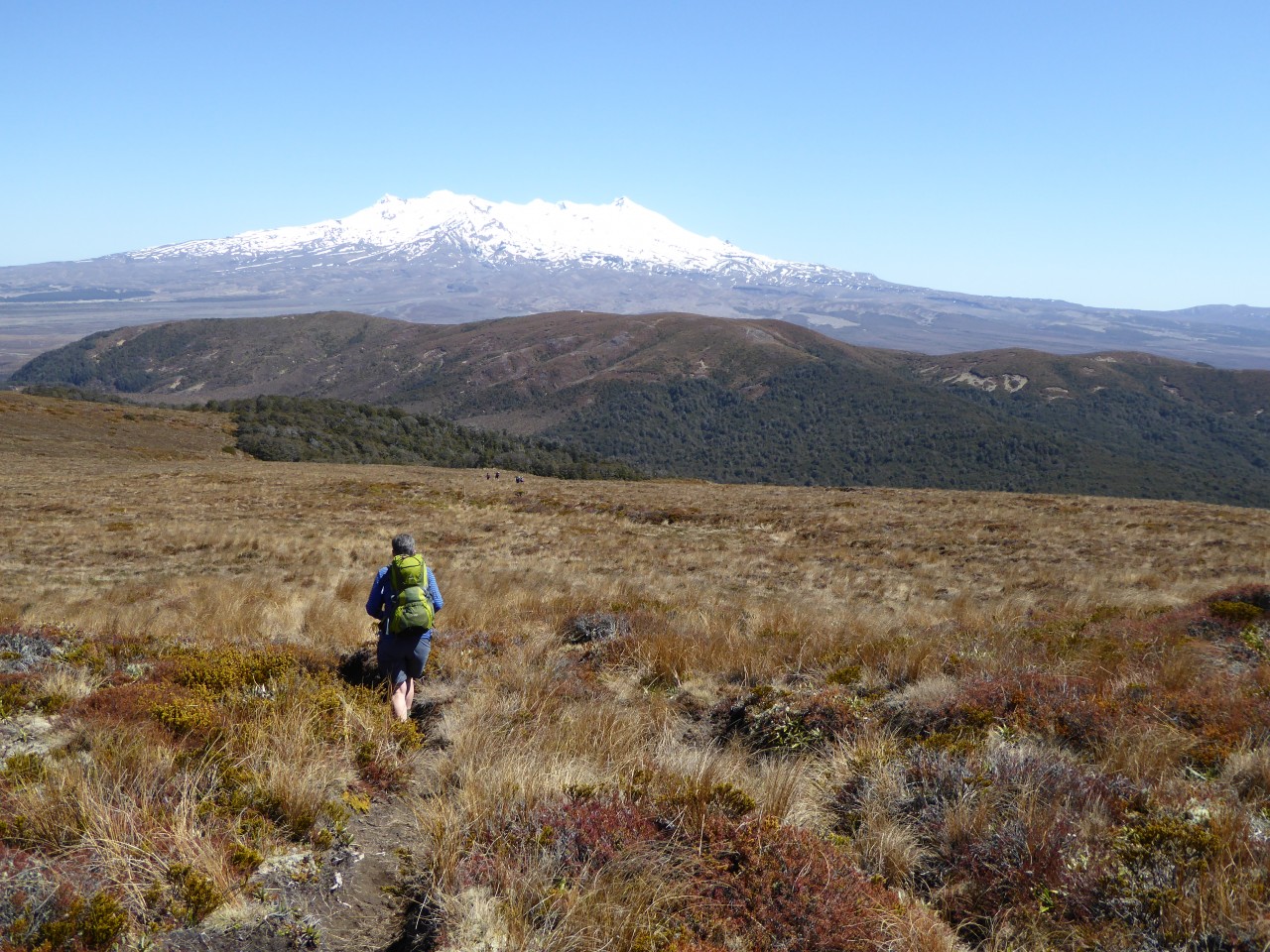
After a few brief spurts of ascent, you’ll reach the open expanse of rolling tussock grasslands, giving opportunity for many stops to look back and admire the spectacular view of Ruapehu, Tongariro and Ngauruhoe in the distance. The higher the track climbs, the better the scene.
After a short sharp ascent through a remnant of beech forest, the track emerges onto flattish tussock land with a few peat bog areas and the destination just 20 minutes away.
At 1450m, the rock formation, geologically of a metamorphic schist composition dating back possibly 175 million years and once lying on the ocean floor, makes for an excellent lunch spot with grand 360-degree views of the surrounding countryside.
Distance
5.81km to Castle Rock
Total Ascent
571m
Grade
Easy
Area
Kaimanawa Forest Park
Time
5hr return
Access
Car park on Desert Road, south of Turangi and opposite the Tukino Ski Field access road
Kaimanawa Circuit (Sharp Cone and Mt Urchin), Kaimanawa Forest Park
Trending Now
Pearson Hut, Kirkliston Range
Takorika, Havelock Water Supply Reserve
Zion Hill Track, Waitākere Ranges Regional Park
A biking adventure to suit
Taking on the Tin Range
Subscribe!
Each issue of Wilderness celebrates Aotearoa’s great outdoors — written and photographed with care, not algorithms.Subscribe and help keep our wild stories alive.