Purple Hill, Craigieburn Station
The road to Arthur’s Pass is one I have driven more times than I can possibly remember. Each bend of the road and each passing mountain retain memories from previous excursions both long and short.
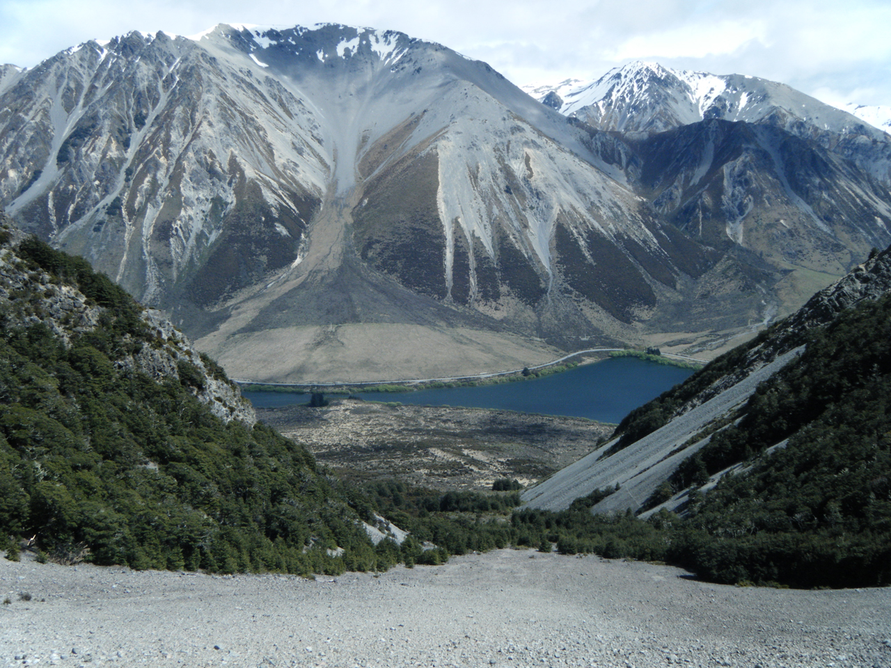
The hour-glass shape of Lake Pearson and the glorious scree slopes that lead to the summit of Purple Hill have captivated my imagination for as long as I have been coming this way. In particular I have goggled at the enormous tract of loose gravel that extends from the top to virtually the bottom of the mountain. My friends and I are scree aficionados and love leap frogging each other down scree slopes as fast as we can.
We chose to climb the mountain during a weekend in late spring and our party of four departed from the north-western end of the lake aiming for the obvious broad face and ridge leading right to the top. An hour or so of easy walking along the swampy and tortuous lake edge delivered us to the bottom of the ridge. The climbing began in earnest with high spirits and even higher expectations for the amazing scree we hoped to encounter. The going is unrelenting but rewarding, we gradually gain the main ridge and head for a false peak to the west of the main summit. Vast new countryside opens up to the north where we can see lakes Grassmere and Sarah. As more height is gained we are treated to the slow rumbling of a coal train destined for the West Coast and the vast Waimakiri Basin draining the surrounding countryside. The view is spectacular and after three and a half hours we reach the summit where we hastily consume copious amounts of chocolate and wait for our nominated group photographer to snap the requisite shots.
A short descent to the south puts us at the top of a long and steep chute of fine gravel and the running begins. The top third is beautiful, soft and consistent and a dream to run down. The lower section becomes harder and full of large annoying rocks that hinder fast travel, however, the view is amazing and we are tired from many hundreds of metres of leap frogging.
The semicircular shape of the mountain causes a funnelling effect towards the bottom and after 40 minutes of bliss we are delivered into a maze of matagouri. We elect to push straight ahead instead of skirting the lake edge to the north and aim for the isthmus of Lake Pearson where we plan to swim the 20m of water and meander along the road back to our campsite.
Finally, bathed in mid-afternoon sun and thoroughly saturated, we walk along the main highway contented to have discovered a fabulous and diverse day trip so close to home.
– David Short

34 years of inspiring New Zealanders to explore the outdoors. Don’t miss out — subscribe today.

Questions? Contact us


