It was shaping up to be the perfect morning for a short trip into the hills, with fine weather and a full moon expected to provide ideal conditions for a pre-dawn climb.
One look outside was enough to change that thought – thick fog lay on the Canterbury Plains, not exactly what was needed given that I was hoping to catch a sunrise. I decided to press on, hopefully getting above the fog.
I was heading for the Korowai Torlesse Tussocklands Park in the eastern foothills of Canterbury and bisected by SH73. South of the highway lies the gentler, tussock-covered rounded tops of Ben More and the Big Ben Range, while north sits the more rugged rock and scree slopes of the Torlesse Range and the goal: Foggy Peak, a 1741m summit.
Fortunately, the top of Porters Pass was above the fog. At 942m, it provided the ideal launching pad for the climb but I still had 800 vertical metres to the summit and about 90 minutes until sunrise. And just to make things more interesting, the climb would be done in near darkness – the full moon was hidden behind the very mountain I was about to climb.
The ascent itself was straightforward. The ridge is broad and a well worn foot trail winds its way steadily upwards. Numerous cairns mark the trail and would be useful if you were caught returning in misty conditions. The route was reasonably steep, with little respite, but it enabled height to be gained quickly in my race against the sun.
A grand spectacle awaits those who make it to the summit. Ahead, the ridge leads on to Castle Hill Peak, the highest point on the range and a worthy day trip for those with more time. The eye roves westwards to the southern end of the Craigieburn Range, then moves around looking south across the complex hills and waterways of the Coleridge region and on to the Hutt Range beyond the Rakaia River. Away to the east, the topography falls away to the flat, patterned land of the Canterbury Plains.
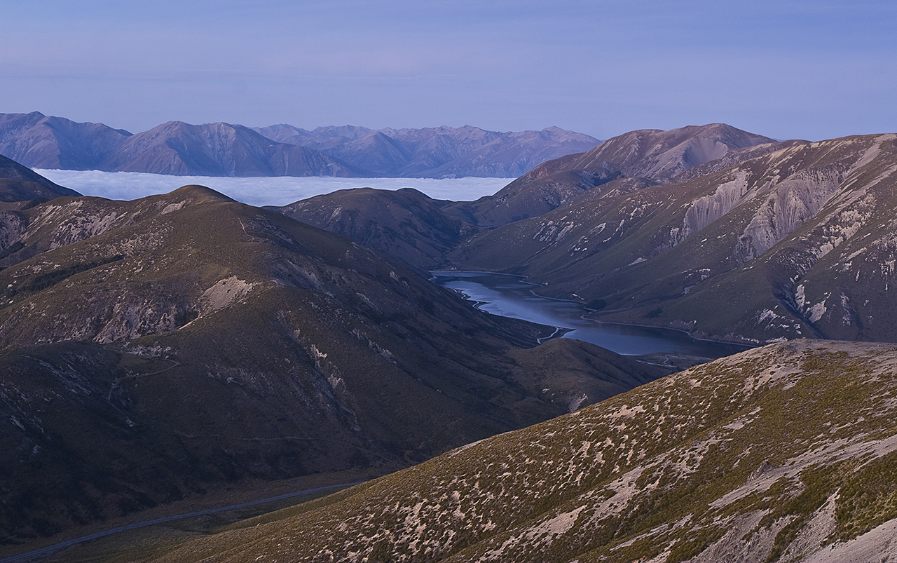
At 5am and at around 1650m, the glow of dawn was upon me. I set up camera and tripod, stunned by the beauty that was slowly being revealed. The Canterbury Plains lay blanketed in fog. Hills and peaks rose above it, like islands in a white ocean. To the south, Lake Lyndon shimmered in the early light.
I could have stayed all morning, but with a promise to return another day, I made my descent.
– Harley James


34 years of inspiring New Zealanders to explore the outdoors. Don’t miss out — subscribe today.

Questions? Contact us


