
To mark Wilderness magazine’s 30th anniversary, current and past editors and contributors scoured the archives for the 30 best trips we’ve published over the decades. This story, original published in January 2014 was included. You can find all 30 of the greatest Wilderness trips in the October 2021 issue.
“So what’s the trail like once we’re up there?” Alistair asked, looking towards the flat summit.
“There isn’t one,” I replied.
“So we’re bush bashing? Should be fun.”
“Should be, but won’t be. Apparently, we’ll be climbing and ducking fallen trees and wading through mud most of the time.”
“Still,” said Alistair, keeping a positive spin on proceedings. “At least it’s a good day. The view will make it worth the effort.”
“If by view you mean stagnant swamp, cutty grass and rotting trees then yes, we’re in for a cracker.”
“So what are we doing here?! How’s this going to inspire readers to get outdoors?”
Anywhere else and that would be a fair question. But though I may not be a Kiwi, I’ve lived here long enough to know there’s no better way to inspire someone in this part of the world than to inform them there’s an utterly pointless trip where you spend the day slogging your guts out among ‘paper cut plants’ and gallons of mud for literally no reward.
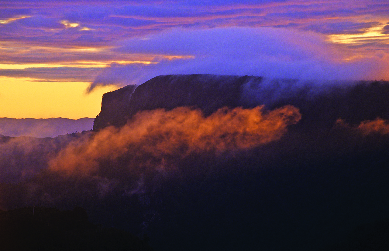
I was drawn to Table Mountain, in Coromandel Forest Park, by the curious psychology of being told it’s absolutely awful. More than 20 years ago, Malcolm O’Neill beautifully described an expedition to the plateau-topped hill in the book Classic New Zealand Adventures. He called the expedition ‘The World’s Worst Tramp’.
‘The Kauaeranga Valley-Table Top tramp involves hard physical toil in unrelenting mud,’ he wrote. ‘This trip has no highlights, no rewards and no views. Your most poignant memory will be of returning to your car after about eight hours grovelling. This track is so unpleasant and environmentally unsound that it hasn’t even been acknowledged on the new topo maps.’
His route description is just as encouraging: ‘Walk up Kauaeranga Valley until you hit the track to Table Top and Mt Rowe. A long grovelly climb takes you to a mud-filled canal known as the Mt Rowe-Table Top Track. A possible diversion is to slime your way up Mt Rowe (795m). Otherwise wade for 2km through a trench filled with mud and submerged logs. Eventually a track takes you back to the road via Wairoa Stream. If you want a view, take a ladder.’

Nothing could inspire me to get outdoors more than this. And I’m not the first. Keen tramper Marcus Bai has climbed Table Mountain on no fewer than three occasions.
The first time was with the same morbid curiosity from having read O’Neill’s words of inspiration. The second was to place a geocache up there. And the third was after ‘friends’ (he calls them friends, I call them sadists) informed him that on the two previous occasions he hadn’t actually reached the summit as defined by the topo map. He, therefore, had “no choice” but to do it again.
“It’s completely unrewarding and there’s no reason to go up other than the unpleasantness of it all,” Marcus said enthusiastically. “It’s slow going – you’re down to 1km per hour with the swampy ground and with lots of fallen trees you have to climb over or under. It doesn’t matter what time of year you go up either, the ground is always wet.
“You have no sense of any direction and, even if you have a compass, there’s no waypoint to aim for.
“There’s no summit. The peak is marked on the map and we got there thanks to the GPS, but otherwise we’d never have known – it’s all swamp. I tied a bottle to a tree at the summit to make it look more official.”
Marcus gave me some invaluable advice for how to make the trip bearable and, if at all possible, enjoyable.
“I’d really recommend a GPS,” he said. “Without one you could get horribly lost. It’s a big area.
“It’s for sick puppies only. You need to be an experienced tramper and know what you’re doing. It would be easy to get lost and, if you did, you could be up there for days.
“It’s not energy sapping so much as mentally sapping. It’s draining and utterly relentless – the biggest challenge is trying to maintain a good sense of humour. If there’s a group of you going up on a lousy day the unpleasantness makes it a lot of fun. It’s so pointless and that’s what it’s all about. But I’d never go up on my own.”
Taking Marcus’ advice on board, I brought a GPS, a PLB, hardy boots and an unsuspecting editor in low cut hiking shoes. After staring at the impossibly flat summit for what seemed like several minutes, Alistair downed the rest of his now luke-warm coffee. “Right,” he said, “let’s do it.”
We decided that, rather than traverse the entire summit as our predecessors had done, we’d head to the high point from Mt Rowe and back again. This was a slightly easier option, as it would mean bush bashing less than half way across before returning. This wasn’t because we’re soft (honest!) but because we planned to spend the night at Pinnacles Hut and the prospect of traversing with our overnight bags sounded worse than breaking a pelvis.
So we set off and soon branched left along Moss Creek Track – a proper backcountry track perfect for stretching the muscles for the self-induced horror ahead. The track became very steep for the final chunk of the climb and only relented when we reached the ridge. It was here we happily dumped our packs, drank until bursting point and munched on cheese rolls.
We examined the path into the abyss or, rather, tried to work out where it actually went. A grumpy looking sign pointed to Mt Rowe and warned the way ahead was for experienced trampers only. All we could see was interlocking cutty grass and trees that looked like a child’s scribble.

We ventured forth, carrying only a GPS, compass, a bit of food, a bottle of water and a GoPro which we were using as our camera (the high-spec Canon we intended to use was sitting on Alistair’s kitchen table. I don’t want to issue blame for who forgot it, but I’d like to reiterate it was on Alistair’s kitchen table, not my kitchen table).
It wasn’t long before we were having fun. As with all trips of this nature, you try and avoid getting your feet wet at first but soon realise there’s no point. Climbing over and under fallen trees and jumping through mud pits is the sort of activity you enjoy aged five, 35 and I sure hope you still do at 75. This wasn’t hell. This was a sub-alpine playground.
Mind you, we still had the luxury of orange markers to follow until the summit of Mt Rowe – a landmark we soon reached and from which we could comfortably see over the tree tops to the complex, steep-sided, forested hills of the peninsula and out to the ocean beyond. It was wonderful. We even caught our final glimpse of the Table Mountain massif ahead of us.
We were somewhat amazed to discover that some kind soul had placed pink and green ribbons to mark the route over to Table Mountain itself. The kind soul, we later discovered, was local ranger Greg Van der Lee who spent two days up there some years back looking at the plant life. It didn’t make things easy – the prospect of putting a foot through a rotten branch or half a metre of mud was constant. Often we’d find ourselves impersonating Hula dancers as we waded through chin-high cutty grass with our arms in the air.
The faint ground trail descended sharply to a saddle before a gradual ascent took us to the summit of Table Mountain. The ribbons then stopped and we were on our own.
It’s a bizarre experience being at the top. It’s silent and almost completely flat. Normally, when you tramp with a hint of fear you’re worried about avalanches, rock fall, river crossings and bluffs.
There’s none of those up there (bluffs perhaps, but you’d have to go well off course), yet it’s almost impossible to relax. There are no points of reference whatsoever. Every overgrown swampy bit of forest looks like every other overgrown swampy bit of forest. If you spin round once, you’d have a job to work out which way you’re meant to be going. At one point Alistair and I were no more than three metres apart – we could hear twigs snapping and grass rustling as we walked but couldn’t for the life of us spot each other. As it was, we could follow the noise, but further apart could have led to problems.
The trip from here to the ‘summit’ felt like a mindless struggle as we waved our arms to remove tangled flora from our faces and took each stride as if treading on glass, bracing ourselves for a log that gives way, a sudden splurge of mud up to our knees or a trip wire in the form of a low branch. We both fell several times. But we never learnt our lesson, as each time we fell we made an involuntary grab for anything that would keep us upright. Invariably, the only option was cutty grass, which led to sliced fingers and an effeminate screech. My mind reverted back to the conversation I’d had with Marcus Bai. It was only now I remembered him saying that we’d better bring gloves.
Every minute or so we’d glance at the GPS. “I reckon it’s about 500m to the summit,” I said. “We’ll be there in five minutes.” We scrambled over rotten logs and crept through gaps in branches.
After about seven minutes Alistair asked: “How far now?” I looked at the GPS and shuddered at the slow progress. “About 400m, I reckon… we’ll be there in 15 minutes.”
The scrambling continued, as did the grazes, cuts and knocks. It was all part of it. We were expecting it. We just wanted to reach the top.
There was no sense of elevation but the GPS was telling us we were pretty much there. We continued, looking for the bottle Marcus said he’d placed at the top. There was no sign so we carried on.

“We must be there by now,” said Alistair.
“Hang on, I’ll just zoom in,” I said, instructing the little screen to pan as close as it could. “Sh**! We’ve gone past it.”
We retraced our steps – the only efficient means of navigation other than GPS and compass being the sun and footprints in the mud, some of which offered fresh memories of surprisingly deep squelches and more effeminate shrieks. I kept my eyes glued to the GPS before making the underwhelming announcement that we were now at the summit.
We looked around us. It all looked the same. No views. No dramatic drops. Just trees, grass and mud. We were delighted! It was the utter anti-climax we’d been hoping for. It brought home the pointlessness of the trip. There can surely be no less satisfying summit to reach than that of Table Mountain – and that made it the most satisfying moment of our day. There wasn’t even the bottle on the branch that we’d been looking for. For all we knew, this wasn’t the summit at all. But then how could anyone tell where the summit actually is in this place?
We started fighting our way back with a feeling of a job well done. But without the sense of anticipation, we were harshly reminded how tough the walk in was. We now had to go through all that again – never walking for more than two steps without encountering an obstacle.
It was far tougher than on the way in and, for the first time, neither of us were enjoying it. We just yearned for that spot where we’d dropped our packs.
There were whoops of joy whenever we saw footprints in the mud after wondering whether we’d lost our way. We also whooped when we first encountered a ribbon once more and when we reached the top of Mt Rowe. But in between was tough, sweaty toil. It was further than we’d remembered, we lost the trail several times and we’d underestimated the amount of water we’d need.
Eventually, after feeling like we’d been beaten up, we saw the flash of colour from our packs. We dove straight for the water before lying down, exhausted and relieved.
Later, back in Auckland, I phoned ranger Greg Van der Lee and spoke to him about the trip.
“It’s nowhere near as bad as it used to be,” he said. “The mud you experienced used to be thigh deep when foot traffic was higher. There used to be a track up there but the conditions meant we would either have to boardwalk the whole thing or abandon it.
“It was a treacherous trip which was being damaged by foot traffic and people could become physically exhausted. We abandoned it as a track and in the last 15 years the foot traffic has decreased and the area has had a chance to consolidate – it’s restored itself.”
This was hard to stomach. Not only had we taken the soft ‘there and back’ option but the experience we had wasn’t of the same scale as that of Malcolm O’Neill all those years ago.
“Its sensitive nature means that if lots of people walk there, there’s the potential to cause the same problems as back then,” continued Greg. “There’s still access for experienced backcountry people but I wouldn’t recommend it. For those hardy souls who require that extra challenge, I’d recommend the Hihi summit walk.”
Malcolm O’Neill had described the trip as the worst in the world and Marcus Bai agreed it was the worst he’d been on. Could the same be said for us despite conditions having changed so much?
I would have to say no, not the worst. But that was only due to our mindsets. If we’d started the tramp expecting it to be lovely, then the disappointment would have been on a par with being a New Zealand cricket fan. But knowing the pointlessness, hardship and anticlimax in advance allowed us to enjoy it on a different level. Marcus is right – with a group of experienced trampers who like a laugh and know what they’re in for, it can be a good day out. If not, it would be a nightmare.
It would be interesting to see if Malcolm O’Neill would still rate the trip as top of his crap tramps, given the change of conditions. But something tells me he won’t be heading that way any time soon.


