Image of the May 2015 Wilderness Magazine Cover Read more from the
May 2015 Issue
Home / Articles / Off the Beaten Track

Journey into Paradise

The author picks his way down the Dart River with Mt Edwards dominating the valley head. Photo: Ray Salisbury
Time
3-5 days
Grade
Moderate
Access
From Rees Valley Road end, north of Glenorchy and an hour from Queenstown
Map
CB10, CA10

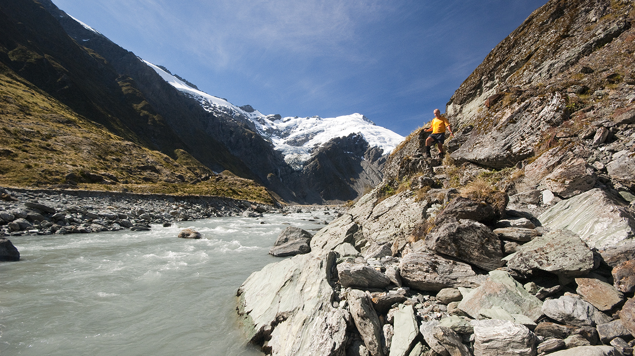
Ray Salisbury spends six days exploring rock bivs and fly camps along the 77km Rees-Dart Track

It is mid-summer when we board the backpacker bus from Glenorchy, a small settlement dubbed the ‘Gateway to Paradise’. I say ‘we’ because I am one of 20 trampers from a diverse range of nationalities. A couple of Kiwi families are complemented by some American couples. Then there is Elisabeth from Germany and Camilla from Australia. As the bus speeds further on up the Rees Valley, the driver negotiates several fords with carefree precision, dumping us off at Muddy Creek.

We don packs and set off at lightning speed on a 4WD road across leasehold land, which was first farmed by William Rees in 1860. Two hours’ cruising along easy flats of the Rees River sees us reach 25 Mile Creek. A memorial cairn catches my eye. The plaque’s inscription tells of a couple who were swept away here in 2005. Today, however, I skip over the creek with dry feet and catch the tail end of an Israeli contingent, 14-strong, who had started out earlier in the day. I do the maths. More than thirty trampers are competing for twenty-two bunks at Shelter Rock Hut. The race is on….

But I opt out, choosing to detour off the beaten track. A short, grassy trail leads up to the dilapidated Twenty Five Mile Hut, built by the Otago Tramping and Mountaineering Club. I eat lunch inside its dark interior with some resident rodents. Apparently there’s a rat plague in these parts. However, the adjacent grassy clearing would be a good spot to pitch a tent, and the views of Mt Earnslaw from higher up the hill are spectacular. Earnslaw beckons me, the second highest peak in the park, though many kilometres distant across the wide, U-shaped valley.

Fording the various channels of the Rees River, ankle-deep, I head towards the silver ribbon of Lennox Falls, thundering through a slot in the impenetrable rock wall. Crawling under electric fences, I eventually spot some marker poles on a long grassy shelf. A large, orange triangle on a giant red beech tree indicates the start of a steep track up to Earnslaw Hut. The path zigzags between bluffs, topping out onto a boggy terrace before climbing up to the lip of Kea Basin. A marked side-track leads off to where the old, corrugated-iron shelter squats in the forest. Though now renovated, Earnslaw Hut still retains the rustic charm of its ancient heritage, though its four sacking bunks do not look inviting. I fill in the visitor book and find water in a nearby pool.

High above is O’Leary Peak, named after the brother of Arawata Bill, the legendary gold prospector of NZ folklore. Joe O’Leary had climbed this 2750m peak on his way up Earnslaw in 1893.

Ten minutes further up is an excellent rock bivouac, made very comfortable by previous climbers. A wind break of stacked rocks divides the shelter into two sleeping quarters, with separate fireplaces. The airy view up to the summit snows of Earnslaw is worth the effort to get here. At dusk I stand on the rim of Kea Basin, now cloaked in deep shadow, the snowy crest of Earnslaw’s east face fading into black. Across the valley an invisible sun bathes the high peaks in radiant shades of gold. A glorious panorama unfolds from Mt Cunningham to Mt Lochnagar and the Centaur Peaks, dusted with fresh summer snow. Far below, the Rees River braids meander along a flat valley floor. I hear cattle bellow and return to the rock biv. It is four degrees, so I sleep in my clothes. A kea cries, then all is silent except for a hidden stream trickling through subalpine scrub, and the haunting roar of Lennox Falls plummeting into unseen depths.

Next morning, back in the valley, I ford the Rees and set off up-river. One kilometre past Hunter Creek, the edge of Aspiring National Park is signposted. Here, the track enters delightful beech forest where lush carpets of moss cloak each side of the benched track. The cool shade of the forest canopy is a welcome relief. A short while later the track spits me out onto Clarke Slip, an old landslide which careered off the south ridge of Mt Clarke, rolling car-sized cubes of granite across the plains like scattered dice.

Evening light on Mt Aspiring viewed from Heads Leap, Cascade Saddle

Evening light on Mt Aspiring viewed from Heads Leap, Cascade Saddle

I wade through the long grass at Slip Flat, then re-enter the bush. A short climb leads to a small wooden bridge, spanning a picturesque cascade. After half an hour of sidling, the trail opens out onto exposed avalanche fans, crossing four rocky creeks. Finally, the route drops to a wooden footbridge across the Rees, leading directly over to Shelter Rock Hut: population four. An Australian couple and French-Canadian join me for a quiet night.

The upper Rees Valley becomes subalpine but is still easy going, through Dracophyllum into a tussock basin. A pair of kea fly overhead, and a giant hare bolts from its hutch, as I drink in the views of Mt Clarke behind me. The side creeks are easy to cross, but they are not always so benign. In 2002, a tramper was swept away here when a freak debris flow surged down a feeder stream.

At the valley head, the track skirts the base of a bluff, then follows poles on a path up to Rees Saddle (1471m). Zigzagging up the snow tussock at a moderate gradient, the ascent only takes me about 20 minutes. If you have the inclination, you can follow the ridge south-east for a couple of hours to look onto the alpine lake Lochnagar, some 1000m below.

But I dart down the narrow, rocky path above Snowy Creek, which glints in the afternoon sunlight, framing the distant peak of Humboldt Tower. After an hour I reach the luxurious Dart Hut nestled above the confluence of the Snowy and Dart Rivers. Ample camping spots in addition to the 32 bunks abound – this lodge is well-designed and spacious, complete with flush toilets. Now in its third incarnation, Dart Hut was originally built in 1937 by the New Zealand Alpine Club. But with a population of 30, I have a brew-up, and shoulder my pack in search of solitude.

The heat of a windless day is changing into a cool, clear evening. Boulder-hopping two steep, rocky side-streams, I make fast progress up the desolate Dart Valley. Outcrops and giant boulders surround me. I feel like a flea on coarse sandpaper. Two hours of following monumentally-large cairns, then the ground trail drops onto the level pan of moraine gravel. The terminus of the glacier is silty black where the rotten ice crumbles into the river, glacial green.

A solitary orange marker pole signals the slow slog up to Cascade Saddle. A sudden crack of thunder has me whirl around. I see a snow avalanche funnel through a gut, filtering down onto the Dart Glacier.

The daylight is ebbing when I crest the alpine world of Cascade Basin, 21 years after my first solo venture here. From Aspiring Hut, I had ascended the treacherously vertical Cullers Route and camped near Heads Leap, only to wake up in a white-out, my tent attacked by territorial kea.

Sunlight on Mt Aspiring’s perfect pyramid finally fades. Pink sky turns to deep blue. By 9.30pm my camera has shutter fatigue. I wrap up in my fleece as the temperature plummets. By starlight and headlamp, I retreat for half an hour below Cascade Saddle. A lone kea stalks me in the twilight, scaring the hell out of me. I set up camp on the gravel trough mentioned in Moirs Guide, as the kea attempts to steal my wallet full of camera filters, rings and adaptors. I pull a plastic survival bag over my sleeping bag and slip in and out of a hyper-adrenalised sleep, as a howling sou’westerly plays with my nylon shelter. The playful parrot nips my feet and every hour or so another avalanche slides off Mt Edward, crashing into the depths of the Dart Glacier. I am reminded of Denis Glover’s prose which immortalised William O’Leary, also known as Arawata Bill:

Under the shoulder of a boulder
Or in the darkened gully
Fit enough country for
A blanket and a billy
When nothing stirred
Under the cold eye of the bird

Twenty Five Mile Hut is a useful stopover if the stream is uncrossable. Photo: Ray Salisbury

Twenty Five Mile Hut is a useful stopover if the stream is uncrossable. Photo: Ray Salisbury

At 6am I awake as drizzle blows into my tiny tussock haven. I pack furiously, put my boots on, and scramble down to the safety of the river flats, while gusts of wind try to throw me off balance.

Back at Dart Hut, I chat with Afik, an officer in the Israeli army for five years. He confirms my speculations that many of the young Jewish soldiers travel overseas after military service, usually to South America or Thailand, which is cheaper than New Zealand. He and his friends clean the hut, then head off into heavy rain. I chop wood, and light the fire. As the day wears on, the next troupe of trampers trickle in, wet and sodden.

When I awake the following morning, the hut is empty, as if the Rapture had occurred, and I am ‘left behind’. Feeling somewhat lethargic, I pack slowly and head down the Dart. After the blazing sun of previous days, I find the cool breeze refreshing. A kea circles as I enter the forest, across a carpet of beech leaves, scattered like confetti. Walls of lush green moss and ferns line the track. You almost expect a hobbit to appear around the next corner. Or perhaps Arawata Bill, dressed in a three-piece suit with gumboots up to his thighs, wielding a miner’s pick or panning dish, his faithful horse Dolly by his side.

After an eternity on Cattle Flat (which, incidentally, isn’t flat but a series of terraces that slope towards the river), I drop to an old swingbridge, noting a nice camping spot on the true right. Not far downstream is the Passburn, the key to reaching O’Leary Pass, Arawata Bill’s death-defying route into South Westland.

I met a man from the mountains
Who told me that Bill
Left cairns across ravines
And through the scrub on the hill
– And they’re there still

Another kilometre and I discover Veints Biv, about three hours from Dart Hut. A boulder the size of your house cantilevers outward with a dry cave beneath, with room for at least 10, with a honeymoon suite round the back. Stacked schist forms a fence; a panel of corrugated iron fills a gap. A throne-like fireplace sits centre-stage. Although the dreaded namu are ferocious, you could erect a tent under the rock overhang.

Lloyd Veint himself arrived in the Dart in 1942 to run Paradise House, guiding hunters up the valley. A decade later he used an Army Surplus raft to float deerskins down the river, 100 at a time. In 1947, Loyd allegedly shot about 1000 red deer.

Back into the beech, then onto Quinns Flat, which makes for a nice contrast. From the bottom of Daleys Flat, I spot the hut 10 minutes further on. Built in the 1970s, this 20-bunker sports a stunning view up-river towards the Barrier Range with such historic titles as Mallory and Irvine Peaks. I recall that the legendary prospector Alphonse Barrington travelled these uncharted mountains during 1863 in his search for gold.

On my last day, mist hangs low over the mountains, as I set my face towards home. A pair of seagulls float through the valley, a strange sight so near the Main Divide. Like yesterday’s walk, the track alternates between forest and flat. Dredge Flat was named because in 1899 a 65-tonne dredge was dragged here by horses in the vain pursuit of alluvial gold. The Dredge Huts have long gone, where Arawata Bill once sheltered for three days with two young climbers from Otago.

The Richardson Mountains tower high above Rees River. Photo: Ray Salisbury

The Richardson Mountains tower high above Rees River. Photo: Ray Salisbury

Sandy Bluff looms large. Here, the Dart cuts under the river bank, forcing me to climb steeply for 70 metres to an exposed shelf where the track was blasted out from the rock face. Steel balcony rails seem a bit unnecessary, although there’s a vertical drop to the right. This man-made viewing gallery has a good outlook to the rugged Cosmos Peaks.

Back on level ground at Slip Flat, I stroll along a sandy shore. Opposite is an old, but devastating landslide which has destroyed acres of forest. Dead tree trunks stand naked in their gravel graveyard.  I insert earphones and push play. My iPod keeps me focused, as Bruce Springsteen provides a rhythm to my tedious hours of walking, a sort of melancholic soundtrack to the scenery slipping by.

The appearance of a jetboat loaded with tourists seems intrusive, sending waves of backwash into the bank.

Now the trail ambles along a river terrace; the braided Dart is flowing swiftly through shingle channels, its blue-grey colour is opaque. Dust clouds are blown across the expansive gravel flats.

Surveyors Flat is reached. Chinamans Bluff lies dead ahead, and requires a full hour to circle around – thankfully without gaining any altitude. This is where Chinese miners left their supplies, and I have them to thank for cutting this track. And then … after six day’s wandering … the road end.

Mice scurry along the foot of the shelter at Chinamans car park. I recognise familiar faces from people I had befriended in the huts. Mt Earnslaw towers above; I’ve come full circle. The shuttle driver greets us with a sort of parochial nonchalance. We stow our packs, climb aboard and leave Paradise.

Having tramped the length of the country for nigh on 40 years, I rate the Rees-Dart Track as one of New Zealand’s most beautiful walks. The mountain grandeur is dramatic, the valleys are huge, the huts historic, and if you’re seeking solitude or saving money, a smattering of rock bivouacs and a plethora of riverside campsites are on offer.

Footnote

At the time of publication, the section of Dart Track between Bedford Bridge and Sandy Bluff was impassable due to erosion. DOC plans to complete a new track to bypass this eroded section. It is scheduled to reopen in February 2017 – check www.doc.govt.nz for updates.