Darkness approached as we continued our slow ascent of the beech-clad ridge towards Mount Faraday. At bushline, the glowing sun dipped from view.
“Well, I don’t reckon we’ll make the tarn,” said Andy, stating the obvious. “Dry camping it is!” Alice replied. We were a long way from water. We set up camp and began rationing the water we had left. The joys of exploring new, untracked, terrain.
In January 2013, Alice, Ari, Andy, Rachel and I set out on a cross-country traverse of the South Island along the 42nd parallel from south of Westport to Kekurengu on the east coast. We called ourselves Project 42ude and we aimed to spend as much time as possible in remote, mountainous, untracked terrain. The resulting expedition took 26 days and encompassed 280km of travel including 19,000m of vertical gain. The trip provided ample time to become acquainted with the intricacies of both off-track bush bashing and orange triangle-marked track walking.
Starting with a ceremonial ocean toe-dipping on a west coast beach, we set off towards the rising sun in the east. Between us and our first food cache lay the rugged Paparoa, Brunner and Victoria Ranges. We had eight days of supplies and full post-Christmas bellies we hoped would provide some additional sustenance as we went.
The trip started smoothly. The record rainfall that had closed highways and washed out bridges and delayed our start by a day had given way to blue skies and high temperatures. We meandered up the beautiful Nile River in the sunshine, stopping for a midday dip and some lunch. The travel, weather, and company were so wonderful we were unprepared for our first hit of adversity: the sole of Rachel’s well-worn boots literally fell off on the first day. We pulled out a heavy duty needle and proceeded to stitch the rubber sole directly onto the leather uppers. Then we crossed our fingers.
Soon we left the river and gained, via some steep and bluffy terrain, the ridge that would lead us to Mt Faraday. Travel along the ridge, at least for our as yet unhardened bodies, proved slower than anticipated. The second night of the trip ended up being a dry camp. We had at least foreseen this possibility and had seven litres of water to get us through the night.
The next morning saw us follow the ridge for a few hours to the nearest tarn where we promptly re-hydrated and then brewed some strong coffee. Our highly-caffeinated legs soon had us summiting Mt Faraday and then, staying high, negotiating the rocky ridge heading east towards the upper reaches of Rough Creek. The long, hot, day culminated in a lovely camp surrounded by big dead trees in a clearing just below the bush line.
Over the next few days we travelled down Rough Creek and up and along an unnamed range paralleling Stoney Creek. We were a long way from any orange triangles. We were happily navigating with only the use of compass and map, relying on our route finding skills and the help of any faint animal track we could find. Progress slowed as we continued along the ridge and the bush thickened as we lost elevation. Darkness fell; we were well short of our desired camp on Stoney Creek. We had to either continue schwacking along in the dark or make camp and rely on what water we had with us. We chose the latter for dry camp number two.
The next day we hit the Reefton Highway. Walking the first road we’d seen since leaving the West Coast, we met Alan, a local farmer. “You jokers have come from there?” he asked dubiously, pointing towards the cloud-shrouded Paparoa Range. We told him we were continuing east, though the Brunner and Victoria Ranges, all the way to the east coast. “Unreal. I can’t believe it. It’s rough up there,” he said.
With Alan’s word’s echoing in our minds, we set off, nervous and excited, into the untracked forest.

The next three days were ideal and not nearly as demanding as Alan had implied. After a heavy downpour, blue skies appeared once again and we climbed through mostly open beech onto the Brunner Range. Twenty odd kilometres of above tree line, beautiful, open, tussocky, ridge walking ensued. We were harangued by a rowdy group of kea, the sole of Rachel’s other boot was stitched back on, we camped by gorgeous tarns, and summitted Mt Pelion. By this stage, we could almost taste our next cache of food. Life was good.
A quick descent down Coffee Creek brought us to our car, our food, and a six-pack of beer that tasted great even though it was warm. The first, and most unknown, leg of our traverse was complete.
While we had started as a group of five, the next section would see only three of us continuing. Ari was only ever going to be with us for the first leg and would drop our next food cache on the Rainbow Road for us on her way back to Christchurch. And while we had worked hard to keep Rachel’s boots together, it was clear that her re-stitched and duct taped boots were not going to last much longer. She decided to head into Nelson for a few days to sort things out with the intention to rendezvous in Nelson Lakes a few days later. That left Alice, Andy and I to continue east.
The transition from the wild and rugged travel of the West Coast to the more infrastructured nature of the Nelson Lakes region was swift. We went from travelling through untracked bush and camping based on topographical clues gleaned from maps to following tracks and triangles and staying in huts. The element of exploration and the unknown was replaced by DOC signs estimating how long it would be until we saw the next DOC sign. The constant engagement with the surroundings, necessary for efficient off-trail travel, was replaced by our constant scanning for orange triangles. On track, we travelled faster and easier and saw more country, but were, in a strange way, not experiencing as much. The strong connection we had to the environment had been severed when we saw that first orange triangle.
Our Nelson Lakes section went smoothly and when we experienced the first really wet weather of the trip we were happy to shelter in huts to escape the rain. We traversed the Mole Tops, visited Blue Lake, and crossed Moss and Travers Passes. We reconnected with Rachel at the Upper Travers Hut and then moved away from the beaten path again to work our way over Begley Col.
We were soon at our next food drop on Rainbow Road and ready to move on to high country sheep stations.
We had gained permission from all the stations we hoped to travel through prior to our departure. As we worked our way up Judges Stream, we found ourselves in yet another kind of wilderness. Beech forests had given way to tussock and scree. Walking tracks and tramper’s huts morphed into old fence lines and musterer’s huts. Our surroundings were a new and different kind of amazing.
A result of our easterly heading was that we spent a lot of our time crossing valleys and ascending or descending ridges. We probably averaged about 1500m elevation gain each day as we worked our way from the Wairau River to the Awatere River. The weather was hot and the sun relentless. We took any opportunity to swim. We found hidden waterfalls, alpine tarns and perfect swimming holes. It was nice to be free to roam off-track again and to choose our own route. Navigation was easy in the open and we found ourselves more engaged with our surrounds again.

Our final food drop was waiting with the McDonald family at Middlehurst Station on the Awatere River. By the time we arrived late in the afternoon, the rain had set in, our bodies were tired and we were ready to rest. The wonderful greeting we received boosted our energy levels, as did the unexpected meal and invitation to stay the night.
It was the perfect way to end our third leg and to begin our final push for the east coast.
As we departed Middlehurst, we could see the Kaikouras looming ahead. They looked rocky, rugged and steep. Our route had us traversing Mt Gladstone before summiting Tapuae-o-Uenuku and descending to a dirt road leading out to the coast. We camped at the base of Gladstone and relaxed ahead of an early morning start and long day.
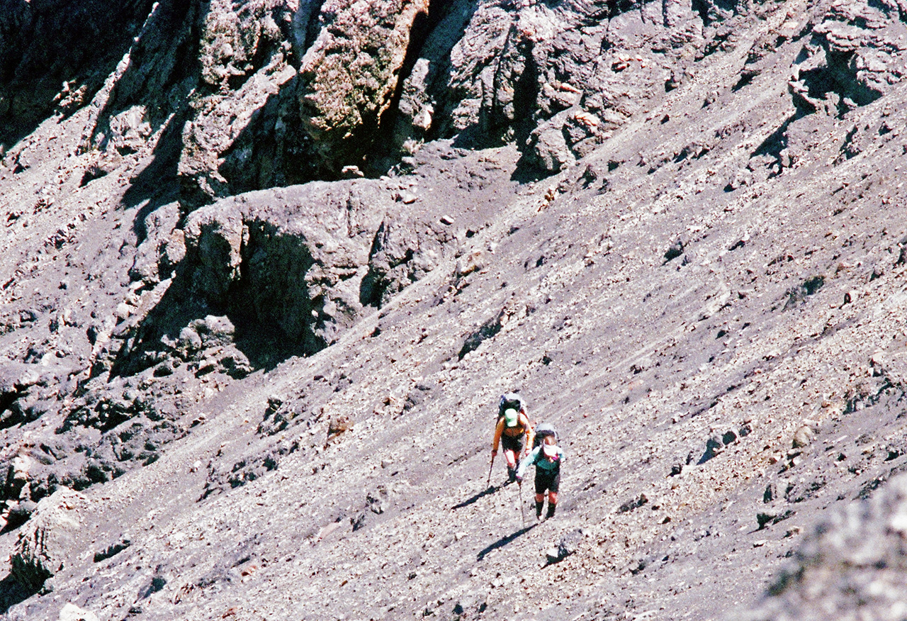
Our ascent of Gladstone was fantastic. We departed under blue skies and followed a beautiful rocky ridge towards the summit. We encountered a few scrambly sections along the way and a decent bit of steep loose rock but everything was easily achievable. We reached the summit about 10 hours after leaving camp and took a well deserved rest on top. We descended to the east and spent the next six or so hours wrestling our way up or down unstable scree to finally make our way into the upper reaches of the Hodder Stream. We arrived late in the evening, tired and dry and ready to rest the soles of our feet.
We ate and gazed at Tappy in the twilight and wondered what weather to expect the next morning.
We got a late start on our ascent, once again under perfect skies. We followed cairns for a while before following our noses up to a saddle south of the peak. Things were much easier and more straightforward than we had anticipated. Once on the saddle, it was but a quick skip up to the summit. Being careful not to stand directly on the highest point, we basked in the satisfaction of reaching one of the trip’s milestones: New Zealand’s highest point outside the Southern Alps. We lingered for a long while, scanning the horizon, looking over the ocean to the east and back at the mountains we had crossed to the west. We were almost there.
I spent the last few days of our traverse enjoying the routine of tramping that we had grown so accustomed to over the previous weeks. I was able to reflect on what we had experienced. Over almost a month, our trip had encompassed four distinct types of New Zealand wilderness: the ruggedly remote and vegetated West Coast; the steep and well-appointed Nelson Lakes; the barrenly beautiful tussock-lands of the station country; and the rocky Kaikoura ranges. I enjoyed it all, but most of all I enjoyed those times where we were exploring, travelling off-trail and relying on our own skills and knowledge to get where we wanted to go. We were totally in tune with the environment and I felt connected to the New Zealand bush in a way that can’t be achieved on a track or in a hut.
Travelling off-track in New Zealand isn’t about exploring newly discovered country like explorers of yesteryear. Pretty much all of New Zealand has been travelled by someone, at sometime. I find exploring country that is unknown to me, without the assistance of existing infrastructure, approaches the pinnacle of outdoor travel: a test of skill, tolerance for uncertainty, and a deeper experience of the wildness that draws us out there in the first place.
There is a plethora of formed and marked routes in New Zealand providing access to some amazingly beautiful locations. New Zealand also provides some amazing off-track travel to remote and stunning areas that are very accessible for trampers with solid basic outdoor skills. Accessing these areas doesn’t require a 26 day trip – most can be reached in only a day or two.
As I shuffled my way along the last bitumen-covered road to Kekerengu and finally felt the salty coolness of the Pacific Ocean lap at my weary feet, I revelled in my reinvigorated connection with wilder, off-the-beaten track backcountry travel.
We’d traversed the South Island and explored some fantastic, remote, country along the way. Alice, Andy, Rachel and I sat in the east coast sand with deserved looks of contented happiness on our faces.


34 years of inspiring New Zealanders to explore the outdoors. Don’t miss out — subscribe today.

Questions? Contact us


