
Dramatic as that sounds, we still enjoyed the five-star views. Every step brought us closer to Aoraki Mt Cook, a peak usually enjoyed from afar. Having to crane our necks to take in the full scale of Aoraki gave us a whole new appreciation of New Zealand’s premier mountain. But each time we marvelled at the landscape, a sobering feeling crept in as our attention was drawn back to the changes rapidly reshaping one of our country’s most unique environments. The threat feels more personal when geological timescales collapse into human ones.
As I was climbing up the final gully to the Playing Field, I realised how hard it would be to provide a useful route description for this story. By the time any reader attempts to follow my description, the landscape will have changed again. Here be dragons, o weary traveller. My best advice is to pay attention to cairns and obvious gaps in the vegetation that are easier to navigate. Mostly, the approach along Hooker Lake requires little elevation gain except to bypass gullies and to access the flat shingle fan where the route begins its ascent to the Playing Field. The edge of the fan has been eroded away and you need to find your own way around the constantly changing edge.
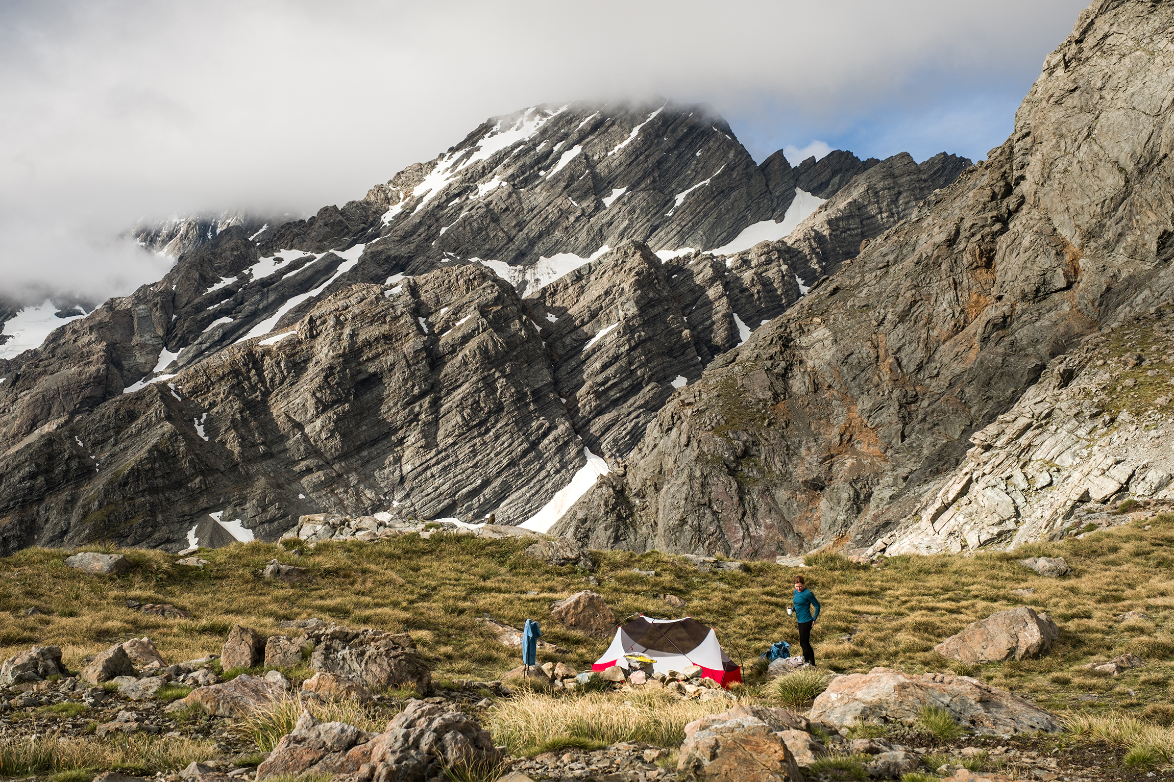
By the time we reached the Playing Field, utter exhaustion had set in. Our trip thus far had not been overly dangerous or challenging, but the expectations set by outdated route descriptions had led us to expect easier progress. Fortunately, our efforts were rewarded with views that left us speechless. Surrounded by our country’s finest peaks, we perched atop the channel carved by Hooker Glacier. Watching it transform from ice to rock to water underscored the prevailing theme of our journey: geology in action.
Morning arrived with clear skies and, best of all, no bush-bashing required. The rocky route from the Playing Field to Ball Pass is easy enough to follow in good visibility. Attempting this segment in cloud or heavy rain is not advisable.
As we approached Ball Pass I found myself constantly re-evaluating the word ‘towering’. Mount Cook Range is wrapped in a cloak of icefalls and rock, and up close appears indomitable and vividly three-dimensional in a way it does not from the far end of Lake Pūkaki.
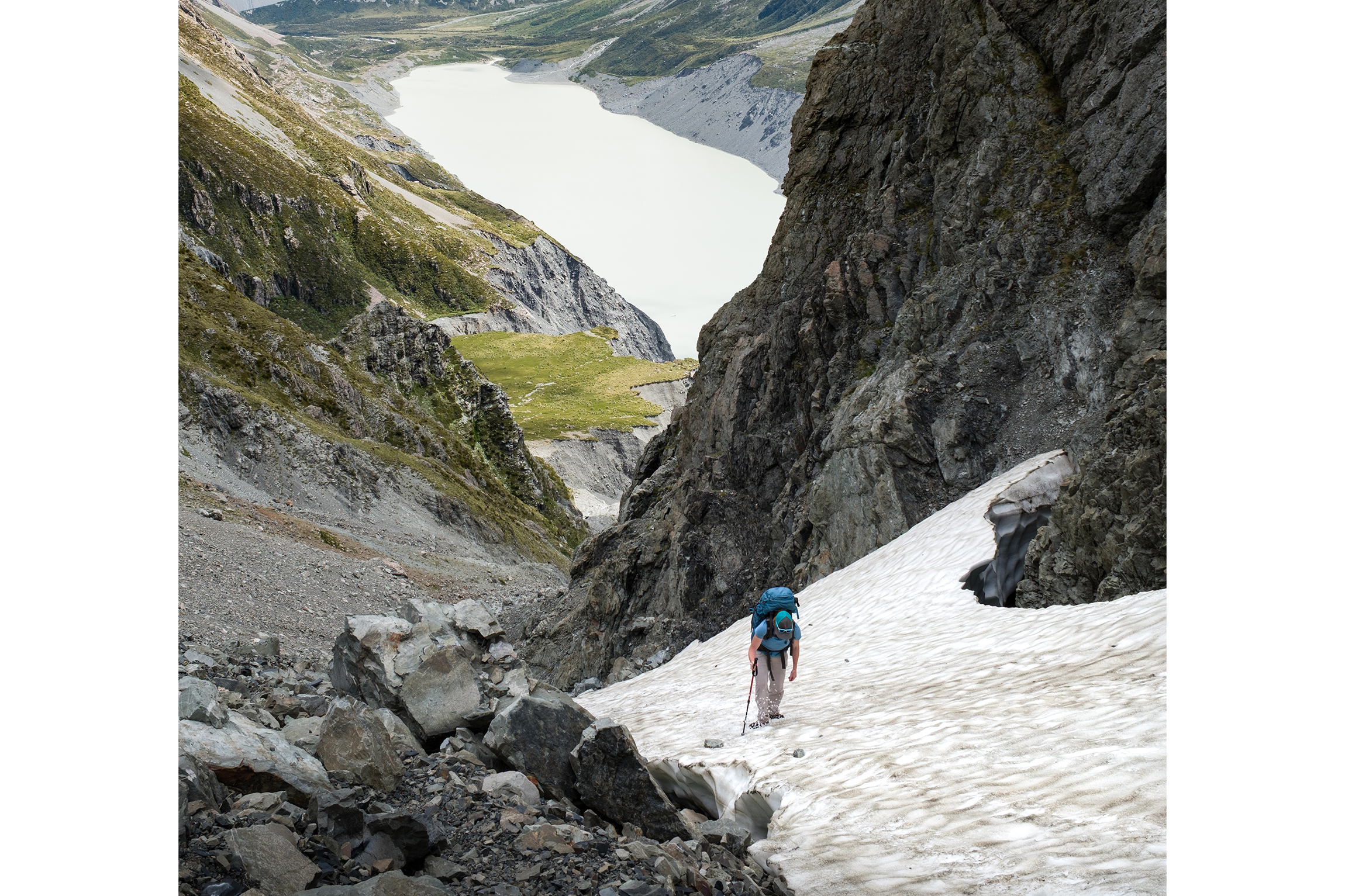
Recent visitors to Ball Pass had suggested microspikes would be sufficient to cover the final, icy approach. While accurate for our mid-summer attempt, I more than once wished for the sure-footedness of mountaineering crampons.
We reached Ball Pass under a cloudless blue sky, ice crunching under our feet. Ahead Haupapa Tasman Glacier flowed through a titanic landscape of rock and ice; to our left the glaciers and icefalls of Aoraki towered above us. It was a good moment to put aside my camera and feel small.
The descent towards Caroline and Ball huts was even harder and more confusing than the ascent from Hooker Lake. Our route-finding aids suggested following the route and to keep an eye out for the new bypass route (erosion once again) towards Ball Hut.
What ensued was a comedy of errors. Staying on the highest point of a spur is usually easy, yet we kept running into washed-out sections with questionable detour options. More than one fake path ended in a terrain trap. The flippant route descriptions we were navigating by further added to our confusion. As well, the marker for the bypass route had disappeared and we followed the old route for too long before realising.
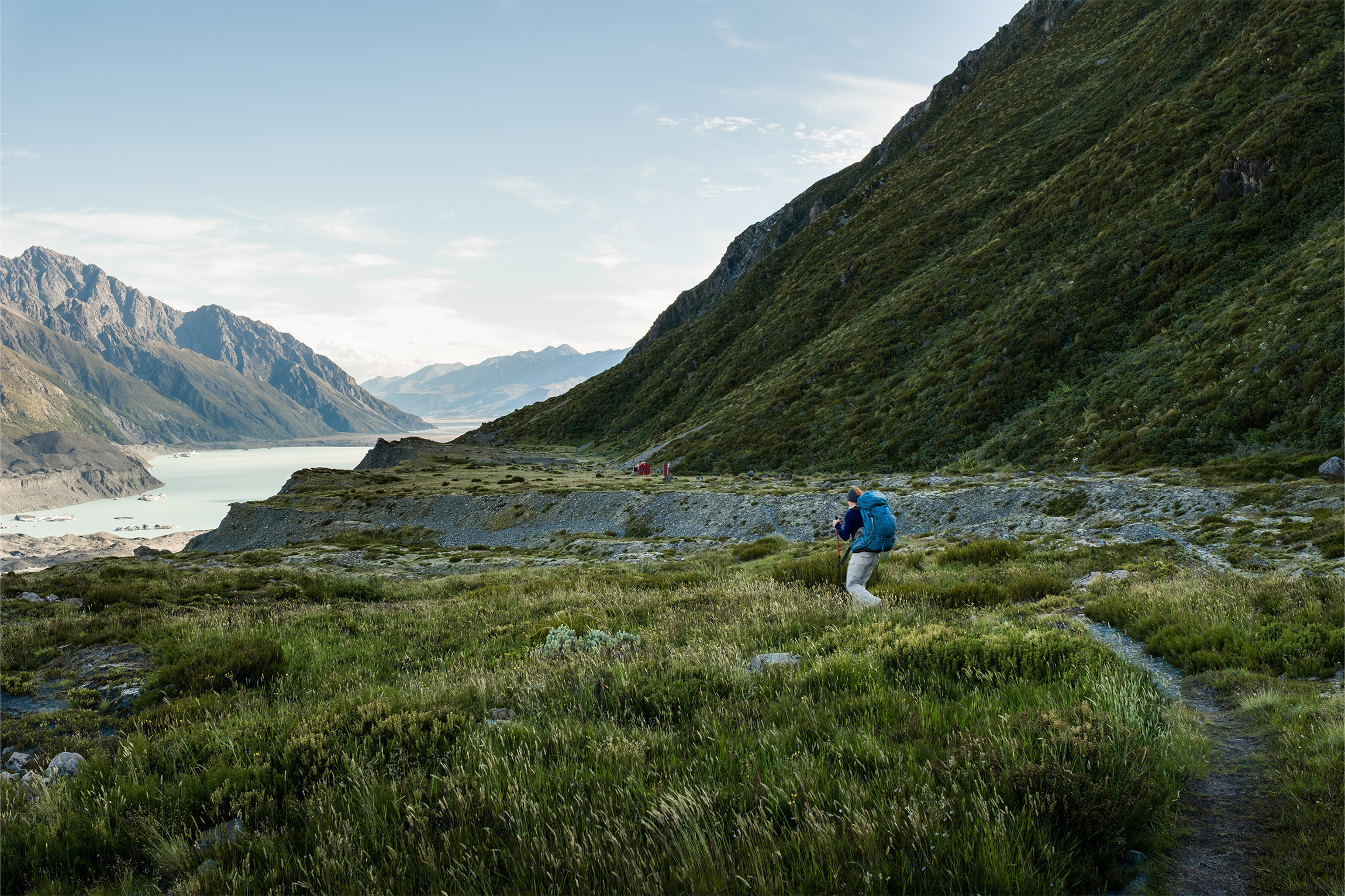
Nine hours into a supposed six-hour walk, Ball Hut finally came into view. As I made my way across the last boulder field, my brain grew sluggish and I was unable to decide where to step next. It was clearly time to bring the day to an end.
As we settled into a blessedly empty Ball Hut, we found that both water tanks were empty. An hour of searching for water in the immediate vicinity was fruitless, and I added another data point to my list of climate woes.
About then a group of trampers walked by the hut. Incredibly, they were covering our three-day trip in one long push of over 20 hours. I don’t typically struggle with a fragile ego, but watching them head off, full of energy to finish their day trip, left me wondering about my level of fitness.
We still had to resolve our water issue. Further inspection revealed a grungy puddle at the bottom of one tank. Using a water bladder and some tape we created a siphon that we inserted into the tap, and after filtering the tank soup we rehydrated our parched bodies and settled in for the evening.
A night of comatose rest was followed by an easy return journey along Tasman Lake, albeit with one last geological surprise. In 2019 a massive slip created a gorge at the northern end of the lake, its scale impossible to convey. Without the scrambly detour route through dense vegetation, finding a way across the embankments or through the bush would have been extremely dangerous.
Towards the end of our three-day trip I noticed that parts of Ball Shelter Track followed the slopes much higher than on our map. Closer inspection revealed that occasional parts of the track had eroded into Tasman Lake. Some of these fragments indicated that our track was the bypass track for an earlier bypass track that replaced the old 4WD road – yet another sign of the area’s transient nature.
Sadly, in April 2025 heavy rain undermined the footings of a bridge along Hooker Valley Track, which is used for the initial approach to Ball Pass. The track is closed until a replacement bridge is constructed – currently scheduled for completion in autumn 2026. Older topographical maps show a possible bypass route along the southwest slopes of Mt Wakefield starting at Hooker Corner bridge. According to some reports this track has also been washed away by erosion, and current maps no longer refer to it. This means your Ball Pass adventure will have to wait until the new bridge opens.
Rarely has a backcountry adventure left me so humbled and confused. Ball Pass Route, while a difficult tramping trip, still allows relatively easy access into an agonisingly beautiful glacial wonderland that reminded me of landscapes only familiar from documentaries of the Himalayas. The dark side of this story speaks of a landscape caught in the throes of climate change – the effects of which are playing out on an unprecedented timescale.
Since 2020 Alpine Recreation, which operates a guided trip over Ball Pass, has avoided the Hooker Valley because it has become too dangerous to guide clients through the crumbling moraine walls.
Instead, the company now completes a loop from Tasman Valley Road that includes Cove Stream and Mabel Col. Ball Pass is still crossed, after a night at the private Caroline Hut, but rather than descending to the Hooker Valley, trampers stay high and traverse around Mt Rosa and Mt Mabel to Mabel Col, where the route down Cove Stream is rejoined.
“It’s a nicer route as it spends more time in the alpine and avoids the long and dangerous slog up and down moraine wall washouts in the East Hooker,” says assistant director Elke Braun-Elwert.
Ball Pass has long been one of the country’s classic alpine routes and provides inspiring views of Aoraki, Mt Sefton, the Copland Pass and the Hooker and Tasman glaciers.
For Ngāi Tahu, the range traversed by Ball Pass is their ancestor, Aroarokaehe. There are two Aoraki traditions. First is the account of Aoraki and his brothers turning to stone atop their wrecked waka. Then there’s the story of the Araiteuru, a waka wrecked off the Otago coast. The crew swam ashore and began exploring the new land. They had to return to their waka by the break of day; those who didn’t make it were turned to stone by the sun’s first rays. Aroarokaehe was an old man with his grandson, Aoraki, sitting on his shoulders. It’s an image of humility and intergenerational strength: the tribe’s most significant ancestor gets his power and status from the generations who came before.
The first recorded European group to reach Ball Pass did so in 1882. Rev W.S. Green and his guides were trying to find a way onto the South Ridge of Aoraki. Green named the glacier adjacent to the pass ‘Ball Glacier’ after the first president of the English Alpine Club, John Ball. He also collected a plant from the ridgeline near the pass, which was sent to England and named Haastia greenii in his honour. In 1924 that honour was revoked after botanists concluded it was actually an example of Raoulia eximia, ‘a remarkable species of the daisy family commonly known as vegetable sheep’. (For more on vegetable sheep, see p20.)
Notable climbers Arthur Harper and George Mannering made the first successful crossing of the pass in 1890, and named it Ball Pass.


