
I’ve had a few tramping romances in my time but until this trip never a night under a drunken sailor. The dramatic scenery clearly evoked by such names as the Dragons Teeth and the Drunken Sailors is a major feature of this area of Kahurangi National Park. We also delighted in evening dips in sun-warmed tarns, multi-coursed dinners in fine company, long sun-bathing lunch breaks and, courtesy of predator control, a great birdsong soundtrack.
Pack weights for we weekend warriors were a shock: six days of food and a tent. But, there’s a rosy forecast, so Paul jettisons some clothing, the spare billy and we share a micro-tube of toothpaste and a headlamp.
Even so, it’s a steady grind towards Boulder Lake Hut. The gradient is kind and the birdlife is several magnitudes better than in our usual Tararua tramping ground. In the first few hours we see tomtits, robins, silvereyes and shining cuckoos and we’re continuously serenaded by melodious korimako.
We continue up Brown Cow Ridge mostly in the bush where the mānuka is flowering spectacularly. Eventually, at Cow Saddle, there is a view of Boulder Lake and the hut we’re bound for.
We’d heard of a party ahead planning to do the Dragon’s Teeth high route and we catch up with them at the lake edge: three South Island arborists and a Pacific Crest Trail veteran. They have a rope. We’ve decided on the low route, bypassing the jagged serrations of the teeth and passing under the Drunken Sailors. We’re rueful now about taking the easier option especially as they tell us there’s a party half a day ahead of us with two kids also doing the high route.
The occupants at Boulder Lake Hut have lit the fire which seemed odd on a sunny midsummer afternoon. But after washing away the day’s sweat, sunblock and dirt in the icy waterfall directly behind the hut, I retract my comments about the fire and enjoy its warmth.
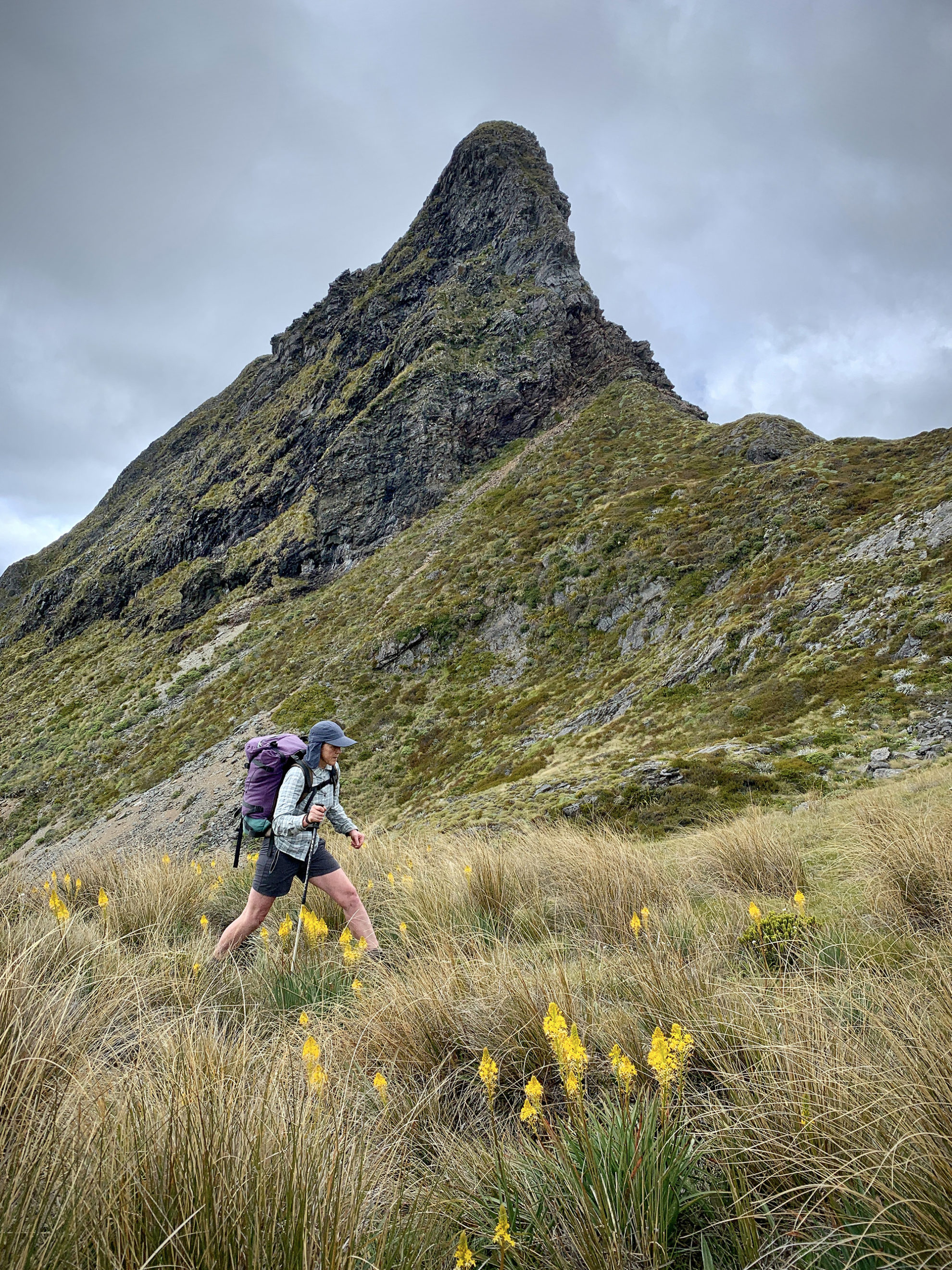
Early next morning, we cross behind the hut into frosty tussock that slices our bare legs. It’s another cloudless day and emerging into the sunlight we climb the tussock spur to Green Saddle and then sidle the Anatoki side of the main range, following cairns. A kea circles above Green Saddle.
The sidle takes longer than expected; it’s up and down and the route isn’t always obvious, but we hunt tenaciously for cairns and eventually find the next one. At one small gully, the cairns lead directly uphill and then we’re through the Needles Eye, a saddle below The Needle. Here there’s a spectacular view of glistening Adelaide Tarn with the tiny silver hut a dot against the Dragons Teeth. It’s a gentle descent to a beautiful lake with a cute hut.
It’s not quite lunchtime. We have a swim, some cheese and crackers and a cup of tea, sunbathing and perusing the hut books. There’s a shag playing on the tarn to remind us that despite the feeling of mountainous isolation, we’re still close to the coast. As we’re launching into our third brew, the arborists appear on the saddle and we try to decide whether to put in a few more hours or stay put.
Eventually, we decide to head off towards our Drunken Sailors. There’s a climb behind the hut before a drop down a steep gut towards the headwaters of the Anatoki. Again there are cairns but not always where you most want them. It’s steep and there’s lots of uncontrolled sliding on tussock and dried dracophyllum.
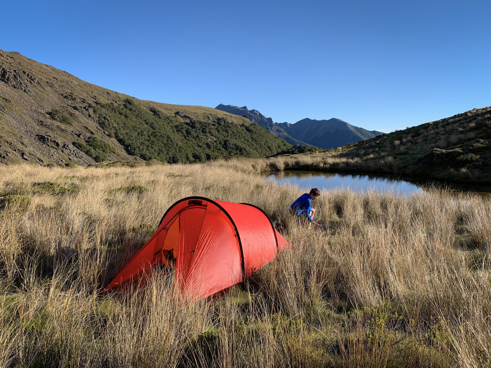
We’re heading for Pt744, one of those inexplicable spot heights that aren’t a peak. We don’t get there that evening. Travel down the true left of the Anatoki is straightforward until the cairns and footpad disappear and we get trapped in a maze of huge mossy boulders. There are few camp spots so when we find one at 5pm we pitch the tent and prepare dinner.
The Drunken Sailors loom above our Anatoki River campsite and I enjoy my night below them immensely. As we’re drifting off to sleep, we hear the unmistakable high pitched whistle of a male kiwi. Our bird tally is rising.
There’s no chance of a sleep in, but we’re not complaining about the korimako dawn chorus. It takes only an hour to get to Pt744 where there’s an extensive campsite, fireplace, massive cairn and a frying pan nailed to a tree with 744 emblazoned on it. We cross the river and begin the steep 700m climb towards the Drunken Sailors.
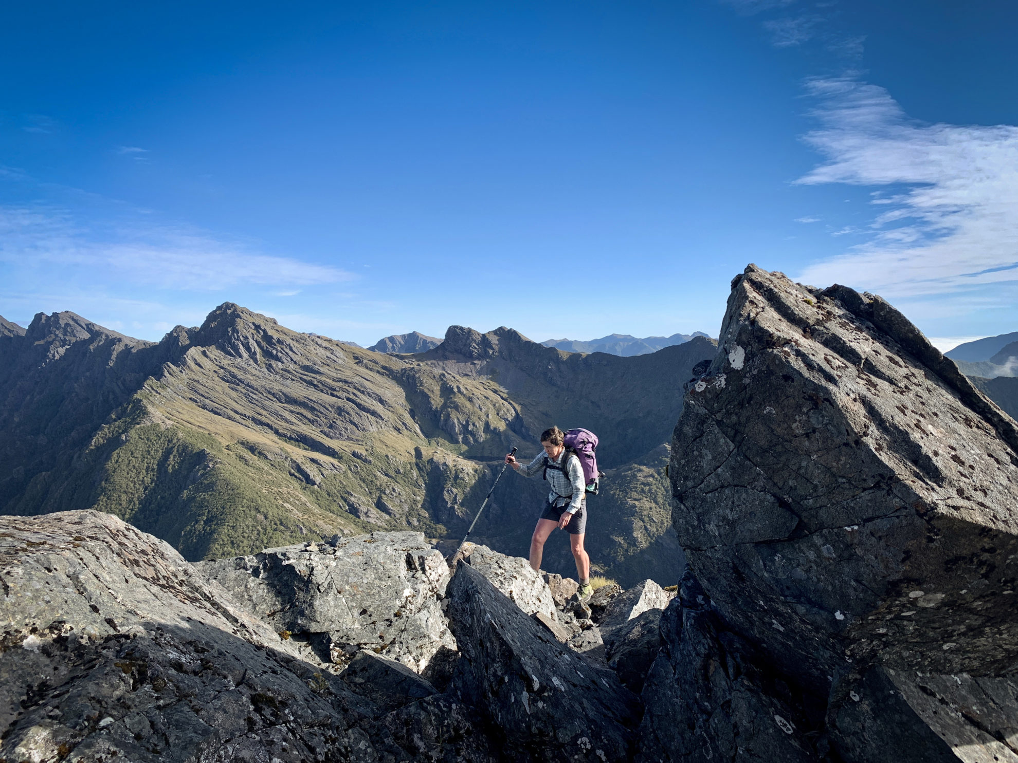
Dracophyllum is again a feature, and this time the plants help us heave ourselves up. It’s hot and dry. Entertainment is provided by the diversity of cairns. We eventually get above the bushline with the Drunken Sailors ahead of us and a view to where we need to go. Route finding should be plain sailing but isn’t. We bash through spikey spaniard, matagouri and other prickly shrubs. Once through the worst of it we can see a clear route to the saddle; the cairns resume service.
For the third day in a row, we reach a saddle and have a beautiful view of a lake: Lonely Lake with a hut. The hut is a groovy gold with a turquoise roof, courtesy of a hut renovation in 2016. It’s taken us six hours from our Anatoki campsite, so we have another sun-filled afternoon to while away.
The hut is a three bunker but more ideal for two. We do some reading, writing and snoozing and keep an eye on the saddle for the Dragons Teeth high route teams. The hut books date to 1972 when the hut was first built by the Golden Bay Alpine and Tramping Club.
The first team to appear is the family, who disappeared near the lake. Later we hear whooping as they dive into it. We wander over to have a swim ourselves and discover they’re from Rotorua. They tell us of the delights of their Whirinaki hinterland. The Dragons Teeth trip was made possible for them by helicoptering to Boulder Lake and getting a load of food dropped mid-way across the route. Dad still has a massive load, including two tents and a rope. Apparently, their daughter danced across the peaks unassisted. Her younger brother enjoyed it but was pleased to be on the rope.
As we’re cooking dinner, the arborists appear. They show us photos of the gnarly bits and are happy with their day’s work. We’re a bit jealous but we’ve had a glorious couple of days and would have struggled to carry a rope. Dinner is a convivial affair at the picnic table in the waning sun, sharing stories of past adventures and exchanging tips on tramping dinners.
Next day, it’s clear on the tops with mist swirling in the valleys. We’re heading along the Douglas Range. There’s not too many ups and downs with big sidles around Kākāpō and Waingaro peaks. We expect to see people coming the other way from Fenella Hut but have the range to ourselves. Tiny pipits dance amongst the rocks. It takes almost five hours to reach the turn-off to Fenella. Here we stay on the tops and bear east onto the Lockett Range.
The Lockett offers more enjoyable tops travel with a bit more scrambling. We plan to camp but water is an issue. There’s a wee tarn not far from the Fenella turn-off but nothing more marked on the map until Ruby Lake, which looks a fair distance. We march on. There are some fun rocky scrambles and a couple of bushy sections. The Cobb River is far below winding amongst patches of open grassland and bush.
We climb up and over a few spot heights, culminating in the looming bulk of Mt Benson. Ruby Lake glistens 200m below the ridge. Rather than drop directly down, Paul insists that we travel a couple of kilometres further along the ridge to a saddle. I’m exhausted and grumpy and none too pleased that the descent from the saddle is horrible – lots of prickly spaniards and rough and rocky underfoot.
We arrive at our Ruby Lake campsite eleven hours after leaving Lonely Lake Hut, and we’re to bed early, though sleep is interrupted by calls of kiwi late into the night.
Next morning, I individually tape each of my toes, my heels and the sides of my feet and miraculously, when I start walking, they don’t hurt. I eschew our route of the night before and set directly off uphill. Perfectly easy travel, and even an acknowledgement from the great helmsman that this would have been a better way to come down.
It would be easy to make it to the road end from here but we decide to use our hut passes for one more night in the wilderness. We crest Iron Hill to view lake land, three larger lakes and numerous tarns dotted within a large basin. Our last night in Sylvester Hut is a social affair, with a good crowd.
All that remained was an hour’s walk to the car park above the Cobb Dam and the small issue of finding a ride back to Golden Bay. A car holding four people and their packs stops for us and we’re successfully wedged in. Next stop: sausage butties and fresh apricots at the Takaka farmers market.
34 years of inspiring New Zealanders to explore the outdoors. Don’t miss out — subscribe today.

Questions? Contact us


