Home / Articles / Mountain biking

Wanaka’s wild side

Image of the May 2021 Wilderness Magazine Cover Read more from the
May 2021 Issue

An exposed ride through a high country station on Wanaka’s lakeshore.

Minaret Burn Track is an enjoyable classic high country station adventure ride located on the wild side of Lake Wanaka.

The track begins at Homestead Bay where the nor-westerly cloud was casting ominous shadows over the mountains and white caps surrounding Roys Peninsula, but we were sheltered on the western side of the lake.

The track climbs straight out of Homestead Bay and above the convoluted lake edge to the West Wanaka Station 4WD track. It then heads inland, around Lookout Hill and over Station Creek to Colquhouns Flat. It passes through well-established regenerating bush before the flat. Here, a last look back along the way we’d come shows the long finger of Roys Peninsula and The Island. This is a massive sand and shingle bank deposited by the Matukituki River where it flows into Lake Wanaka.

We bombed down to Colquhouns Flat and back to the lake edge. The once-cleared hillsides have been left to regenerate, mostly with kānuka. The track then sidles across Station Creek Conservation Area with Mou Waho, the famous ‘lake within a lake’ island floating 2km offshore.

These are both DOC reserves and an important sanctuary for many bird, plant and insect species that have all but vanished from the surrounding area.

Crossing the Rumbling Burn marks the start of the ride’s biggest climb and is a good place to fill drink bottles with crystal clear stream water and to check out the beautiful lake edge vista. The catchment spans the Mt Alta Conservation Area and is thickly bush-clad from top to toe.

Beyond the stream is the start of an honest ascent that will have riders changing into granny gears and stripping off unwanted layers. The top arrives in its own good time along with expansive views and a chance to really appreciate the vast glacier-formed landscape below.

West Wanaka Station’s Minaret Hut. Photo: Dave Mitchell

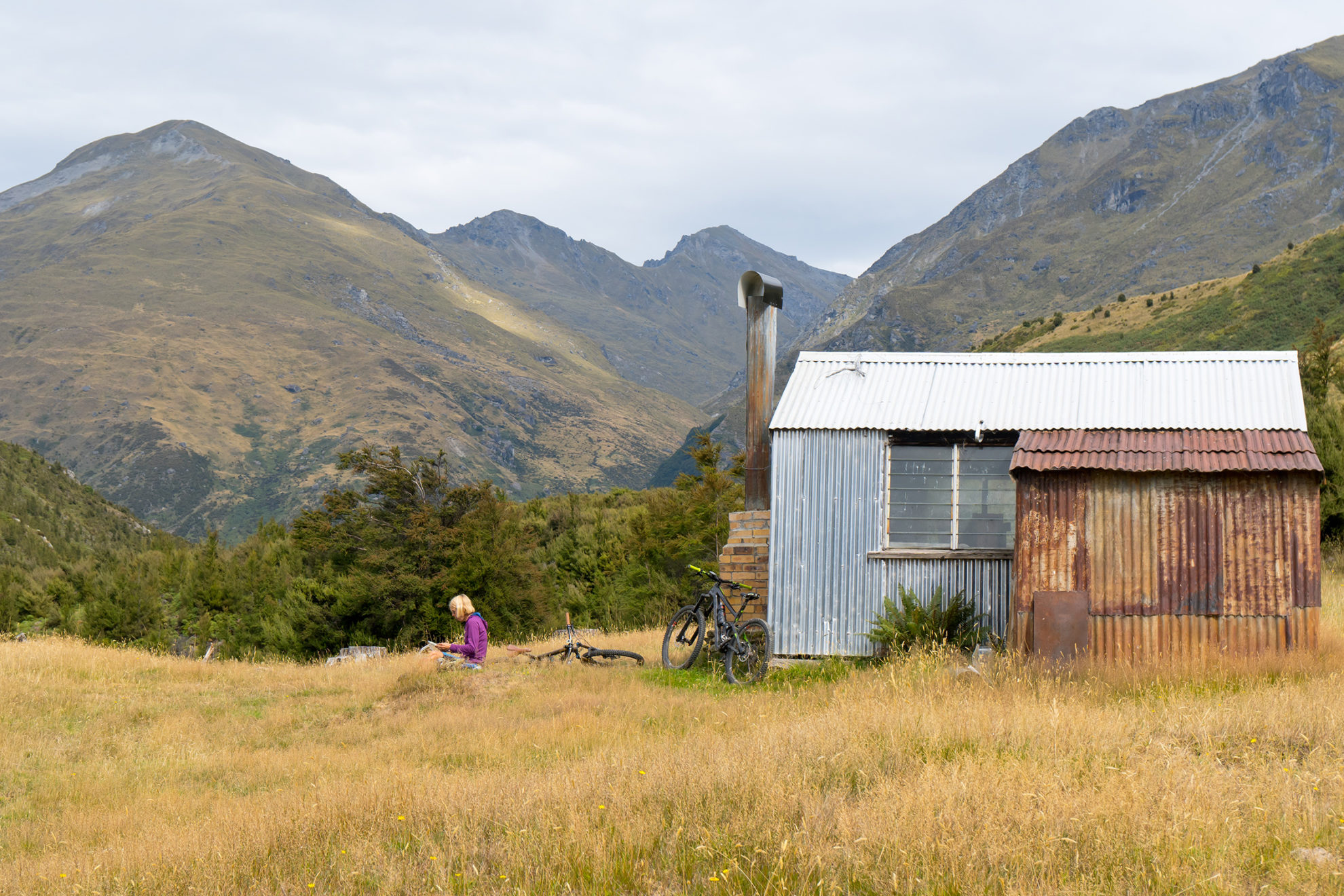
There is a farmed corridor sandwiched between the Mt Alta and Minaret Burn conservation areas where the 4WD track leads over an open high terrace. About halfway along this is the West Wanaka Station’s private Minaret Hut. It’s distinctively clad in shiny corrugated aluminium with a contrasting red rusty lean-to attached and clay brick fireplace with a funky chimney pointing skyward. It’s the perfect spot to gaze out across the lake and stare skywards at the high mountains above.

The trail continues to the end of the terrace and into the Minaret Burn on a short steep descent that’s often subjected to slips and washouts. The track splits before reaching the stream with the right fork heading downwards to the lake and the left heading into the Minaret Burn catchment (Permission is required from West Wanaka Station (03 443 7144) to access the track on the true left of the Minaret Burn).

It’s a rough farm track for the first kilometre and then the trail descends to the river below Twin Peaks. There is a short forested gorge and a kilometre of open river flats to ride with views up and down the valley. The track is rough in places and narrows to a pack track as it leaves the river for the last stretch to an old mustering hut.

The hut is just past Slip Creek and is a good turn-around point, though keen riders may wish to push further up the Burn to the top hut near Boil the Billy Creek. Both huts are derelict providing just a basic shelter from a storm.

If you’re lucky, as we were, a wild westerly will be blowing, providing a tailwind on the open sections. Much of the return climbing is more gradual with steeper descents and a collection of dramatically different views over the lake.

By the time we returned, the lake was incredibly choppy and dust was blowing from Roys Peninsula as we rounded the last headland before Homestead Bay. The moral of the story: head out early, enjoy the magic light and you might get a good tailwind home.

Distance
24.4km one way
Total Ascent
1215m
Grade
Moderate / Difficult
Time
5-7hrs
Access
Mt Aspiring Road, take West Wanaka Road and park at the road end
Map
CA12

GPX File

minaret burn track (gpx, 20 KB)

GPX File

Your device does not support GPX files. Please try a different device.