Home / Articles / Mountain biking

Sounds incredible

Image of the November 2022 Wilderness Magazine Cover Read more from the
November 2022 Issue

The Link Pathway, a new cycle trail between Picton and Havelock, offers easy riding with gorgeous Marlborough Sounds views.

Hidden along the convoluted and often steep north-facing ridges and valleys of Wedge Point runs the 42km Link Pathway, a community-based construction that soaked up thousands of volunteer hours and utilised four sections of historic pack track and an old stock route. It roams from Anakiwa, east to Picton and west to Havelock. It’s an amazing trail to ride with stunning scenery and a historic bent. A bonus section of track starts from Picton and heads northeast to a prominent coastal point called The Snout. It can also be linked up with the Queen Charlotte Track, Whakamarina Track and Waikakaho/Cullens Track.

Wedge Point stretches like an accusing finger into the sunken valleys of Queen Charlotte Sound. Its hills are cloaked in regenerating native bush and rise up to Te Tara-o-Te-Marama / Mt Freeth and along a broken ridgeline with watery views. Dotted along its coast are baches, homes and wharves, and sailing boats are moored in its many coves and bays. There is nothing else like it in the South Island.

Basing ourselves at the DOC campsite in Momorangi Bay, we began our first ride to The Snout. 

A chilly start, accompanied by the screeching of gulls, found us pedalling up singletrack above the road before descending into Ngakuta Bay and around the waterfront. Wading birds were catching their breakfast while pūkeko scoured the wide reserve in front of a long row of baches sitting just above the high-tide mark. 

We recrossed the road and climbed to the 100m contour. A roller coaster of short climbs and descents carried us through regenerating bush, a mixture of kānuka, wineberry, marbleleaf, pittosporum and toetoe with remnant stands of shady beech forest and cool gullies of ferns, broadleaf and fuchsia.

Prolific trapping in the area explains the birdsong we heard as we descended towards Wedge Point and crossed the main road to head south through tall stands of black beech that populate the hillsides of Shakespeare Bay. The air was full of the scent of cut pine from massive piles of logs dwarfing Kaipupu Point. The track rolls into Picton Harbour with views to the ferry terminal and the township, its profusion of wharves neatly packed with a variety of boats. 

A logjam at Kaipupu Point. Photo: Dave Mitchell

We wove our way around the harbour to the start of Snout Track, which zigzags to the ridgetop where Ridgeline Track flows onto Westside Track and finally onto the Kanuka MTB Trail. This heads to The Snout on the dry, north side of the ridge and offers fleeting coastal views. It’s a fantastic ride with a slow descent from above Karaka Bay to The Snout. We are always surprised by how the track opens out    suddenly at the end, delivering us to the sea where a tiny coastal beacon stands. It’s a great lunch spot with beautiful views and plenty of boat traffic plying the narrow gap between there and bush-clad Allports Island.

Halfway back we turned left onto the Lions Centennial Track and climbed to the 150m ridge, where the trail cruises for a couple of kilometres to rejoin Westside Trail and the Ridge Line Trail. From there we took the Leicester Trail to Leicester Street and onto a multi-use track back into town and thence back to camp.

Original trail work at Ngakuta Bay. Photo: Dave Mitchell

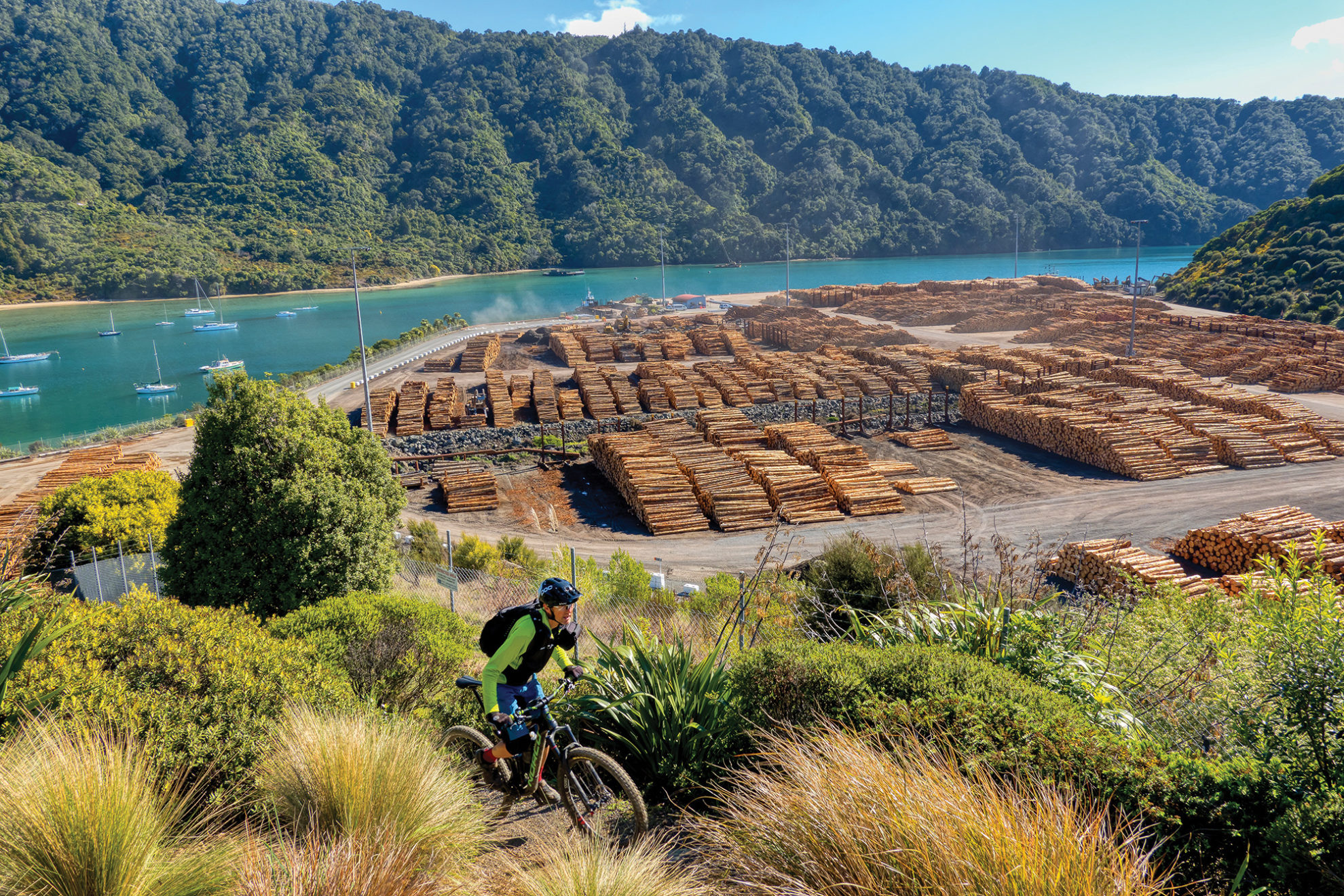
The following day we headed west on singletrack to The Grove. There’s a short section of tarseal before a roadside trail runs through dairy country and Linkwater to Oruapuputa and the estuary end of the Mahakipawa Arm of Pelorus Sound. Sections of the track run through small settlements before climbing above Moenui into the Mahakipawa Hill Scenic Reserve, following an original pack route. An optional 4WD track crosses the trail and climbs due south from where the track gets close to Cullen Point. This ascends to a comms tower at 400m and provides incredible 360-degree views of everything Marlborough.

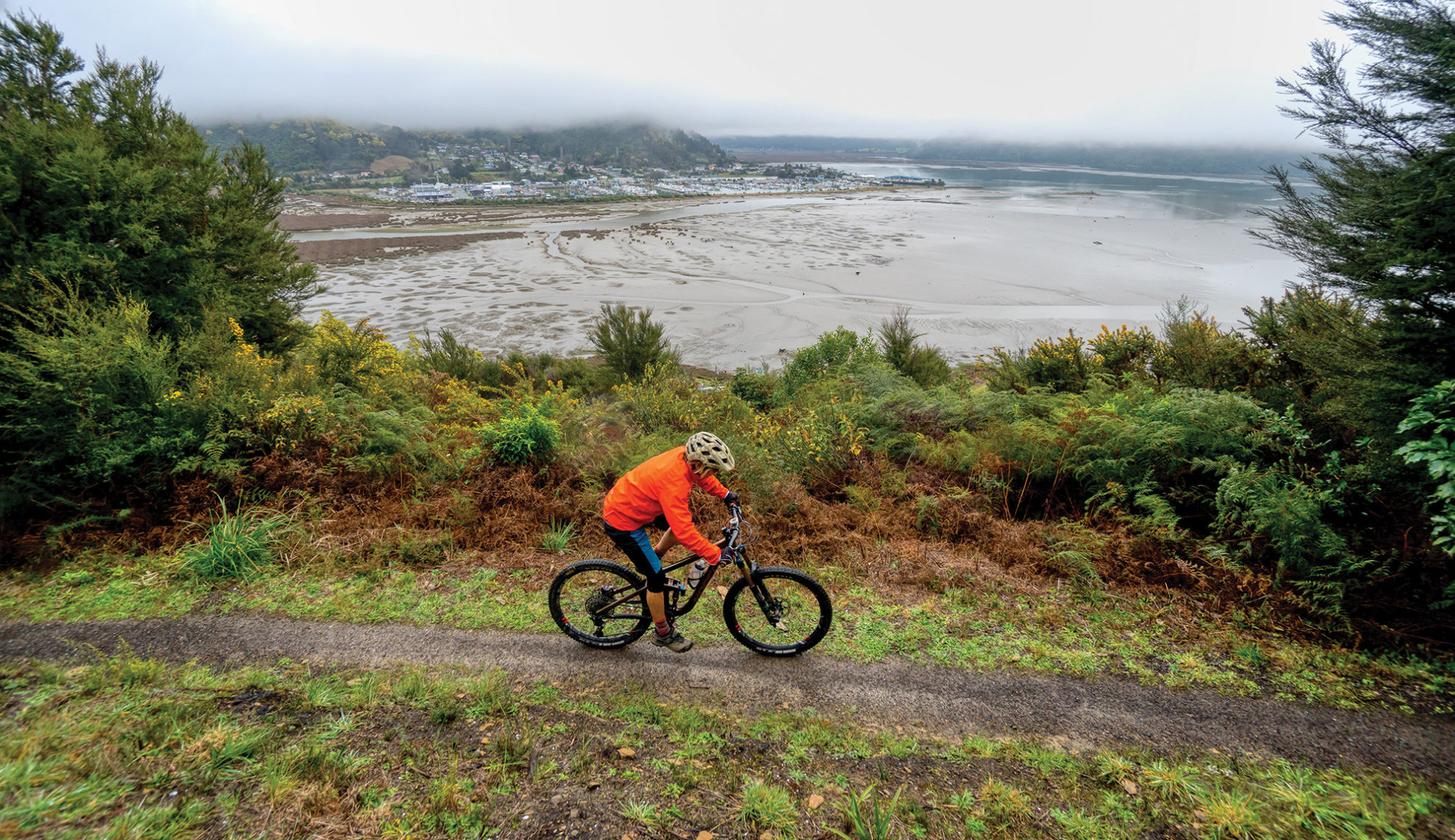
The trail then turns to face Havelock and cruises downhill through a sea of yellow-flowering wattle trees to where the Kaituna River meets the Havelock Estuary. It’s the Marlborough Sounds’ largest wetland and has a menagerie of bird life, aquatic invertebrates, colour and activity. Havelock provides a great selection of cafes for lunch before the homeward journey.

An attraction of the Link Pathway is that it can be done in sections; an in-and-out trip or a linked trip with a host of other Marl-borough Trails.

Distance
The Snout, 50km; Havelock, 40km
Total Ascent
1300m (The Snout), 750m (Havelock)
Grade
Moderate / Difficult
Time
5–6hr (The Snout return), 4–5hr (Havelock return)
Accom.
DOC camp, Momorangi Bay
Access
From Momorangi Bay in Grove Arm off Queen Charlotte Drive