Home / Articles / Mountain biking

Coro street

Image of the May 2022 Wilderness Magazine Cover Read more from the
May 2022 Issue

With the addition of the just-opened Coronet Loop Trail, Queenstown positions itself as one of New Zealand’s best mountain biking destinations.

After five years of hard work, the Queenstown Trail Trust, backed by untold volunteers and local businesses, recently opened the 50km Coronet Loop Trail. This epic trail opens new territory to the public, crossing land owned by developers Soho Properties. 

The new trail adds to other best-in-class trails in Queenstown and across the wider Southern Lakes District.

It begins at Arrowtown and is best ridden in a clockwise direction. We set off alongside Bush Creek on a trail we had previously only descended thinking it way too steep for peddling. However, Creek bridging and major track work has seen almost all the steep pitches re-aligned, leaving just a few short sharp pinches to challenge riders. It was like riding a completely new track.

At Bush Saddle, the trail leaves the creek for the Coronet Peak Water Race Trail.

Deceased wilding pines litter the trackside; no longer would they compete with the surrounding native beech, matagouri, spaniard, hebes and snow grass. At the Dan O’Connell Track junction, we took the Coronet Water Race Connector Trail upwards to Coronet Peak Road. Stunning views extend to the cloud-crowned peaks of The Remarkables, and Walter and Cecil peaks on the opposite side of Lake Wakatipu / Whakatipu Waimāori.

Crossing Coronet Peak Road onto the newly-built Tradesmans Link Track, we then climbed to a low saddle below Pt1036 which is a great spot for lunch. On the far side of the sidle, the grade 4 Pack Track and Sack Downhill trails provide a fun descent onto the historic Skippers Pack Track. The pack track wings its way down Long Gully, opposite Skippers Road. 

Nearing the bottom, there’s a new single track that climbs in zigzags to Green Gate Saddle.

Rustic Eight Mile Hut. Photo: Dave Mitchell

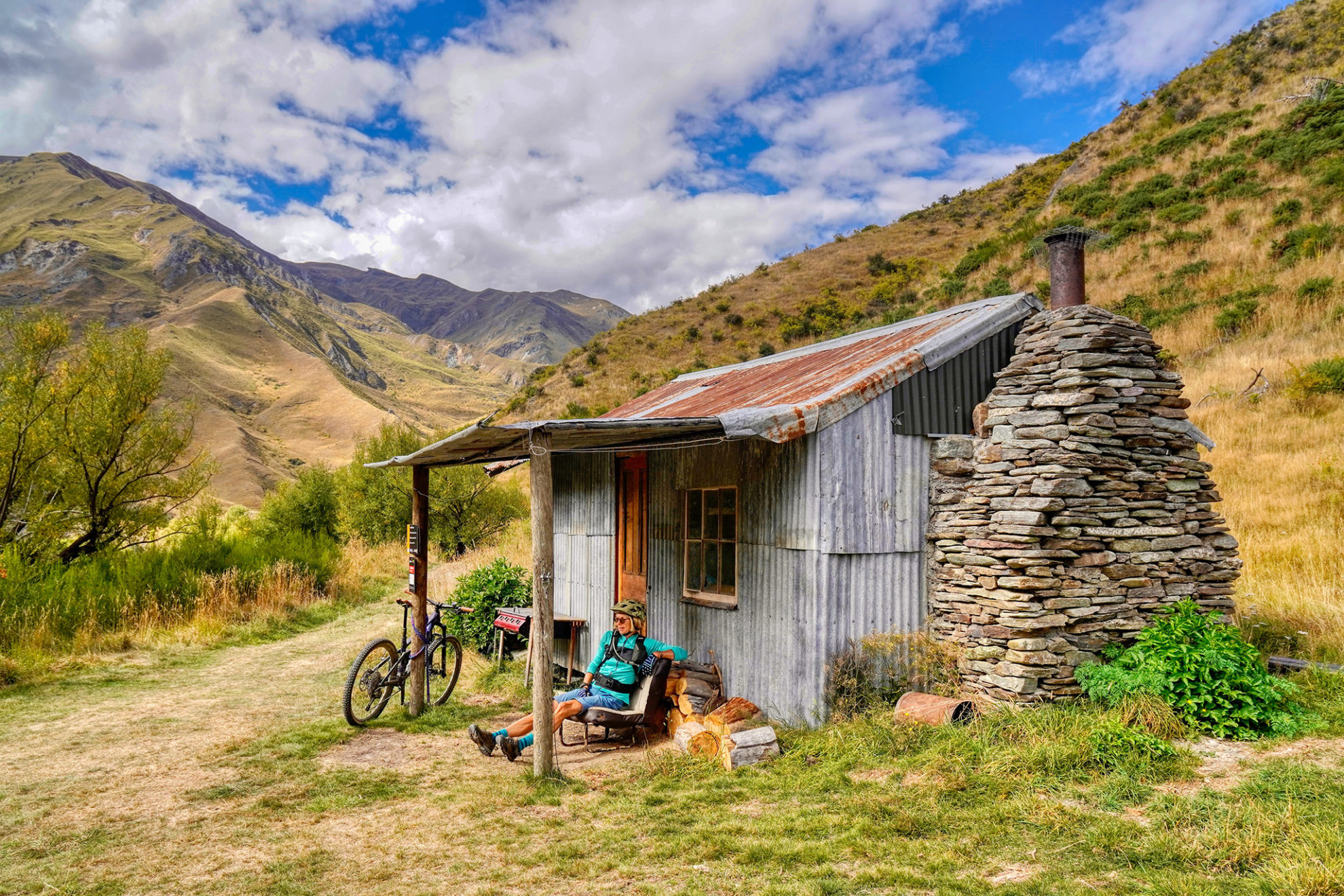
The saddle is above the energetic Green Gate Creek which tumbles into Deep Creek. In no time we were looking from a high terrace onto the historic schist and corrugated iron Green Gate Hut. The hut is being upgraded for overnight stays, adding another dimension to the trail.

When we rode the trail, just beyond the hut was a small digger guarded by two dogs. With Barry Sarginson in control, it was vigorously repairing a culvert. Sarginson has spent the last couple of years digging his way between Green Gates, Eight Mile and Macetown Road. He has no intention of stopping there, with upgrades still to be done around Macetown and Advance Peak.

We headed up a short climb that swings east above Deep Creek. Below are the remains of the Green Gate Hotel, built in 1864. The hotel was serviced by the original Long Gully Pack Track, which used to come this way. It was closed in 1888 with the formation of the present road into Skippers.

This is beautiful open country, yet with a remote feel. Mt Marsden and Mt Vanguard dominate the northern skyline with large rock faces and tors up the multitude of streams that roam their faces. To the south, Coronet and Brow Peaks can be seen.

The newly minted zigzagging singletrack to Green Gate Saddle. Photo: Dave Mitchell

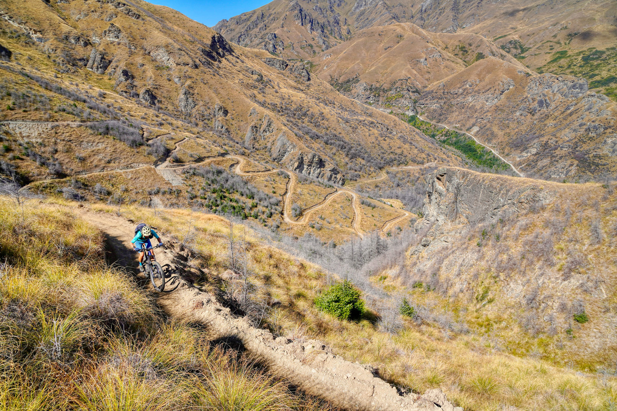
The well-graded track follows the path of least resistance over bluffs and river terraces on its spectacular way to Deep Creek Saddle. From here, it drops into the Eight Mile Creek catchment and on to Eight Mile Hut which sits beside the Arrow River. It’s another classic abode with its thick corrugated cladding now showing its age.

Not far past the hut, a new trail leads to the Macetown 4WD Track where skinny sections of singletrack and bridging keep walkers and bikers out of the water.

A profusion of mining relics lie beside and above the Arrow River with long stretches of water race, riveted pipeline and sluicing claims and their ubiquitous jumble of rocks and boulders. A final bridge crossing and steep switchback climb reaches the Arrow Gorge Track with its narrow bluffed balcony section, then a wider flowing downhill back into Arrowtown.

Distance
50km
Total Ascent
2953m
Grade
Moderate
Time
4-6hr
Access
Butlers Green, ArrowtownButlers Green, Arrowtown

GPX File

Coronet Peak Loop (gpx, 1 MB)

GPX File

Your device does not support GPX files. Please try a different device.