
We drove through Murupara towards the forestry town of Minginui. Minginui was hard hit when Whirinaki logging ceased in the 1980s. Now iwi are busy growing native trees in their extensive nursery. In partnership with the Crown Research Institute, Scion, they’ve developed a new silviculture technique for propagating the podocarps that Whirinaki is famous for. The plan is to extend the forest by planting areas that were formerly in pine.
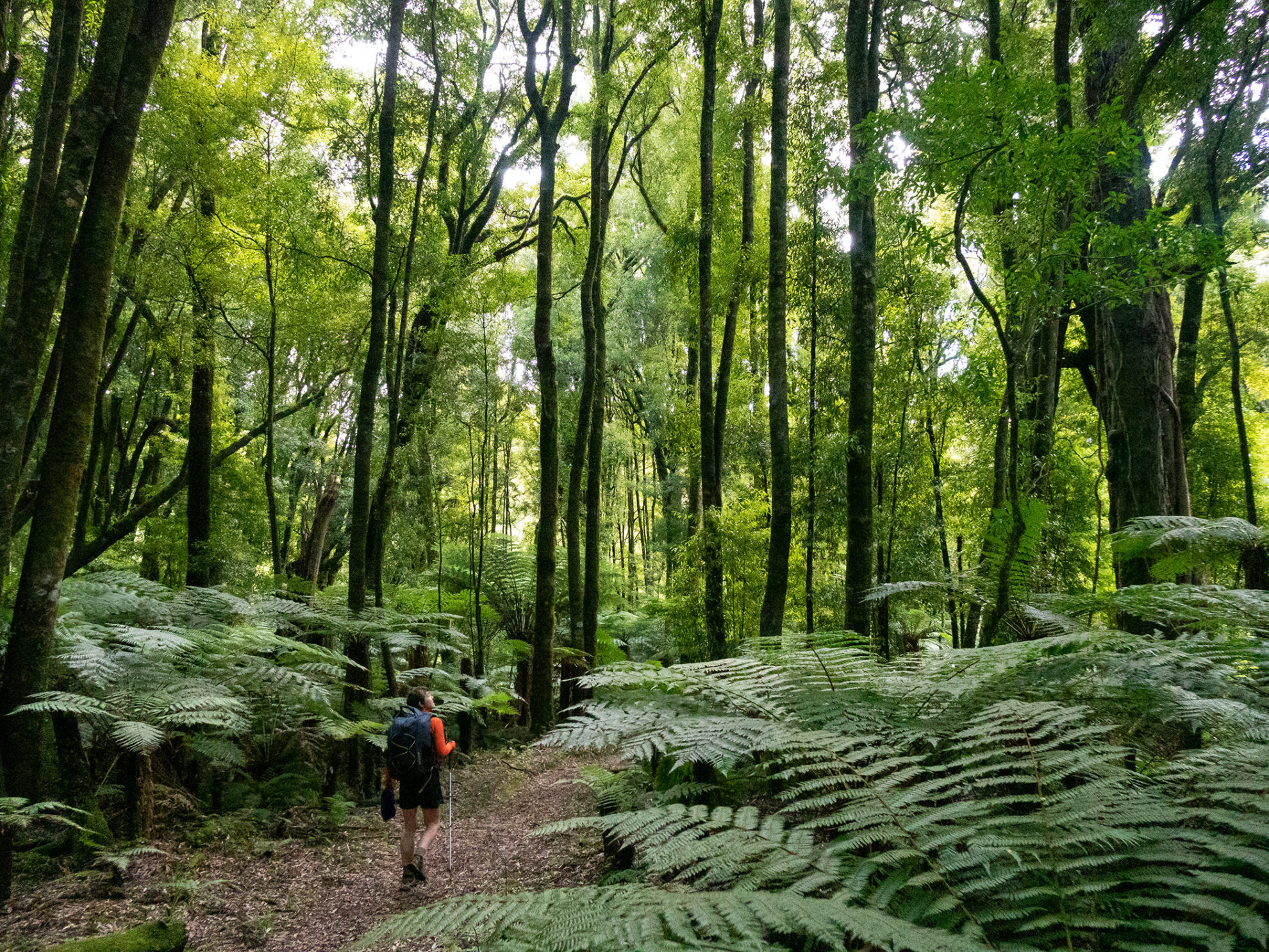
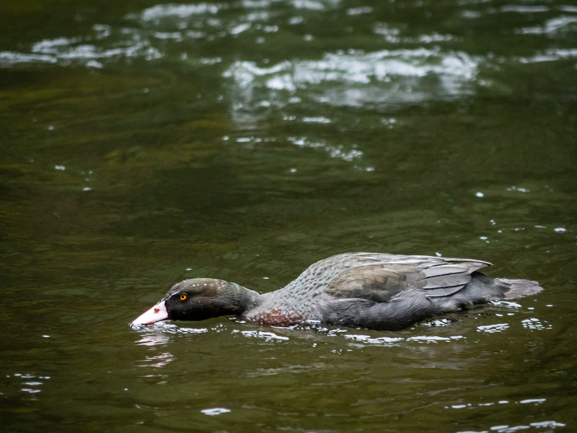
As we left the car park, the morning’s heavy rain receded and the sky lightened. We set off down the wheelchair-friendly superhighway, not worrying about looking at our feet, but staring skyward towards the tops of the huge trees we were amongst; and also keeping an eye on the river for whio.
Te Whaiti-Nui-a-Toi Canyon is a short distance from the road end. Green moss covers the blocks of sculpted rock that rise from the rushing water far below the bridge.
The pair of whio, when we spotted them, had their heads down hoovering insect larvae from the river surface. They were unperturbed by us, negotiating the rapids and surfing downstream.
From the canyon, the track continues in an easygoing manner through the spectacular forest, following the Whirinaki River for 15km before reaching Central Whirinaki Hut.
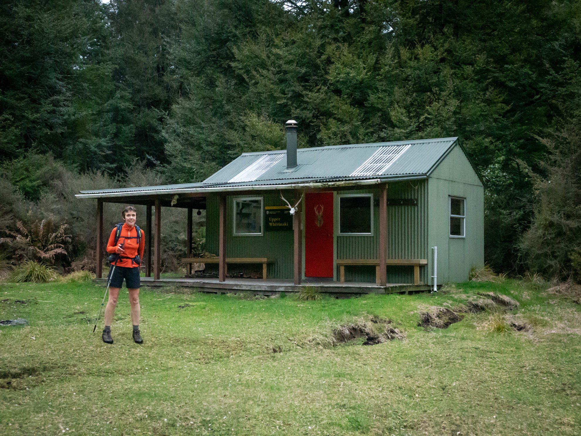
We had a drinks break at the hut, for from here the terrain changes abruptly. It’s no longer a manicured track and we dipped in and out of the freezing Whirinaki River. The signage was contradictory. It seemed we were travelling much slower than the DOC times and wouldn’t get to Upper Whirinaki Hut before dark. We were relieved when it appeared just at dusk.
There was firewood and soon the hut was warming up, candles flickering, and we were tucking into our best-yet home-dehydrated chicken curry. Almost a perfect scenario with one detrimental factor – the hut book was so new there were no intrepid tramping stories to entertain us. The lone entry, from DOC workers, was from six weeks prior when they’d delivered the new book.
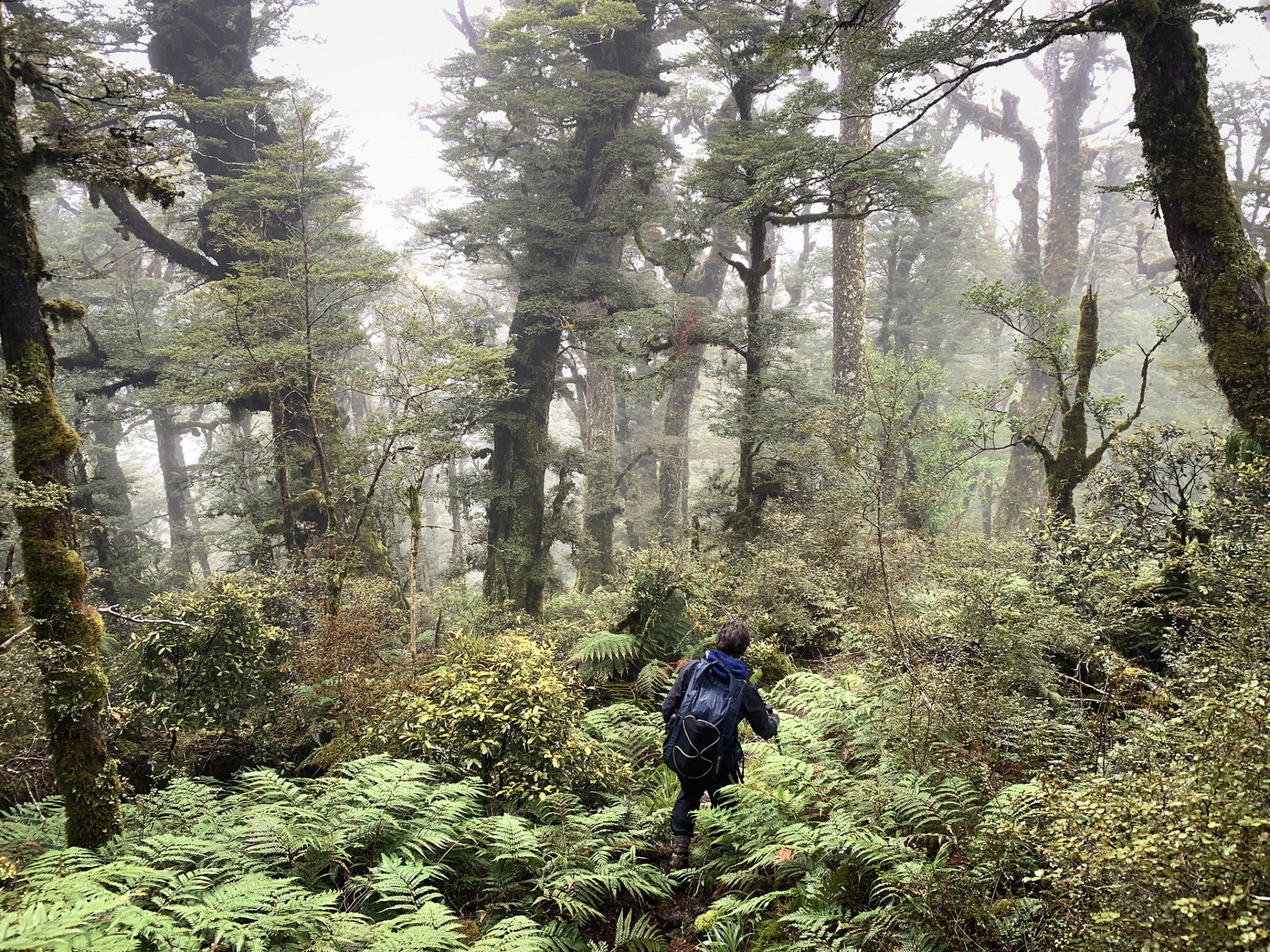
Whirinaki is an interesting area for trampers. Over the past 20 years, there’s been a lot of work put into developing tracks. The big circuit we were on has had major development, with a wide pack track cut through much of it, but it now appears DOC is giving up on the more remote section. There is frequent tree fall and the light volcanic soils are unstable and prone to slips. At the next hut, Upper Te Hoe, there was a notice saying the track was no longer being maintained and the middle part of the circuit is now a route. Backcountry navigation skills and sturdy boots were deemed essential.
This was most evident in the section between Upper Whirinaki and Upper Te Hoe huts. Although there were frequent orange triangles, the ground trail between them was hard to follow. We lost our way once and bashed some way up a creek before realising we hadn’t seen a triangle for a while. Later, we reached the highest point of the route at almost 1200m before dipping down to Upper Te Hoe Hut where we unsuccessfully tried to warm up with instant soup supplementing our cheese and cracker lunch.
The forecast for our five days on the circuit was for plenty of rain and Paul took much coercion to get started. As yet, temperatures were low, but there’d only been a chilling misty drizzle. Thank goodness then for another uphill grunt to warm us before the long descent to Central Te Hoe Hut. The track got a little sketchier and we picked our way through some more windfall and over a small hump to be suddenly dropped onto a remarkably wide and generous pack track which has been blasted through the Te Hoe bluffs to then zigzag easily down to Central Te Hoe Hut.
We’d been happy with the previous night’s accommodation, but this was a step up. Like all the huts we visited in Whirinaki, Central Te Hoe is surrounded by a large grassy area, giving the hut an airy open feel, helped by great skylights. The 15-bunk hut is in the southernmost and most remote part of the park. It’s obviously well loved by the hunting and fishing fraternity and was in spotless condition. There was a beautifully curated shelf of condiments, a complimentary pair of red-band gumboots and all the pots and pans you could wish for. Sesame oil, capers or hot chilli anyone?
The rain started to hammer and we were glad to be at this hut. It is perfect in many ways for a rest day, not least that there were beds framing the dining table so we could stay in our sleeping bags whilst eating, cooking and playing cards. Again, there was a brand-new hut book but the hut library housed both classic novels and historic Wilderness magazines so we weren’t short of reading material.
Next day it was still raining and we were worried that we’d need to ford Parallel Creek as a bridge over it had been closed due to cyclone damage in 2017. Would it be too high after all this rain? We mulled over a plan for another rest day, but finally donned storm gear and forged on. When we got to Parallel Creek, the bridge was still there, although tipped at an alarming angle. We crawled cautiously over it rather than risk a dousing.
From Central Te Hoe, the tracks are well benched and of a gentle gradient, although they belie the terrain which is a confusing mass of ridges overlaid with dense forest. The gentle tracks allowed us to motor along, up, and over low saddles.
Next stop, for lunch, was Rogers Hut, situated near the confluence of the Moerangi and Mangakahika Rivers. This is a charming six-bunker, constructed from hand-split mataī and red beech in the early 1950s. Beautiful stained-glass windows and quirky decorations give this hut character.
From Rogers Hut we were on the Moerangi dual-use track, touted by some as the North Island’s best mountain bike track (see Wilderness, January 2021), and a dream to walk on. However, the light soils and high rainfall combined with mountain bike use has led to deep ruts forming and it must be hard work keeping the tracks in good order. The rain started to ease, and we saw glimpses of sunlight and many whio.
Our last night was in Moerangi Hut and finally, the hut book entertained. There were lots of conflicting opinions on the rough middle section of the circuit. Some declared it their ‘favourite part’, others getting benighted and losing their way.
On the final day, we closed the loop with the last couple of kilometres along the track we’d started on, past Te Whaiti Nui A Toi Canyon. The sun was out, and tomtits and robins kept us company. We heard whiteheads zit-zit-zitting and the occasional squawk of a long-tailed cuckoo.
Close to the car park, there were some people enjoying the forest; they were the first we’d seen after being dropped off five days previously. Our shuttle driver declined our offer to share the last of our cheese and crackers. He’d had a venison steak for lunch.


