
Ātiamuri Bridge to Mangakino, Waikato River Trails, Waikato
38km, 3-6hr
River views predominate on this section of mostly downhill, narrow track through open reserves, pine and native forest. The picturesque trail follows the river, with solitary, distant Pohaturoa Rock rising 200m, seen near the start; boards relate its geology and Māori heritage.
Later, white cliffs interrupt the rolling farmland beyond the river’s far side. Whakamaru Dam, where water lies placid on one side and flows northwards through a far-below valley on the other, and a 70m suspension bridge, approximately 5km south of Mangakino, are other highlights.
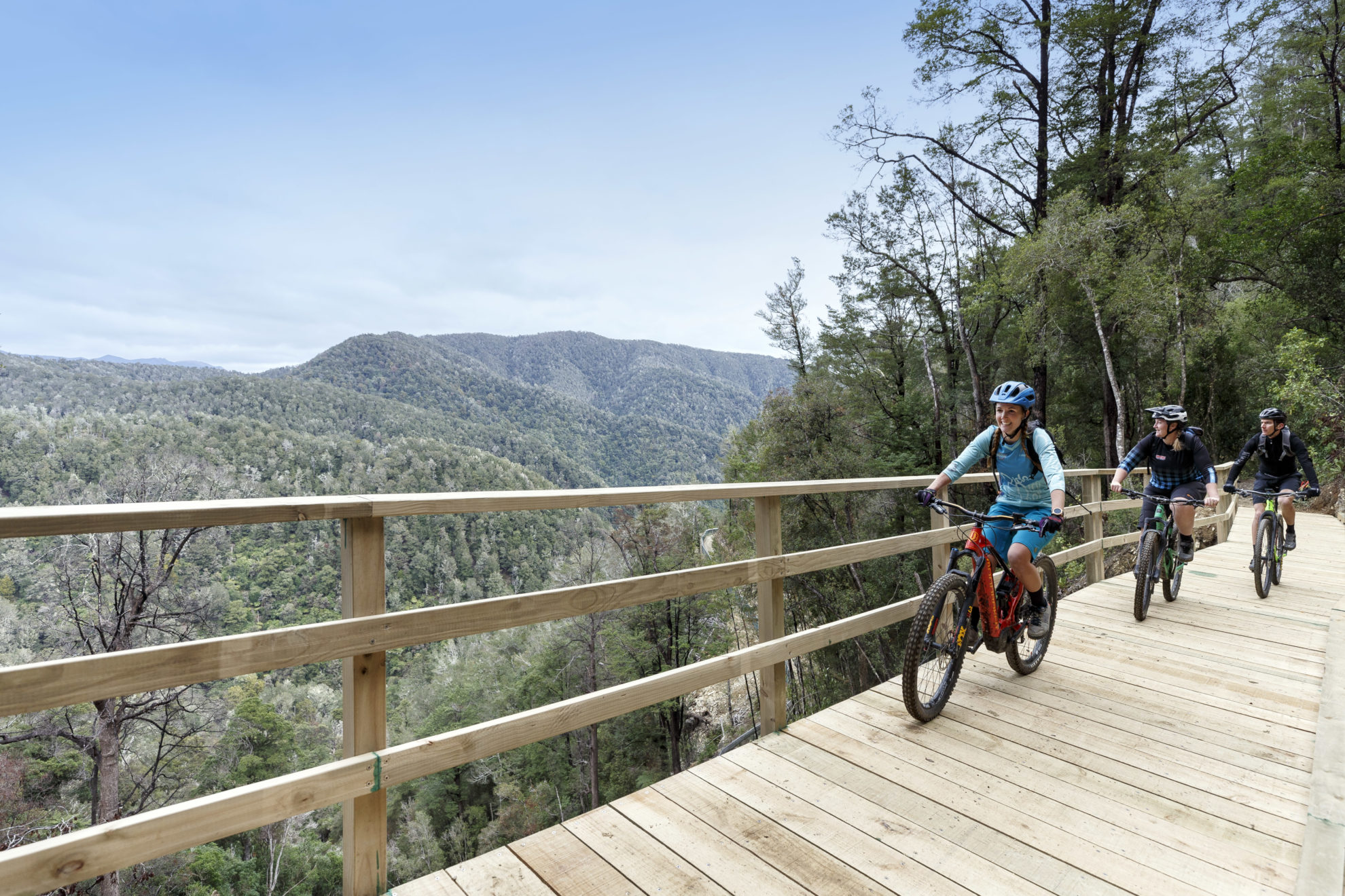
Clutha Gold Trail, Otago
73km, 5-6hr
You’ll learn not only the area’s gold history on the Clutha Gold Trail but also of its Māori moa hunting era, rail, hydropower, farming and orchards. It makes for an interesting ride and takes in the rural towns of Roxburgh, Millers Flat and Beaumont between Roxburgh Dam and Lawrence, Otago’s first gold-rush town.
It’s recommended as a two-day ride, but the undulating trail alongside the ice-blue Clutha River, hemmed by dramatic ranges, can be ridden in six hours. The suspension bridge at Horseshoe Bend, built in 1913, and the Lonely Graves, slightly off the trail, are two highlights. The river is left behind at Beaumont and follows an old railway line, going through a 440m tunnel (you’ll need a torch), then descends into Lawrence, passing the 1880s Chinese Camp, once home to 120 people. In town, there are some delightful, heritage-listed Victorian buildings.
Roxburgh Gorge Trail, Otago
21km, 5-6hr
The first 10km snakes alongside the Clutha River, through the spectacular V-shaped gorge from Alexandra to Doctors Point.
A pre-arranged, 45-minute, 13km jet boat ride is then required – a highlight for many – to navigate the turquoise river. The driver brings alive gold mining history and points out various sites, such as the stone remains of an 1860s goldminer’s cottage.
Back on the bike, incredible river views continue on the 11km between Shingle Creek and Lake Roxburgh Dam as the trail climbs gently then more steeply into a series of switchbacks to a lookout above the river.
Cyclists can continue on the Clutha Gold Trail, which starts from the dam, and ride another 9km into Roxburgh or organise a shuttle.
Pākihi Track, Motu Trails, Bay of Plenty
44km, 3-6hr
The Pākihi Track begins at Motu Road, a two-hour shuttle drive from Opotiki. It was formed as a pack track around 1905. About 20km of the trail wends downhill through forest wilderness on a narrow track. It can only be ridden in this direction and is graded advanced due to steep drop-offs.
From Pakihi Hut, the trail flattens out and, after crossing a 35m suspension bridge, follows Pākihi Stream along verdant, fern-lined banks for 10km. Keep an eye out for swimming spots.
The final 14km to Ōpōtoki is flat, on country roads and gravel trail alongside the Ōtara River.
Coppermine Trail, Nelson
43km, 4-6hr
Trail providers offer shuttle services to access the Great Rides, but this is not required for the Coppermine Trail, a loop from Nelson.
The trail follows the old railway line which was opened in 1862 and is regarded as New Zealand’s first. It was used to transport chromium copper from the hillsides. It’s a puff to climb 900m to the summit at Coppermine Saddle, the past site of a railway terminus with views encompassing Maitai Valley and the Richmond Range.
One of the country’s longest downhill mountain bike trails follows. It’s possibly a little hair-raising for novices, but the gnarly bits can be walked if necessary. Things quieten down approaching Maitai Dam and it’s then 11km back to Nelson.
Waihaha Bay, Great Lake Trail, Taupō
30km, 4-5hr
This undulating trail provides panoramas of the stark bluffs of the bush-clad Waihaha River Canyon, a far-below, thundering waterfall spilling into a green pool, with sheer rock cliffs rising from Lake Taupō, and bush-covered fingers of land interspersed by turquoise water.
Be sure to stop at the towering Echo Rock, which echoes the stream below so it sounds as if the water is flowing from above.
Tight zig-zags may have novice cyclists walking in places, as will a narrow passage resembling an open-ceilinged tunnel.
Shuttle providers drop cyclists at Waihaha Bridge with a pre-arranged boat required from Waihora Bay to Kinloch for an onward shuttle.
The energetic could check out Maitai Caves just after the Maitai South Branch Bridge, an hour’s return walk.
Scotties Hut, St James Cycle Trail, Canterbury
34km, 1.5-2.5hr
The 59km St James Cycle Trail is classed as a 1-2 day ride, but you’d need a good level of fitness to complete it in one. An easier option is an out and back of approximately 34km, from St James Homestead to Scotties Hut.
The homestead has an historic woolshed, cookhouse and stable, built around 1880. The St James was one of New Zealand’s largest high country farms.
The ride crosses boardwalk and climbs around 400m through Peters Valley to Peters Pass at 800m, then descends into the Edwards Valley, hemmed by rugged ranges and crossing rocky riverbeds and four streams. Scotties Hut, a four-bunk corrugated iron structure, is located at a historic mustering site. On the return, a 1km detour brings cyclists to Cow Stream where rock pools have captured thermal spring water. Take a dip, or soak feet, surrounded by nature.
34 years of inspiring New Zealanders to explore the outdoors. Don’t miss out — subscribe today.

Questions? Contact us


