
Who were Neill and Winchcombe?
In the late 1920s, Wally Neill and Alex Winchcombe were two young guns from the Tararua Tramping Club (TTC). As a teenager, Wally Neill hardened himself to outdoor life by sleeping in a tent at the back of his parents’ section – for 13 years. Alex ‘Winch’ Winchcombe was not just a tough tramper: he was a champion skier who competed in national cross-country endurance events and also had success in the gruelling Trampers’ Marathon, which ran for many years in the Remutaka Ranges.
Both men were part of a youthful vanguard that were shaking off the conservative, safety-conscious attitudes of the older TTC members, and daring to venture into untrammelled ground.
In June 1929 Neill and Winch decided to take on the ‘bold, craggy ridge’ that had foiled two previous attempts. They set off from Pakuratahi late on Saturday afternoon of King’s Birthday weekend and didn’t arrive at Upper Tauherenikau Hut until well after dark. As Neill later reflected in The Tararua Tramper, both he and Winch hardly slept in the crowded hut, and at 3am they tried to heat the water frozen in their billy over a fire.
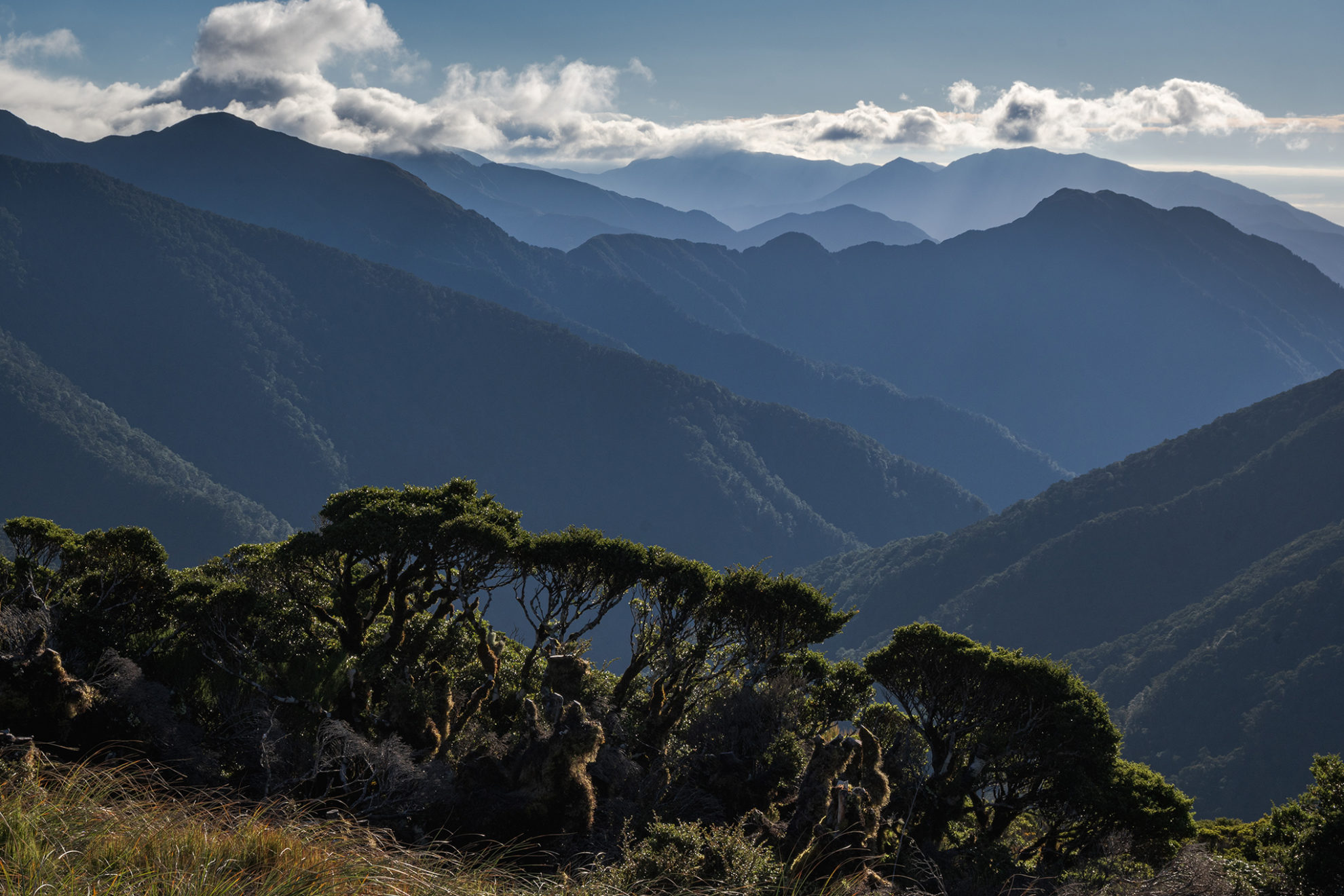
In pools of torchlight they went across frosty flats, then climbed through bush onto Cone. As dawn broke they could see the route ahead, although, as Neill wrote, sunrise revealed ‘a magnificent panorama of snow-capped mountain ranges emerging from gloomy river gorges.’ Their ridge ‘looked a very long way’ and ‘seemed very forbidding, with its rocky pinnacles and stunted snow-covered leatherwood’.
This notoriously tough sub-alpine plant would test the trampers’ limits. ‘We found,’ Neill wrote, ‘that the only method of making progress was to walk over the top of it until we fell through.’ When that didn’t work, they adopted ‘the worm’s method of getting over the ground’.
Small rock pinnacles sometimes forced them onto yet more sidling over snow-covered leatherwood, which ‘called for our last ounce of strength’. By 2pm their trousers were in shreds, their oilskins much battered and their legs were beginning to cramp badly.
Beyond the leatherwood the duo faced other challenges: deep snow covered the tussock, and ice glazed the many pinnacles. Finally, through a ‘belt of driving mist’, Neill and Winch staggered exhausted onto Mt Hector. It was dark. ‘The Kime Hut would have been very welcome had it been there,’ Neill wrote. It was not built until the following year.
Fortunately, however, they found the tracks of a ski party leading towards Field Hut. Once there, after 15 hours of effort, they rested and slept soundly for 12 hours before devouring a billy-full of rice and tramping out to Ōtaki Forks.
Neill and Winchcombe had completed an arduous route in tough conditions near the shortest day of the year, and cemented a firm partnership. In recognition of their feat, the two highest knolls were named after them. Later TTC parties cut the first track through the forest.
Neill-Winchcombe Ridge
Kathy and I are travelling in the opposite direction to Neill and Winchcombe and have the huge advantage of good maps, route beta and the shelter of Winchcombe Biv. Nevertheless, navigating down the rugged ridge is more testing than going up. The clouds toy with us, sweeping away one minute then closing in again. Endless variations of mist play along the rows of spurs and acres of leatherwood.
“Better than bright sun,” I enthuse to Kathy. “This cloud makes the landscape look so mysterious.”
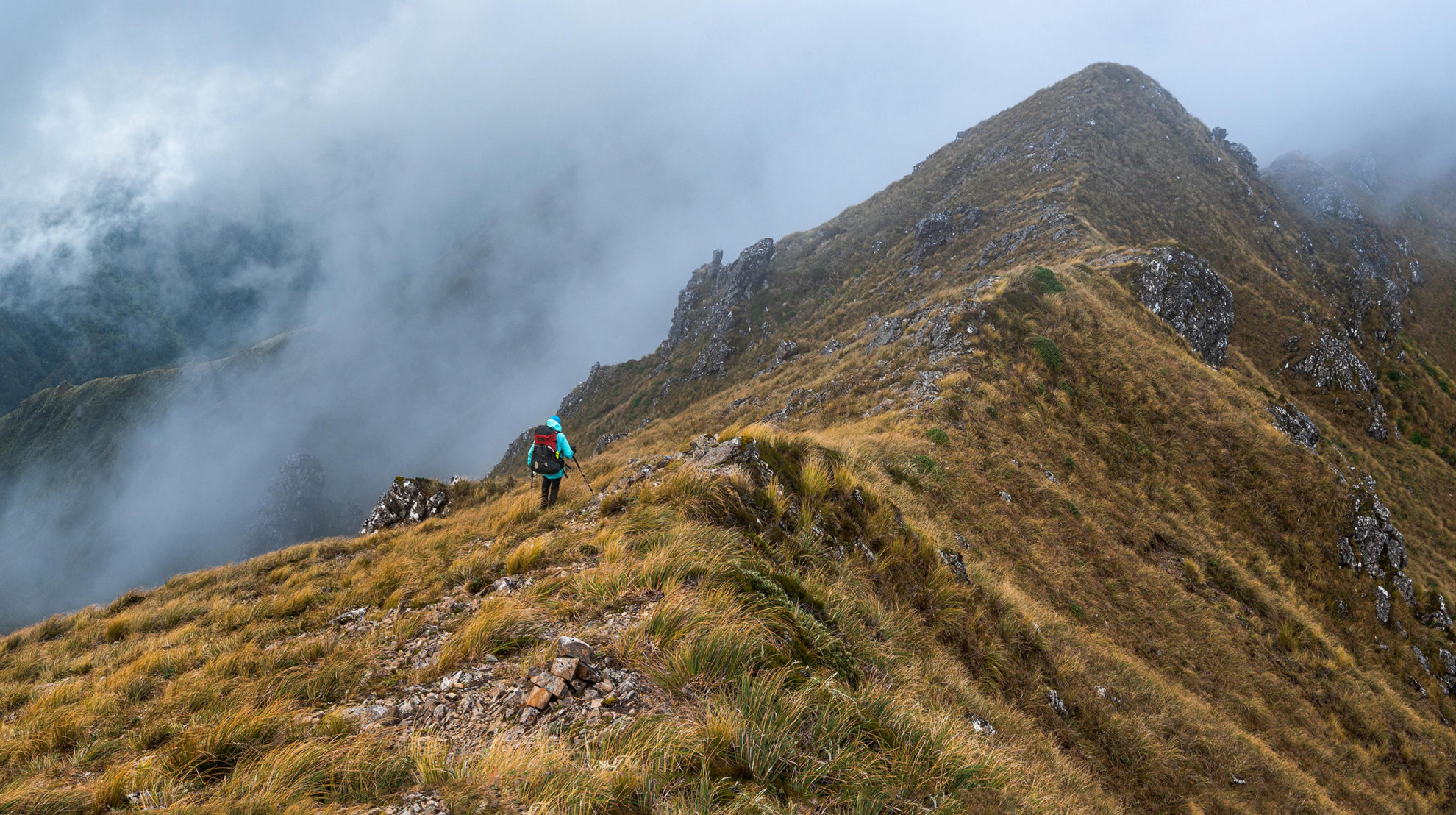
There’s the last straggling edelweiss of summer flower on unlikely slopes. By now we’re sidling steeply, clambering across boulders, hanging on to tussock. My inner voice begins to nag: Where was the last cairn, where is the ground trail?
A clearing reveals the ridge ahead, which looks straightforward but – hang on – it drops into the headwaters of some gorgy-looking creek. There’s a daunting precipice, and – the mist swirls – we’re below the ridge proper.
“Damn it,” I say to Kathy, “I’ve stuffed up. We must’ve come off on that last knoll.” Kathy seems nonplussed. She’s impressed me with her sure-footedness and stoic acceptance of the route, and my mistake doesn’t seem to worry her. It’s usually galling to retrace your steps, especially uphill, but it doesn’t take too long to rewind the error.
The visibility improves and soon enough we top Winchcombe (1261m). Ahead lies the prominent dome of Neill; beyond it, Cone Ridge and the Wairarapa farmland lie sun-drenched. That’s tomorrow’s challenge. For now all we have to do is descend to Winchcombe Biv.
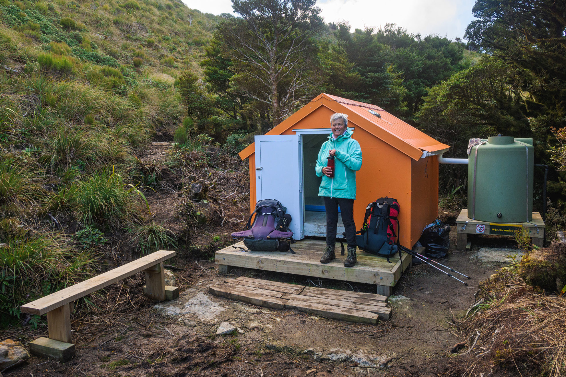
Painted Forest Service orange and nestled against the bush edge in a hollow, the two-person dog-box bivouac proves to be a cracker. We owe thanks for this cosy hideaway to Wairarapa man John McCann.
Back in the 1970s, McCann was a Forest Service deer-culler. He spent many nights in Winchcombe Biv I, later replaced by Biv II. By the 1990s McCann was working for DOC. During a spate of backcountry hut ‘rationalisation’ he had the unenviable job of removing this biv. Although he and his Masterton boss didn’t like the decision, they had to wear it.
For almost 20 years, anyone tackling the Neill–Winchcombe was in for a long day without shelter and with little water en route. Both were factors in deaths.
In retirement, McCann gathered together a group of ex-cullers who were keen to look after the old Forest Service huts and bivouacs. Recently, they had decided to reinstate Winchcombe Biv. With funding from the Backcountry Trust, McCann and Paul Gush built a new bivouac frame, which in April 2021 was lifted onto site by helicopter. Over the course of more trips, a team of volunteers completed the remaining work. Winchcombe Biv III was at last a reality.
With no one else in residence, Kathy and I settled in. There’s a foldaway bench for cooking, water in the tank, and a ceiling vent to draw moisture away.
The next morning it’s cloudy and windy; true to the forecast. We head into the forest, following the lightly marked route, up and down, which offers a much easier passage through the tūpare than Neill and Winch experienced.
In places, Prince of Wales fern brushes against our legs, while lower down we reach the band of fantastically twisted silver beech. Over knolls, down dips and around rocky steps the route wends, sapping energy. Atop the open summit of Neill (1158m), cloud robs us of a view.
However, by lunchtime we’re on Cone, in sun, enjoying food. We’ve done the Neill–Winchcombe ridge, and it’s been even more satisfying than I’d imagined. High fives.
“Camp here?” I ask Kathy, “Or go home?”
We debate each plan’s merits, but opt to head out over Cone Saddle. Near dusk we reach the spectacular footbridge over the Waiohine River gorge. It’s been a long day, but a good one.
“Want to hear one more story?” I ask Kathy.
“Go on then.”
In 1929, Stuart Fyfe, one of the Tararua Tramping Club’s most accomplished mountaineers, had invited Neill and Winchcombe on a Southern Alps climb. Sometime later another member, Ian Powell, asked Fyfe how Neill and Winch had acquitted themselves as budding mountaineers.
“I would never take those two young buggers away again,” replied Fyfe emphatically.
Much surprised, Powell queried, “Weren’t they any good?”
Their climbing was terrific, explained Fyfe, but “they just keep eating”.
Later in life the two friends parted ways. Both moved from Wellington, Winchcombe to farm in Hawke’s Bay and Neill to an insurance career in Hamilton.
Happily, a reunion came.
In 1974 the TTC organised the 50th anniversary of Field Hut. There’s a photo of Neill and Winch, standing together and smiling, about to tramp up Judd Ridge to join the celebrations. It was 45 years since their pioneering tramp over the route named for them. They look to be the greatest of mates.


