Home / Articles / Features

Predicting the next big bang

Image of the November 2022 Wilderness Magazine Cover Read more from the
November 2022 Issue

Volcanoes are unpredictable, but scientists are working to pinpoint the signs that suggest an eruption is imminent; research that is helping those charged with managing volcanic risk in New Zealand’s oldest national park.

The quest to understand steam-driven volcanic eruptions is personal for Dr Sophie Pearson-Grant.

“I have started going on overnight tramps with my six-year-old to huts around Wellington, and we love it,” the GNS Science geophysicist says. “I’m looking forward to taking him tramping at Mt Ruapehu one day and telling him all about what we have learnt through this project.”

Fascinated by volcanoes since her own childhood, Pearson-Grant is leading a Marsden Fund-supported study to uncover precursors to steam-driven eruptions, like the Whakaari / White Island tragedy in 2019 that killed 22 people and injured 25. There have been no tours on Whakaari since the eruption, and court action is being taken against the island’s owners, GNS and tourism operators over alleged health and safety breaches. 

At the other end of the Taupō Volcanic Zone is Tongariro National Park, where thousands of people head each year to tramp and ski alongside three active volcanoes.

DOC, which manages the park, will be interested in Pearson-Grant’s findings.

“Any new information that has particular relevance to the behaviour of volcanoes is definitely important to us in our decision-making because we house so many visitors at Tongariro National Park,” says Hollei Gabrielsen, the department’s technical adviser for volcanology.

Most of Aotearoa’s volcanic eruptions in the past 100 years have been phreatic, where water trapped within a volcano expands explosively into steam.

“Recent eruptions worldwide have shown there isn’t one single dataset that tells us a phreatic eruption is coming, as there can be with magmatic eruptions,” says Pearson-Grant. 

Along with scientists in the US and Switzerland, Pearson-Grant is developing numerical models of heat and fluid flow under the extreme temperature and pressure conditions within Whakaari and Mt Ruapehu.

“The idea of these models is that we can use physics to explore how changes within a volcano lead to an eruption,” she says. “The models will tell us whether these changes happen really quickly at a certain threshold, or whether there is a grad-ual build-up over hours, days or even months that we can detect.”

Software that can compute the extreme conditions within volcanoes is used to make the models. The softwre, CSMP++ hasn’t previously been applied to New Zealand volcanoes or phreatic eruptions but it has been used on volcanoes in Iceland, where it has revealed new information about how magma and groundwater interact.

Decades of data from Whakaari and Mt Ruapehu are also being mined to see which models marry up with the real-life measurements.

“This will tell us how much uncertainty there is, which we can use to tweak the models as we run them into the future to create eruption forecasts,” Pearson-Grant says. “The project may even indicate new things we might measure, which could make it easier to differentiate between when a volcano is breathing and when we should be on alert for an eruption.”

Dr Harry Keys led volcanic risk management plans for Tongariro National Park following the 1995 and 1996 eruptions of Mt Ruapehu.

“We always knew phreatic eruptions were incredibly dangerous because they tend to happen without much warning,” Keys says. “That’s why this research is really important: to look for some warning signs.”

Volcanic activity in Tongariro National Park is assessed by GNS from monitoring data, producing an alert level for each volcano, ranging from no volcanic unrest at level zero to a major eruption at level 5. However, not all eruptions are preceded by a period of volcanic unrest. The September 2007 eruption of Mt Ruapehu is one example.

“Those eruptions are unheralded in terms of our understanding and monitoring of volcanic activity,” Keys says. “This is still the weakness in the system.”

The original risk plans were “pretty rudimentary,” Keys says. “They went from two paragraphs I did with a colleague for Mt Ruapehu to multi-page documents that eventually applied to the whole of Tongariro National Park. Each time there’s a new eruption it spurs lessons. The focus on phreatic eruptions is a result of the Whakaari tragedy.”

^ View from Mt Ruapehu to Mt Ngauruhoe and Te Maari Craters, the site of Tongariro’s most recent eruptions. Photo: highluxphoto

Keys retired from DOC at the end of 2018, but not before passing on some of his knowledge to Hollei Gabrielsen, who worked alongside him in 2016.

Gabrielsen grew up in Taupō watching Mt Ruapehu erupt. She says the department’s current risk management guidelines reflect lessons learned from previous eruptions and modern society’s lower tolerance for risk.

The guidelines dictate DOC’s response to volcanic activity in Tongariro National Park. For example, when the volcanic alert level for Tongariro or Ngāuruhoe is anything other than zero, DOC closes the Tongariro Alpine Crossing and assesses the risk. It may reopen the crossing at level 1 (minor volcanic unrest) but not at level 2 (moderate to heightened unrest).

Level 1 is the normal, or background, level for Mt Ruapehu, but when it rises to 2, as it did this year between March and July, DOC imposes a 2km no-go zone around Te Wai ā-moe, the Crater Lake.

“The difference there is the proximity of the crossing to vents,” Gabrielsen says. “The ski fields are well down from the vent on Mt Ruapehu, but the crossing comes within 1km or less of vents.”

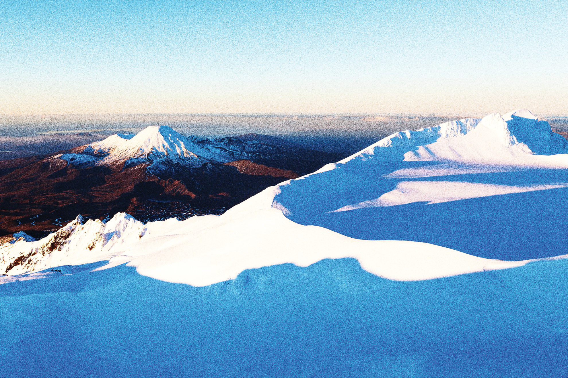
Active vents near the crossing are Ngāuruhoe, Red Crater and Te Maari, site of the park’s most recent eruptions in August and November 2012.

The Tongariro Northern Circuit Great Walk also gets close to vents because it follows the same route as the crossing from Mangatepōpō Hut to Emerald Lakes.

At all times, the area around Crater Lake can be hazardous, Gabrielsen says.

“People who access that part of the mountain or camp around the Summit Plateau: we don’t advise you to do that, because eruptions can happen at any time.”

Valleys on Mt Ruapehu can become lahar paths in an eruption. The Round the Mountain Track crosses two lahar paths – the Whangaehu and Whakapapaiti river valleys – and several potential lahar paths overlap Tūroa and Whakapapa ski fields.

While the Tongariro Alpine Crossing is a drawcard in summer, some days attracting more than 2500 walkers, it’s the ski fields that keep Tongariro National Park busy in winter.

Ski season visitor numbers for Tūroa and Whakapapa have been known to exceed 450,000.

Gabrielsen says the ski fields are subject to risk management measures, “purely because they operate on the mountain, and through their business they bring a lot of visitors to Tongariro National Park”.

When there’s an exclusion zone around Crater Lake, Tūroa’s High Noon Express chairlift cannot operate as it’s within 2km of the lake, and signs are put up throughout the ski fields to warn people that the upper mountain is off-limits.

The Whakaari eruption hasn’t led to any changes in risk management at Tongariro National Park, but DOC works with research organisations like GNS to keep its approach to volcanic risk up to date.

“We lean on those relationships quite heavily to ensure we are making the best decisions we can with the information we have,” Gabrielsen says.

Keys says Whakaari has highlighted the dangers of volcanoes, but no one has been killed by volcanic activity in Tongariro National Park “for as long as we know”.

The 1953 Tangiwai disaster was caused by a secondary, or post-eruptive, lahar released from Crater Lake when a dam of volcanic material from eruptions in 1945 collapsed. The lahar damaged a railway bridge across the Whangaehu River just before a train approached it at 10.21pm on Christmas Eve. Six carriages ended up in the river and 151 people died.

An even bigger secondary lahar was unleashed in March 2007. “But this time we had warning systems,” Keys says. “Desert Road traffic and trains were stopped, and the road bridge at Tangiwai was closed. We had a response plan in place and it worked very well.

“Science and technology and the response have all improved dramatically over nearly 70 years, but because volcanoes are unpredictable – especially some, like Mt Ruapehu and Whakaari – there’s always going to be uncertainty.”

Good to know

Tongariro National Park’s volcanic hazard zones are detailed on DOC’s website.

Volcanic alert levels for the park’s three volcanoes – Tongariro, Ngāuruhoe and Ruapehu – can be found on the GeoNet website, and updates on volcanic unrest are posted on the DOC Tongariro Facebook page.

In an eruption, DOC’s advice is to move away from the eruption site immediately and stay out of valleys to avoid lahars. If you see flying rocks or a steam and ash cloud coming towards you, take shelter behind a bank or ridge and cover your head with your pack.