

Motu Maha/Auckland Islands
The Auckland Islands were formed from the back of two massive volcanoes and have been hacked and carved by waves and ice. The result is a spectacular landscape of cirques, moraines, sheer sea cliffs and glacier-carved fiords.
The islands were first discovered by Polynesian voyagers in the 13th century. Pākehā followed, charting the group in 1806. Two attempts at settlement were made in the 19th century, first by Māori and Moriori from 1842 and then by Pākehā from 1849. The latter eked out a living for only two and a half years, and the island has been uninhabited since 1854.
We landed at Port Ross in the north, the site of the most human activity on the island, and I couldn’t help but think what it must have been like trying to live there. The landscape of twisted trees and alien-like mega-herbs was hardly inviting.
Even less inviting are the island’s high basalt cliffs, which claimed many ships in the late 19th century. Incredible stories of hardship from castaways led the government to construct a series of castaway depots across the Subantarctic Islands. These depots appear to be little more than dog kennels, but they have stood the test of time.
Across the bay, the more substantial Ranui Coastwatch Station stands vigil over Port Ross’s entrance. The station was built following the sensational story of the Nazi MS Erlangen escaping New Zealand bound for South America with holds full of southern rātā.
Spare a thought for the men who lived at the station; they recorded rain on an average of 331 days each year for the four years they were there.
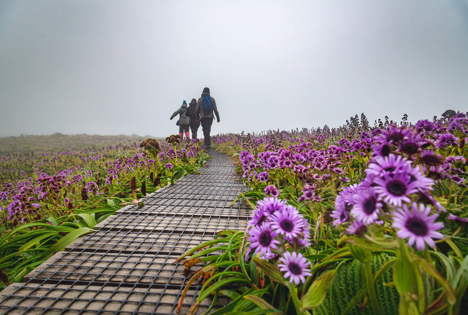
Although the highest point on the islands is the 705m Mt Dick, there are extensive subalpine and alpine zones due to the harsh climate. Tussock, dracophyllum and coprosma reign supreme.
As unforgiving as the landscape seems, there are numerous species of seabird, including the white-capped albatross. One of the most incredible experiences of my life was visiting the colony at South West Cape. Thousands of these birds, with wingspans ranging up to 2.5m, soar overhead. The route to the colony leads steeply above Victoria Passage, which separates Auckland and Adams islands. The colony is in decline due to introduced feral pigs and cats, and urgent pest eradication is needed to save it.
Motu Ihupuku/Campbell Island
Campbell Island was also formed by an ancient volcano. It is 300km southeast of the Auckland Islands and, of the Subantarctic Islands, is the furthest from New Zealand.
The island has the most complex human story of any of the Subantarctic Islands. First discovered in 1810, the island saw periods of intense whaling and sealing.
In 1874, a French astrological expedition visited to observe the transit of Venus and named many features, including Dent Island (after its resemblance to a tooth).
Farming was also attempted, and shepherds were enticed from the Shetland Islands, north of Scotland. The pastoral lease was abandoned in the 1930s as farming was not economic, but this was compounded by the Great Depression. Some feral sheep died out naturally, and the rest were exterminated by DOC in 1992. This was followed in 2001 by what was, then, the world’s largest rat eradication experiment. It was successful: after almost 200 years, Norway rats were cleared from the island. Campbell Island is now an important pest-free haven for seabirds. The 2001 operation was also hugely important in laying the path for more ambitious eradication programmes in the subantarctic and on mainland Aotearoa with Predator Free 2050.
With zero predators, the island’s birds and sea mammals have flourished. Campbell Island snipe (a bird resembling a strange love-child of a kiwi and a weka) have since reintroduced themselves from tiny sheer-sided Jacquemart Island. Scientists were unaware of the species until 1997.
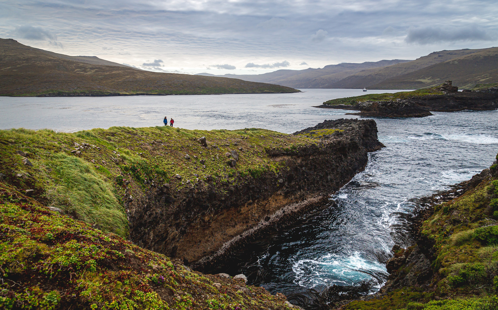
We landed on a grey day at the met station. This was built under the wartime programme that also established the Coastwatch Base on Auckland Island. We walked the boardwalk that stretches from Perseverance Harbour to the cliffs on the other side of the island. The clagged-in view from beneath Col Peak was unspectacular, but the force of the wind was awe-inspiring. I wondered how anything could live there.
Also spectacular is the walk to the summit of Mt Honey (540m). The mountain’s slopes are covered in mega-herbs including magnificent meadows of Pleurophyllum, a plant with purple daisy-like flowers. Around here, southern royal albatross congregate to practise their courtship. This involves an elegant flapping of their 3m wingspans followed by enthusiastic squawking into the air. It’s unforgettable.
Beyond the circling albatrosses, there are impressive views over Perseverance Harbour, the met station and the rest of the island. It’s quite a place.
Moutere Mahue/Antipodes Islands
The Antipodes Islands are north-west of Campbell Island and sit near the antipodal position to London.
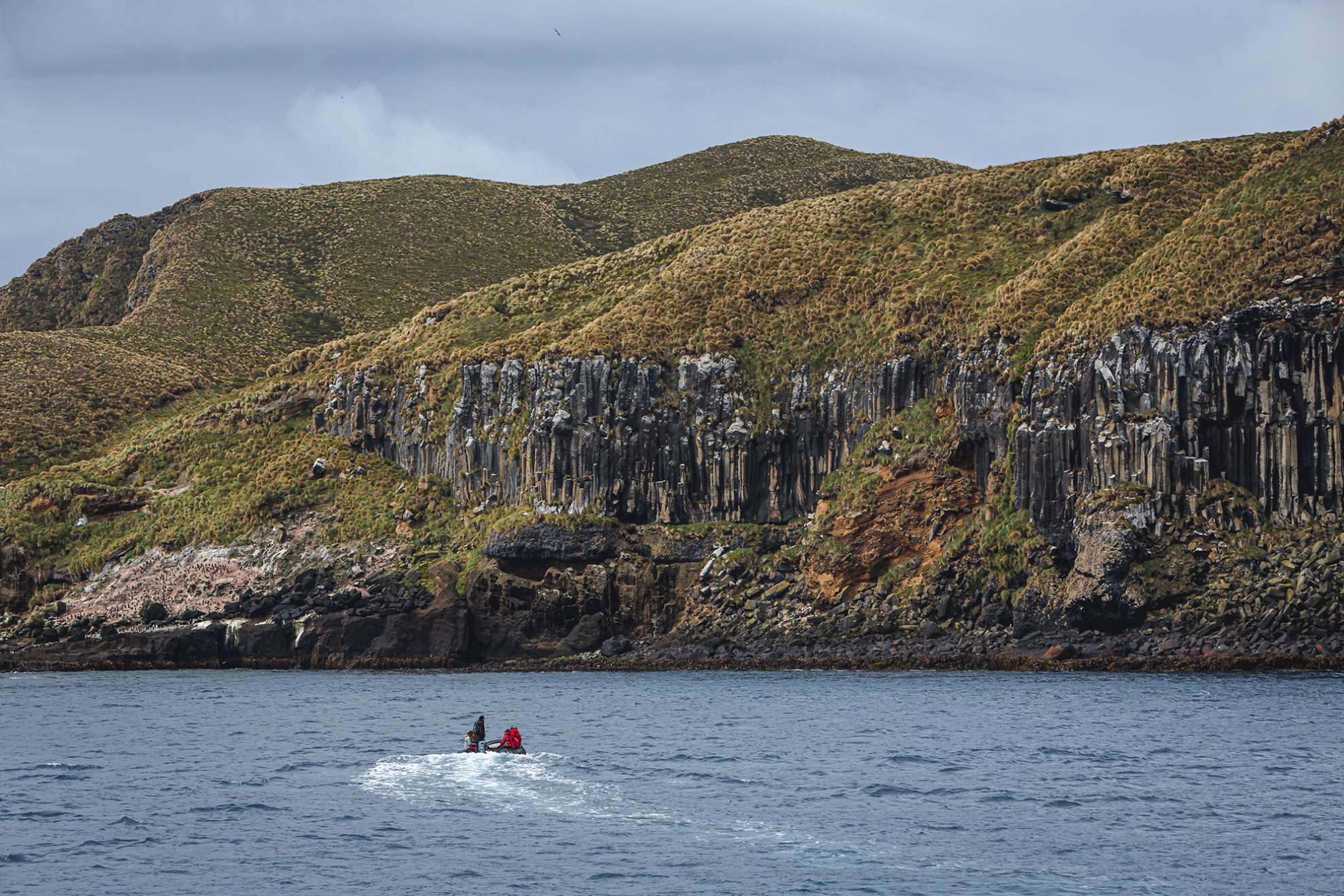
Antipodes Island’s volcanic origin can easily be discerned from the crater-shaped Bollons Island. Other evidence is in the island’s cliffs, which are textured by abstract lines and, in places, grand hexagonal columns. Cruising beneath these massive walls, it’s impossible not to be struck by the sheer scale of the place.
Other than sealing in the early 19th century, an abortive attempt at cattle farming and a few shipwrecks, the Antipodes have seen little human interference (although if the British Admiralty had had their way in the 1950s it might have been a nuclear test site).
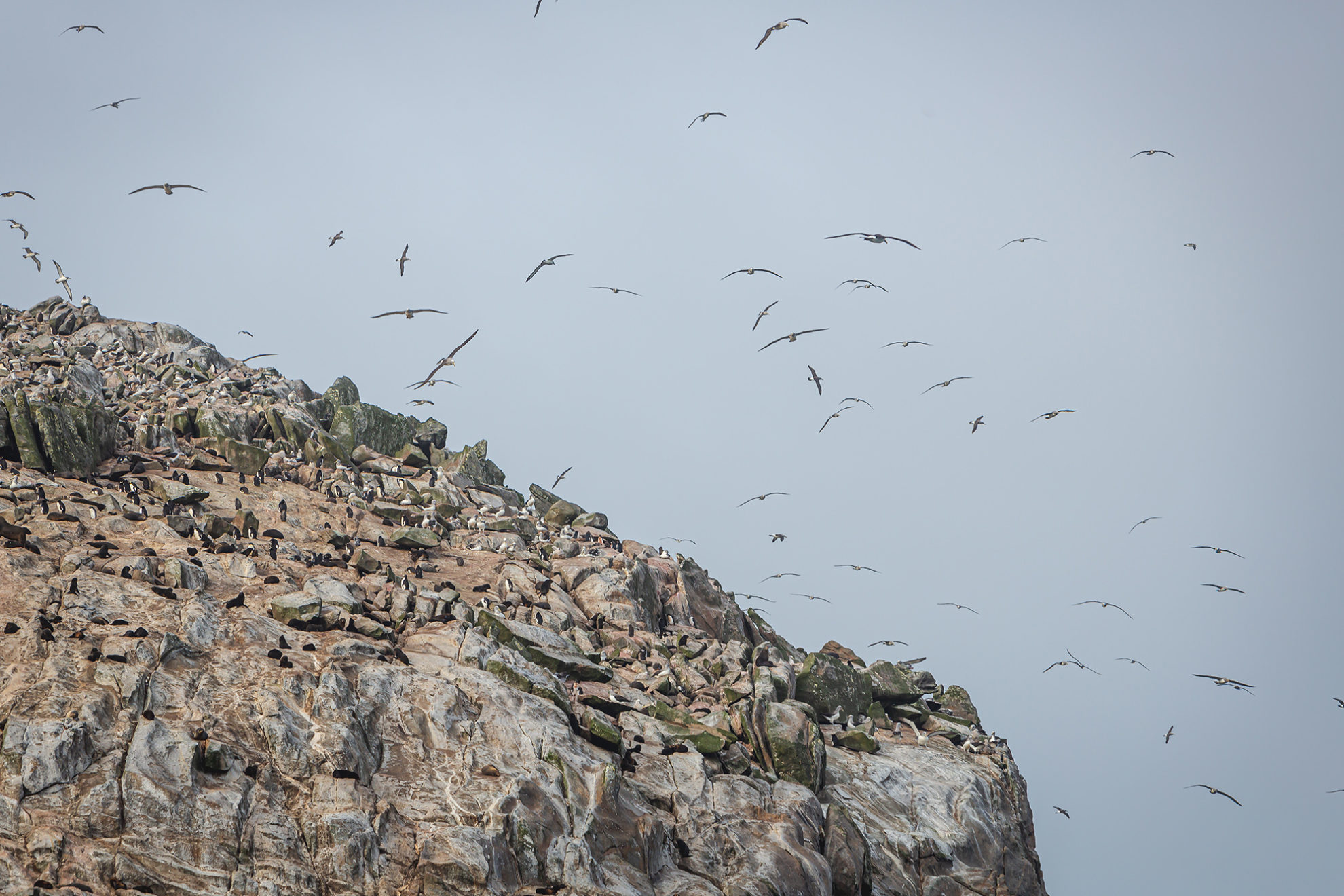
The islands are host to a plethora of seabirds, including half the world’s population of erect-crested penguins. These birds crowd the shores and look disapprovingly at visitors.
There are no trees, yet there are two species of endemic parrot: the Antipodes parakeet and Reiseck’s parakeet. They exist in the interior and on cliff faces. The parrots, along with the endangered Antipodean albatross and Antipodes snipe, were threatened by mice until 2016, when a crowd-funded eradication effort, known as the ‘Million Dollar Mouse’, cleared the only mammalian threat from the island. Three helicopters and 65,500kg of cereal-based bait brought the rodents to heel. Lessons learned here and on Campbell Island now pave the way for further island pest eradications. The Auckland Islands and Rakiura are prime candidates.
Moutere Hauriri/Bounty Islands
The Bounty Islands are the least hospitable of all the Subantarctic Islands. The archipelago of 13 uninhabited granite islets barely reaches above the Southern Ocean. They were first discovered by the HMS Bounty in 1788, just months before the crew’s infamous mutiny. That the islands have virtually no vegetation or flat land did not deter Wellington bureaucrats from attempting to auction a pastoral lease there in 1895.
When we left at dawn, the glowing rocks were crowded with thousands of penguins, albatrosses and fur seals, all jostling for prime positions. The quantity of life was striking, the air thick and the smell ‘aromatic’.
Even at the most desolate outposts in the Southern Ocean, nature finds a way to captivate and inspire.


