


The 42 Traverse Track crisscrosses Tongariro Forest on old logging and 4WD roads and is one of the North Island’s best adventure rides
Tongariro Forest’s 25,000 hectares are strategically wedged between Tongariro National Park and the top of the Erua Forest near National Park.
Gazetted in 1900 as State Forest 42, the forest was systematically logged of its totara, matai, rimu, miro and kahikatea over the following decades. The Dominion Timber Company and the Egmont Box Company built large mills to process the trees with a myriad of tracks and bush tramways slowly penetrating the entire forest. With the millable timber all gone by the 1930s, the slow process of regeneration took over and many of the tracks have disappeared.
Eventually, a collection of some of the remaining trails became the 47km 42 Traverse and in the late 1980s one of the great North Island mountain bike adventure rides. It travels over a mix of gravel road, 4WD and quad bike track and crosses the entire Tongariro Forest. It is best ridden from east to west due to its predominantly downward direction. There are plenty of DOC markers to point riders in the right direction, but the track is so well worn these days it’s hard to go astray. A good bike shuttle service both ways is available from National Park.
The track itself starts 15km east of National Park from the end of Kapoor Road. Here, the trail joins Slab Road heading north, passing beneath the twisted stand of old-growth rimu which tower high above regenerating juveniles. These big trees were fortuitously saved from the saw by their uneconomical shape.
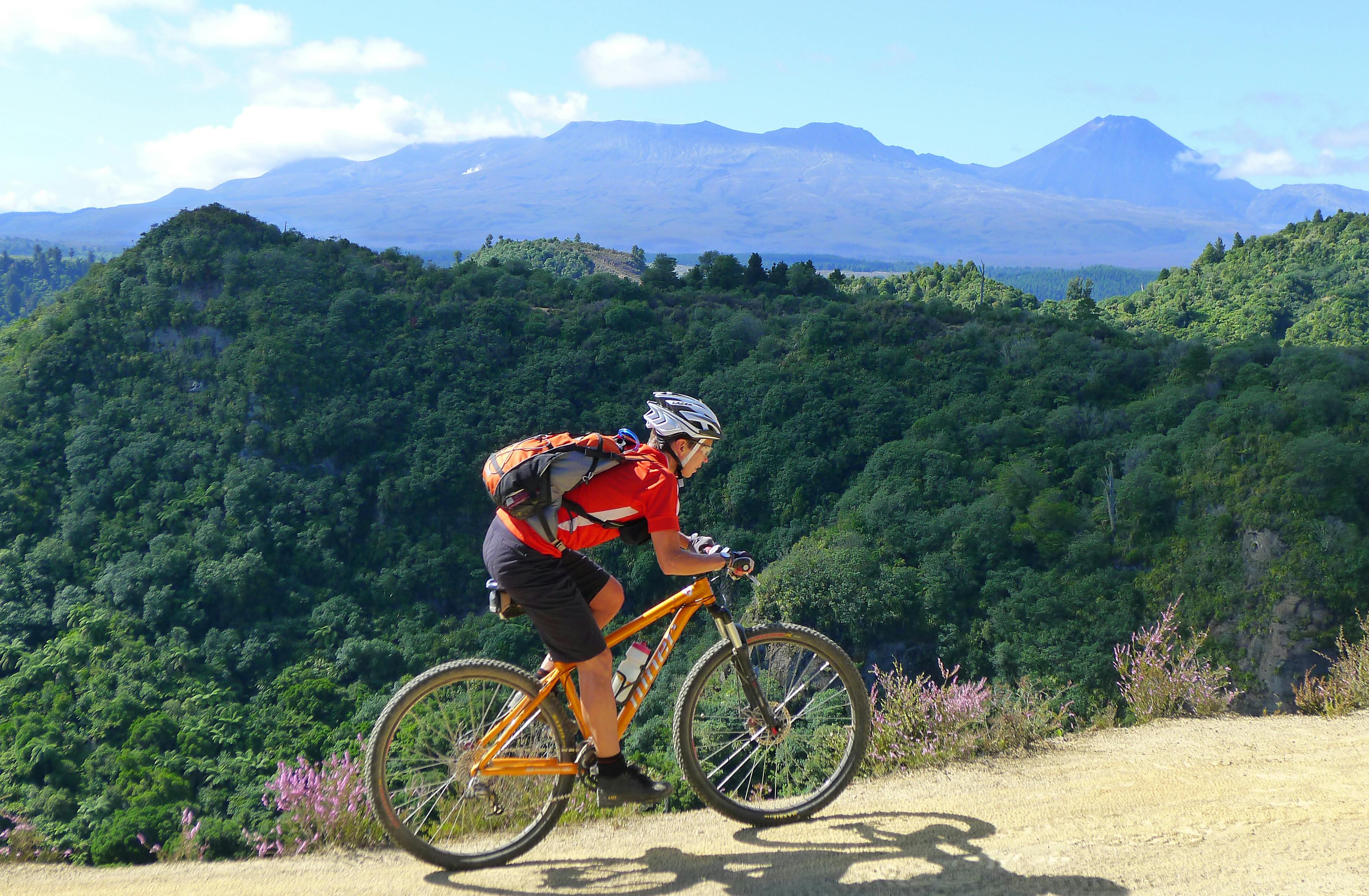
The track descends onto Magazine Road and after about two-kilometres, a right-hand sidetrack leads to Cooee Lookout. This provides views into Echo Canyon and across to the volcanoes of Tongariro National Park. In the canyon, the bush is lush and dense with any remaining patches of gorse disappearing under the progress of native regeneration.
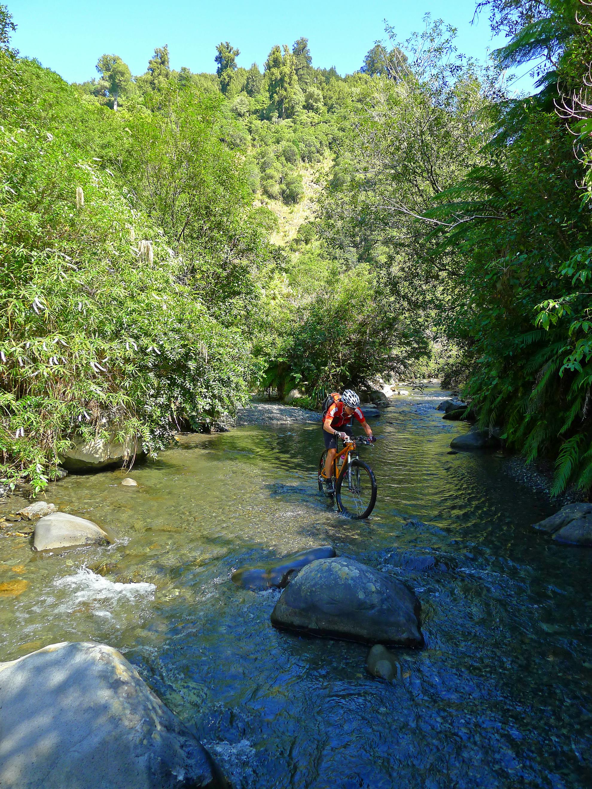
Back on the main track, a 500m undulating descent leads to the ford at the confluence of Bluey’s Creek and Waione Stream. The stream can get high in wet weather and parts of the track can become extremely muddy.
After a big ascent out of Waione Stream, there’s another exhilarating descent into the Waipungapunga Stream and the halfway point of the ride. The climb from this ford goes close to the snaking origins of the creek-size Whanganui River and there are excellent views to it from the most northerly section of the track near Ngapari Peak.
The track now undulates its way to Owhango, fording Mako and Pepenui streams, and trundles past the historic Bennetts Hut site.
At Dominion Road, hook a left to ride to the site of a blown-up bridge, crossing its replacement. Further down is the 20m waterfall from Waterfall Bridge to admire. It’s set amongst beautiful lush bush.
A long stretch of gravelled 4WD track eventually crosses Deep Creek and then the Whakapapa River on a massive concrete bridge. A final climb on a wide gravel road circles the Ohinetonga Lagoon before reaching Owhango Township.
The cafe on the main street is a perfect place to wait for your shuttle or refuel for the 20km road ride back to the start.
- Distance
- 47km
- Total Ascent
- 1468m
- Grade
- Moderate
- Time
- 5-7hrs
- Access
- From National Park or Kapoors Road end, off SH47
- Map
- BH32
GPX File
- 42 traverse (gpx, )
GPX File
- Your device does not support GPX files. Please try a different device.
