10 trips on Te Urewera’s Ikawhenua Range

June 2015

Read more from

June 2015

Ikawhenua Range. Map by Geographx
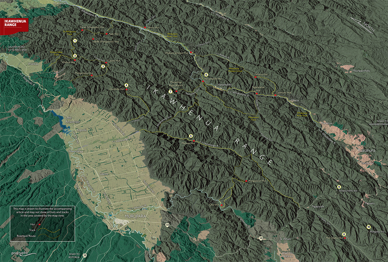
With more bends in it than an anaconda, the Ikawhenua Range snakes through the western side of Te Urewera. The range is almost entirely forest covered, with most peaks rising no more than 900m. Dividing the Rangitaiki and Whakatane Valleys, it stretches for some 85km to end at the north-eastern edge of Whirinaki Forest Park. […]
Shaun Barnett

About the author

Shaun Barnett

More From Wild Range

Related Topics

Similar Articles

Kahurangi double

11 trips on the Bealey Range

A slice of the unusual

Trending Now

Kãnuka Loop Track, Bendigo Historic Reserve

What’s the big attraction of the Old Ghost Road?

‘The hut my dad built’

Cascade Hut, Kaimanawa Forest Park

High country gold

Subscribe!
Each issue of Wilderness celebrates Aotearoa’s great outdoors — written and photographed with care, not algorithms. This Christmas, subscribe or gift a subscription and help keep our wild stories alive. It’s the perfect way to connect with friends and whānau who love the outdoors as much as you do.

Join Wilderness. You'll see more, do more and live more.

Already a subscriber?  to keep reading. Or…

34 years of inspiring New Zealanders to explore the outdoors. Don’t miss out — subscribe today.

Your subscriber-only benefits:

All this for as little as $6.75/month.

1

free articles left this month.

Already a subscriber? Login Now