Lake Sumner Forest Park
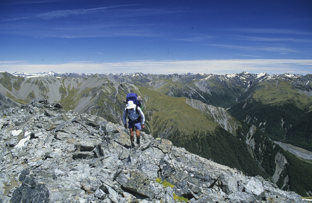
The Dampier Range presents a dramatic profile as it twists and turns through the headwater sections of many of north Canterbury’s major rivers.
At 44km long from its northern extremity where it intersects the Crawford Range above the upper Hurunui catchment in Lake Sumner Conservation Park, to its eastern most spur which joins it to the Puketeraki Range, the range is both remote and challenging. A tramp of at least two days will be required to access the more spectacular portion where it swings north and west above the Hurunui River South Branch and North Esk River.
Grand isolation describes tramping in this sector of the range which borders the seldom visited eastern corner of Arthur’s Pass National Park.
1 Ian Col
One of only two named crossings of the Dampier Range, Ian Col (1587m) is a key crossing between Bull Creek, a tributary of the East Poulter, and the South Branch of the Hurunui. Traversing this route will take 4-5 days.
2 Roche Pass
Linking the Cox River and South Hurunui, Roche Pass (1196m) is the second named crossing on the range. It lies close to Lookout Peak, a remote Arthur’s Pass National Park summit, and can be combined with Ian Col for a double-crossing of the range.
3 Mt Crossley
The highest peaks on the range can be found in its mid-section and not near the northern end as might be expected. Mt Crossley (1980m) can be readily ascended from the North Esk via a long open spur, or on a more difficult approach from Candlestick Stream.
4 Mt Turnbull (2024m)
Mt Turnbull is the highest summit on the range and is most easily accessed from either Ant Stream or Nigger Stream. A traverse linking it to Mt Crossley would be more difficult, though rough sections on the ridgeline could mostly be avoided by descending into Ant Stream.
5 Esk Head and Top of The Ladder
Near where the range abuts the Puketeraki Range are two summits adjacent to each other, Esk Head (1864m) and Top of the Ladder (1792m). They could be climbed in a day from Esk Head Road (South Branch of the Hurunui) or accessed from further along the range as part of a traverse.
6 Hurunui River South Branch
A long and remote catchment, the Hurunui River South Branch is part of a mainland island project for protecting native birds. There is only one hut in the upper valley, Upper South Branch Hurunui Hut, a few musterers huts lower down and only poor routes out of the valley head to the Hurunui River to the north. However, the valley is quiet and very scenic in the upper reaches.
7 North Esk
The North Esk is a tributary of the South Hurunui and though only a relatively short catchment it is very attractive, particularly around the upper flats where there are routes over the Studleigh Range to the Hurunui River South Branch and to Bull Creek, as well as onto Mt Crossley. North Esk Hut is dilapidated.
8 Ant Stream Bivouac and Ant Stream Hut
These two huts are in the isolated Ant Stream Valley which drains the southern flanks of Mts Turnbull and Crossley, they make good bases for climbing the peaks. A low range crossing can be made from the bivouac to the North Esk.
9 Cox River
Penetrating deep into the north-eastern extremity of Arthur’s Pass National Park, Cox River provides easy access through this sector as far as Upper Cox Hut from where more challenging access will take parties onto the Dampier Range via Roche Pass. A sub-range can also be crossed over Cox Saddle to Cherrywood Creek and Thompson Stream. Upper Cox Hut and Cox Bivvy have been removed making this area a virtual wilderness.
10 Bull Creek
Bull Creek is the main thoroughfare for gaining Ian Col and has two huts.
11 Mounds of Misery
These striking post-glacial features, comprising low hummocky hills, boggy tarns, and tussock clearings are located on a large terraced tableland south-east of the East Poulter. They are usually accessed via the McArthur Gorge from the main Poulter Valley. Lochinvar Hut makes a good base for exploring the area.