
While the low-angled volcanic cone of Pureora (1165m) may be a relatively minor summit, its panoramic views are some of the best in the North Island. From the summit trig, an impressive array of other mountains surround you in one great 360-degree arc: Mt Taranaki, the Herangi Range, Mts Karioi, Pirongia, Maungatautari, Tauhara, the Kaimanawa Ranges, the Tongariro volcanoes, and the Hauhungaroa Range, of which Pureora forms just one summit. Closer to hand is Titiraupenga, Pureora’s sister summit, with its distinctive rock spire.
While Pureora is accessible in any season, the cooling weather of autumn makes the possibility of a cloud inversion layer more likely. There’s nothing to make a tramper feel more smug than to climb through the cloud layer to emerge above it all, spread like a blanket, with the surrounding mountains rising higher still.
Pureora had a brief few years of popularity, when the Te Araroa route went over its summit, but now most thru-hikers use the Timber Trail instead, which sidles around the mountain’s lower flanks. That’s left the summit for the more traditional day walkers and trampers.
Two tracks lead to the top, with the most accessible beginning from Link-Kakaho Road. The climb starts gradually, through forest dominated by totara and rimu, and the understory festooned with ferns. Bridges span three streams, then, higher up, the gradient increases with steps and boardwalks leading through the increasingly stunted forest. Shortly after breaking through the bushline, the summit trig is reached. Allow three hours return. Those who have made suitable transport arrangement can descend the alternative Toi Toi Track, which links with the Timber Trail.
Access From Link-Kakaho Road Grade Easy-moderate Time 3hr return.
– Shaun Barnett
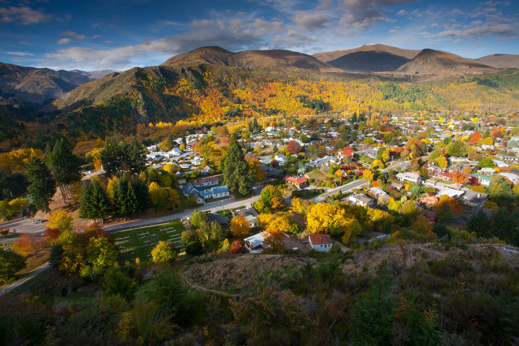
The Arrowtown Millennium Walkway was built in 1998 to mark 150 years since Europeans settled in Otago. It was those settlers who first brought deciduous trees to the area.
The walkway is hugely popular, but don’t let that be a deterrent, as the chuckling waters of the Arrow River, the sublime colours of the foliage and occasional glimpses of the schist landforms create a sense of place, which is uniquely Arrowtown.
The historical note which propelled the Arrow Basin to fame was the discovery of gold in 1862. An ‘X marks the spot’ sign indicates where Jack Tewa (Maori Jack) found the first flecks, shining in the Arrow River. Two mining parties followed, one led by Thomas Low and John MacGregor, the other by William Fox and John O’Callaghan. Both managed to keep the find under wraps. It was not until they had loaded over 54kg between them that the rush was on. A year later, over 1500 miners swarmed the basin, including the upper settlement of Macetown.
The track follows the true right of the river to a bridge. Stay on the same side of the river and continue to the next bridge, from where you can cross and head upstream back to the first bridge and the junction with Tobins Track.
By 1874, Cardrona was also in boom times and a track was constructed over the Crown Range to the Cardrona Valley. Tobins Track, named after Thomas Tobin, an Irishman who won the roading contract, follows the old road and the hillside is awash with colour.
The gold in the rivers is now replaced by the gold in the leaves, celebrated every year with the Akarua Arrowtown Autumn Festival in late April.
Access From Ramshaw Lane Grade Easy Time 1hr return.
– Marios Gavalas
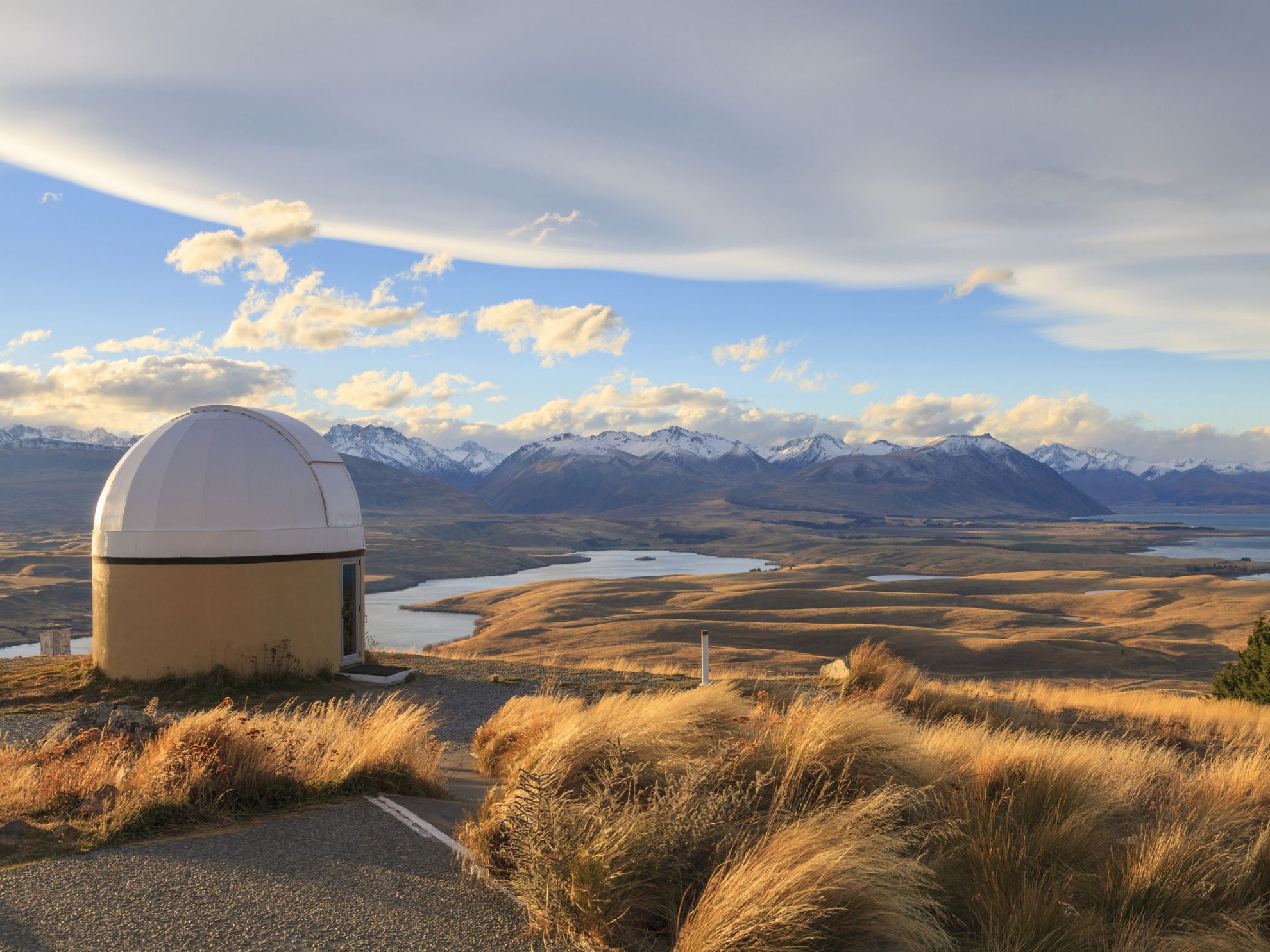
A sign at the top of Mt John, where there is also an observatory, states: ‘Probably the best place on the planet for a café’. Mt John is also worth climbing for the view. From the car park by the entrance to the hot pools, poplars flourish on the lake shore. It’s a steady ascent of more than 300m to the summit with the trail initially passing through coniferous forests, with a dusty sparse understorey. Breaking out of the vegetation near the summit there are breathtaking views of the vast expanse of the Mackenzie Country, with New Zealand’s highest peaks in the distance.
The walkway continues north, up the lake, and starts its descent through sheep-grazed paddocks. The track is signposted, but can be difficult to decipher.
The Mackenzie District is named after James McKenzie, who was imprisoned in 1855 on the charge of stealing sheep from Level Station. He travelled Canterbury and Otago with his bullock and dog, Friday. He was known for his cunning, strength and rebellious spirit.
It is said Mackenzie ‘discovered’ the area that now bears his name on one of his forays with sheep he was either droving or stealing. The pioneers who came afterwards brought the European deciduous trees, whose descendants now provide the bright foliage rivalled only by the springtime bloom of lupins.
The track eventually doubles back on itself, skirting above the turquoise lake waters and re-entering forest before arriving near the hot pools. This is the best place to witness the autumn colours. The contrast with the milky opalescence of Lake Tekapo is blinding. And at sunset, the richness of colour is at its most pronounced.
Access From near Tekapo Springs Grade Easy Time 3hr.
– MG
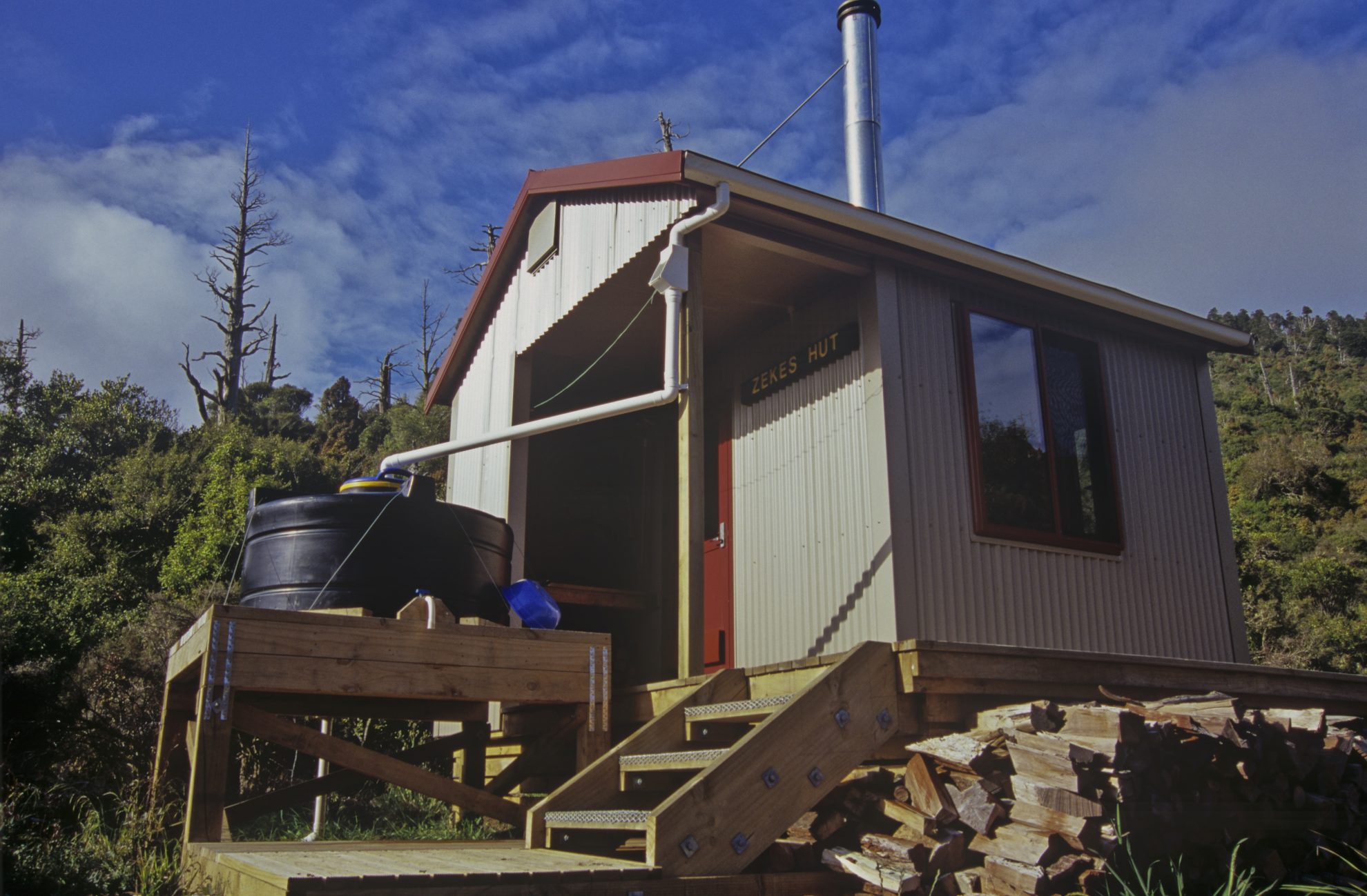
The cute four-bunk Zekes Hut is the only shelter in the Hihitahi Forest Sanctuary, one of the most important forest remnants in the country. Pahautea, or mountain cedar, is an attractive native tree that grows at relatively high altitudes, and once dominated the landscapes of the central North Island over a great 300km2 swathe of country between Taihape and the northern Ruahine Range. Fires, felling and farming have since reduced the forest, with the Hihitahi and northern Ruahine remaining its most important strongholds.
Aside from being one of only two huts beginning with a ‘Z’ (Southern Marlborough’s Zoo Hut is the other), the main attraction of Zekes is the approach through the Rangitikei, which boasts the prettiest autumn colours of the North Island. While it may not match Central Otago for the sheer brilliance or breadth of colour, the Rangitikei has its own autumn charm, with the lush green of the farmland contrasting beautifully with tall golden columns of poplars.
The track initially follows farmland, which can be boggy, before entering the forest to begin the climb to the highest point, Hihitahi (1116m). On the summit, views unfold of Ruapehu, the apex of the North Island, plus a substantial chunk of the Kaimanawa and northern Ruahine mountains.
The track resumes on the north of the summit, descending through mountain cedar forest before swinging east towards Kaitapu Stream. It crosses a grassy slip at one point, then re-enters the forest before reaching the hut, situated above a river fork.
Built in 2007, the hut takes its name from Turangi hunter Zeke Martin. A wood stove makes it cosy during cool autumn nights.
Access From SH1 south of Waiouru Grade Moderate Time 3hr.
– SB
34 years of inspiring New Zealanders to explore the outdoors. Don’t miss out — subscribe today.

Questions? Contact us


