- Distance
- 8.03km
- Total Ascent
- 425m
- Time
- 3hr
- Grade
- Easy
- Access
- From near Tekapo Springs
- Map
- BY17
- Notes & Map
- Tekapo Mount John Walkway (pdf, 7 MB)
- GPX File
- Tekapo Mount John Walkway (gpx, yo 19 KB)
- Your device does not support GPX files. Please try a different device.
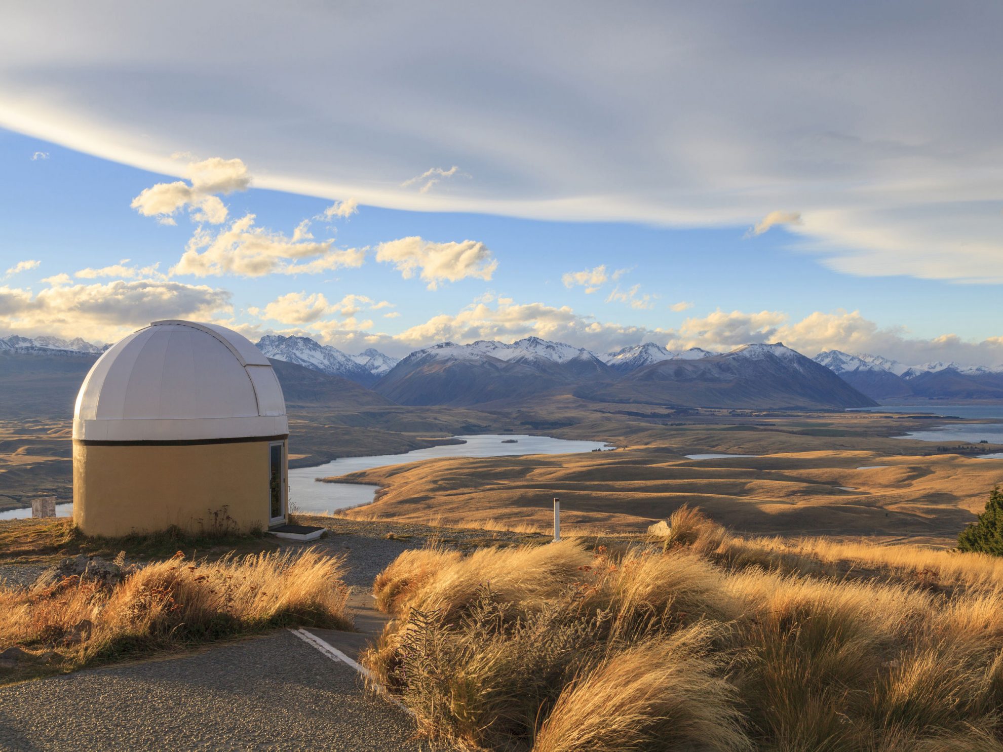
A sign at the top of Mt John, where there is also an observatory, states: ‘Probably the best place on the planet for a café’. Mt John is also worth climbing for the view.
From the car park by the entrance to the hot pools, it’s a steady ascent of more than 300m to the summit with the trail initially passing through coniferous forests, with a dusty sparse understorey. Breaking out of the vegetation near the summit there are breathtaking views of the vast expanse of McKenzie Country, with New Zealand’s highest peaks in the distance.
The walkway continues north, up the lake, and starts its descent through sheep-grazed paddocks. The track is signposted but can be difficult to decipher.
The track eventually doubles back on itself, skirting above the turquoise lake waters and re-entering forest before arriving near the hot pools.
The McKenzie District is named after James McKenzie, who was imprisoned in 1855 on the charge of stealing sheep from Level Station. He travelled Canterbury and Otago with his bullock and dog, Friday. He was known for his cunning, strength and rebellious spirit.
It is said McKenzie ‘discovered’ the area that now bears his name on one of his forays with sheep he was either droving or stealing. The pioneers who came afterwards brought the European deciduous trees, whose descendants now provide the bright foliage rivalled only by the springtime bloom of lupins.