A walkway of surprising variety, colour and history for those seeking a day trip from the capital.
‘Ridge Track’. Such an unimaginative name for what is a surprisingly inviting and approachable walk – one that traces a crest between wilderness and human intervention, of untouched forest and regenerating bush.
An easy 7.2km in either direction, Ridge Track is described here from its eastern access at Pākuratahi Forks to Te Mārua in the west. It is benched and well graded throughout.
The track starts with steps for the first few hundred metres to gain a spur above the Pākuratahi River. This is the steepest section of the walk. It then swings west onto the ridge separating the Te Mārua plateau from Te Awa Kairangi Hutt River, passing through an ancient forest of red beech and podocarps.
About 1hr from the trailhead you will reach a junction at Pt485m, also known as Tussock Knob Lookout. The lookout is one of two open viewpoints along Ridge Track, and offers fine views northwest over bushy Maymorn Ridge and out to Quoin and Alpha on the Tararua skyline. Here you’ll find a memorial bench to bushman and conservationist Dave Peebles.
Keep left at the junction.
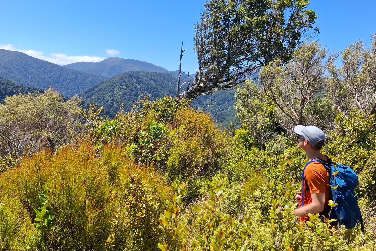
The track enters a zone of regenerating forest and mānuka and kānuka.Thirty minutes beyond Tussock Knob is Upper Valley Lookout, a two-minute deviation that’s well worth the detour. This time, views open southwest over a landscape considerably altered by human activity. In the foreground are the Macaskill Lakes, which provide water storage for Wellington. Indeed, a water tunnel beneath your feet feeds water from Te Awa Kairangi to the reservoirs.
It’s an hour from Upper Valley Lookout to Te Mārua. From the lookout the track widens considerably, its breadth and cut banks resembling an old road as it leads up and over Pt432m and down to Te Mārua. Greater Wellington Regional Council’s history of Kaitoke notes that the Maymorn Timber Company was milling the area until the 1930s and had two tramways, including one from near Te Mārua, of which the exact history is unknown. Perhaps it is this tramway that now serves as the western end of Ridge Track. That could also explain the stark difference between the regenerating bush near Te Mārua and the rich, virgin bush at Kaitoke.
A seat and a horseshoe bend at Pt304m signal the beginning of the descent to Te Mārua. You’ll soon emerge from the bush and zoom down a straight 500m section of grassy track lined with blackberries in summer. A footbridge across Benge Creek leads to the car park. You can finish your walk here if you’ve arranged transport back to Kaitoke; alternatively, it’s a superb spot for a picnic before heading back the way you came.