Corner Peak, 1683m, is accessed from the Timaru High River Track above the Timaru River. From the car park we crossed Peter Muir Bridge and, about 50m up the road, a DOC sign marks the beginning of this track.
After a short walk through a patch of manuka the track crosses a grassy area and leads onto a 4WD track. After around 10 minutes a sign marks the beginning of the poled route up to Corner Peak.
We climbed unrelentingly for 400-500m and eventually gained a prominent ridge which we followed for some time up to point 1410m (it is possible to sidle here rather than gain and lose height).
The poles lead down off this point and swing slightly left to follow the ridge, before heading over a fence to the lake side of the ridge to avoid some rocky outcrops. Here the route takes a ‘scrambly’ sidle before heading back up to the ridge line.
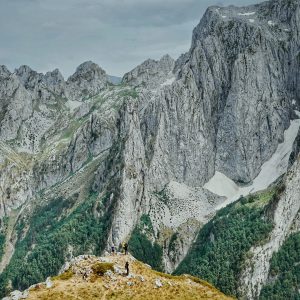
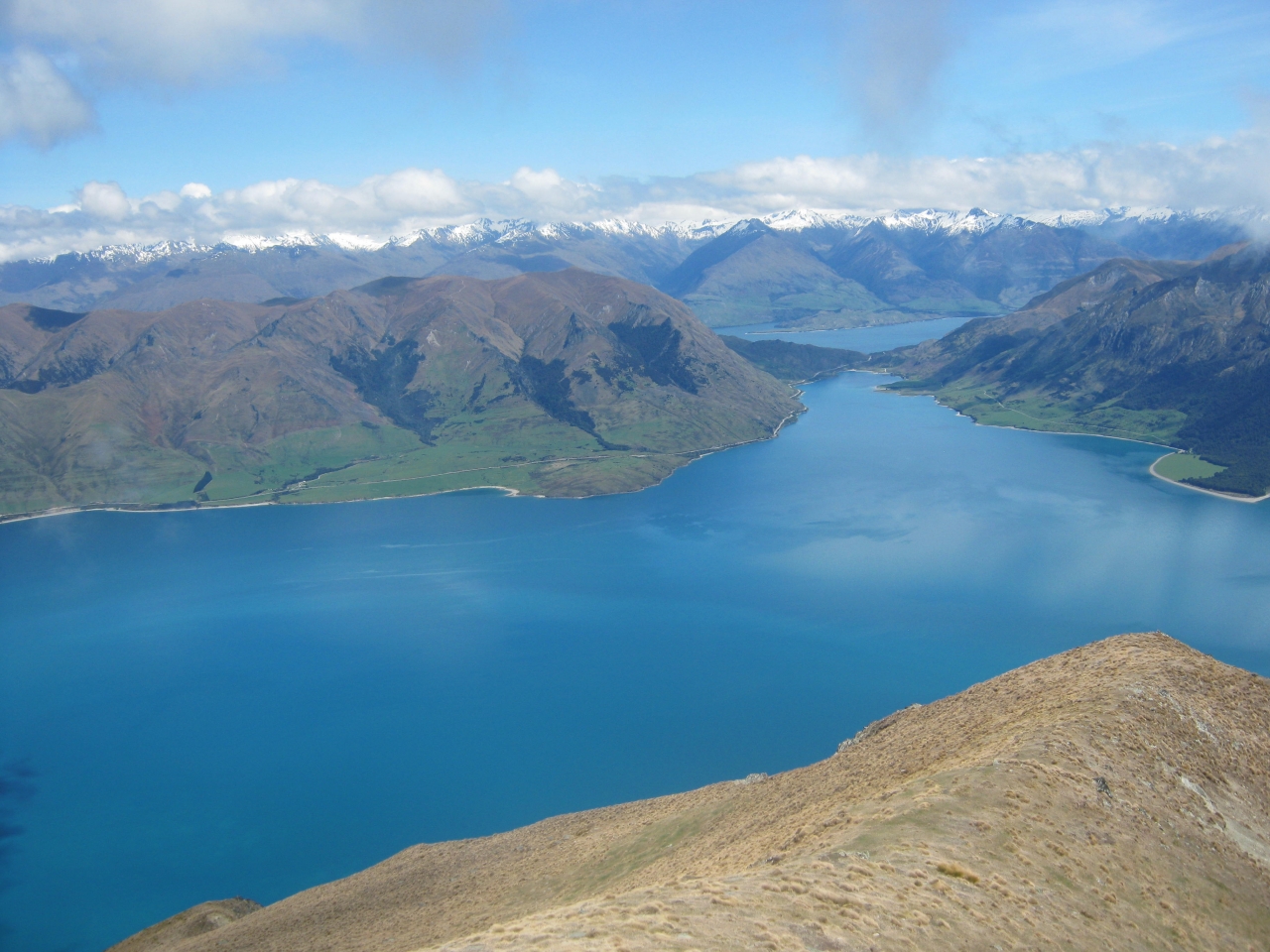
The views down towards the lake are magic with jagged rocky spurs reaching down to the water.
Looking up at this ridge from the other side of the lake before we’d started the tramp, it seemed a tedious distance to cover all the way from Timaru River to Corner Peak (6-7km as the crow flies). Surely there should be a way up through these spurs directly onto the summit or at least near it! However, as we traversed the ridge and peered down at the near vertical scree and rocky spurs, we realised the ridge is not such a bad option.
Shortly, another small hop took us back to the Dingle Peak side of the ridge where a handy fence gave a little extra security as we sidled above the slopes leading down into Deer Spur Creek between Dingle and Corner Peaks on a well-defined animal trail.
The ridge soon dips into a hollow where a stile and a DOC sign indicate the end of the poled route. At this point a light trail leads off, sidling to the right on the Dingle side and then angling up towards the broad saddle just short of the summit. This is the prominent saddle clearly seen from the road on the other side of Lake Hawea.
It is only 30 minutes or so from the sign to the summit. The trail from here is a little indistinct at times but it’s just a case of aiming for the saddle. Keeping to a high sidle, avoiding the large tussock, is probably easier underfoot than erring low and then going straight up.
Very near the summit an obvious gully leads down towards the ridge between Corner and Dingle Peaks, so anyone with the time and energy can do both peaks in the one day. It would be a long trip!
There is no water after the Timaru Creek High Track and the presence of stock make even this of doubtful quality. Apart from the very short section of manuka scrub at the start, the route is very exposed.
A satisfying finish to the day is to relax either at the pub or cafe back in Hawea and look back up the lake at this iconic and prominent landmark.
-Viv Eyers

34 years of inspiring New Zealanders to explore the outdoors. Don’t miss out — subscribe today.

Questions? Contact us