Image of the August 2014 Wilderness Magazine Cover Read more from the
August 2014 Issue
Home / Articles / Wild Trips

Sandwiched between the volcanoes

View over Upper Tama Lake to Mt Ruapehu. Photo: Matthew Pike
Distance
27.5km
Time
8-9hr. Desert Road to Waihohonu Hut, 3hr; Waihohonu Hut to Lower Tama, 2hr; Lower Tama to Waihohonu Hut via Tama, 3-4hr
Grade
Moderate
Accom.
Waihohonu Hut (28 bunks)
Access
Car park 100m west of Desert Road (SH1), juts south of Rangipo Intake Rd
Map
BH34, BH35, BJ34, BJ35

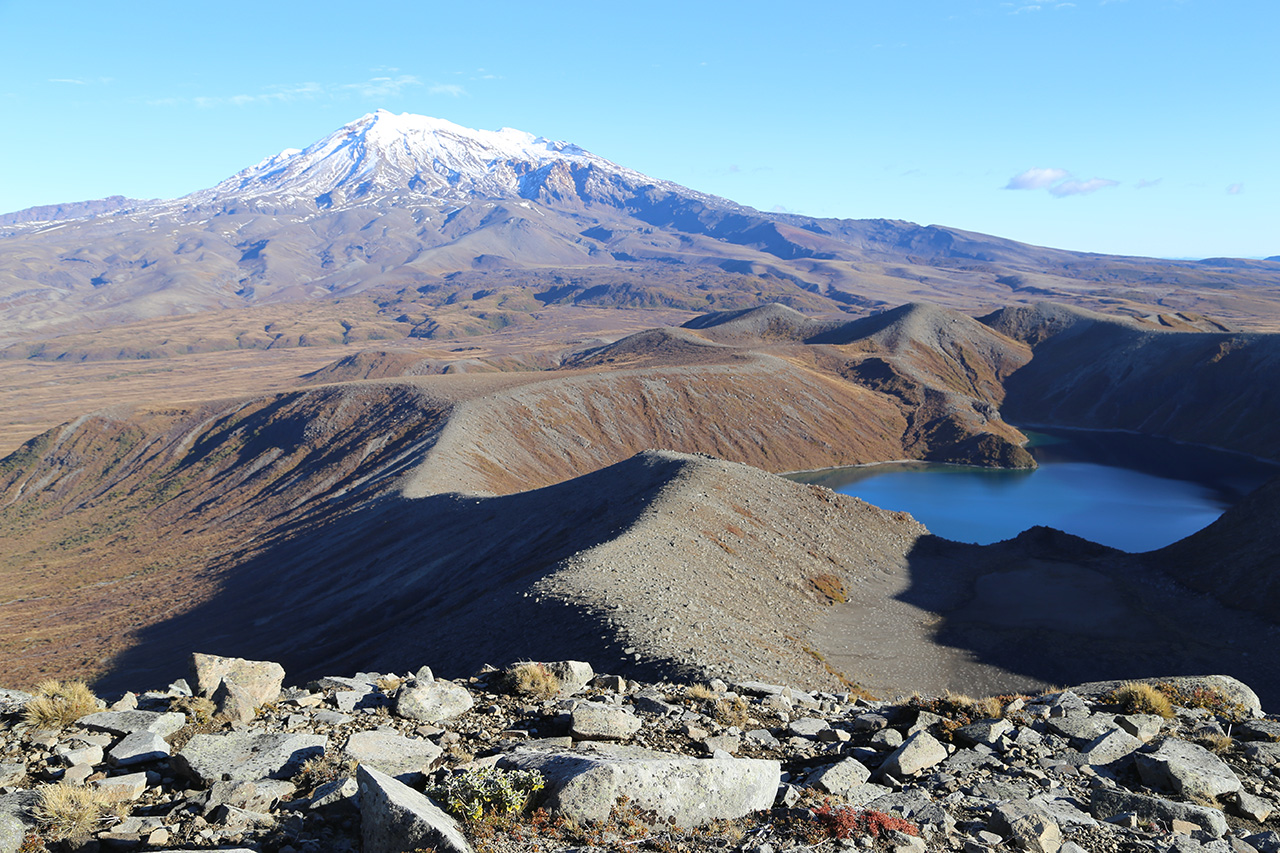
Tama Lakes via Waihohonu Hut, Tongariro National Park

From Waihohonu Hut you can see both Mts Ngauruhoe and Ruapehu. It’s a stunning view of two of the North Island’s iconic summits. But the view also encompasses a series of smaller, more manageable ranges, over which I hoped to complete an enjoyable loop walk.

These smaller ranges are perfect for those spending the night at the hut without wanting anything too strenuous. This is desert-like country so nothing blocks your view of this striking landscape. The route I took brought me to within touching distance of Mt Ngauruhoe and I’d recommend a similar trip to anyone tramping the Northern Circuit to or from Whakapapa Village and wanting to make things a bit more challenging. It can also form a long day walk to, and from, the Desert Road.

I set off from the Desert Road on a perfect winter’s morning – the easy track to Waihohonu Hut made just a little more difficult by thick ice on the track.

I soon reached Waihohonu Hut, dumped most of my gear and continued along the Whakapapa Waihohonu Track with a far lighter load.

The first place of interest is Old Waihohonu Hut – a little red shack built in 1904. It’s New Zealand’s oldest recreational hut and contained separate rooms for men and women. The men had the room with the fireplace while the women made do with a tiny cell which apparently contained the luxury of a mirror.

I continued along the excellent track with a gentle incline, gradually becoming sandwiched between the two giant volcanoes. I passed some hills, these peaking at Tama (1623m), and began the ascent to Lower Tama. As I neared the lake I veered right, off the track and followed the ridge above the eastern side of Lower Tama.

The lake is a startlingly bright blue-green and sits deep within the steep crater walls. It looks as if a bite has been taken from its northern side, as a grey shelf rises above the water level creating a dry crater floor.

I continued up to Pt1450. To get the real money shot, head north-west and, two summits away, you’ll reach the end of Upper Tama Lakes Track where the lake aligns itself in front of Ruapehu.

I opted to head north-east, though, dropping above the southern shore of Upper Tama, with Ngauruhoe popping its head up behind Pt1584. I stopped for lunch here, enjoying the silence – few venture in this direction.

I then continued up the narrow ridge to the east of Upper Tama to Pt1562. Until this point the terrain had been finely crushed, almost sand-like, volcanic rock – soft underfoot and easy to negotiate. But here it became rockier and it was fun clambering my way to the top.

From Pt1562 there’s only a small dip between you and the slopes of Ngauruhoe. It looks imposing up close; a magnificent spectacle.

I followed the ridge to Tama, the highest point on the walk, before carefully sliding down the scree to the ridgeline heading south-east towards the Waihohonu-Oturere Track. Take care descending from the summit because there are loose rocks that could cause substantial damage to a person once they gather momentum.

Once on the ridge, it’s an agreeable descent through numerous boulder fields with the Kaimanawa mountains ahead in the distance.

I turned right when I reached the track, following it down into the forest, across the river, past a frozen campsite which must be lovely in summer but never gets the sun at this time of year, and back to the very inviting Waihohonu Hut.