We had long ear-marked Oxford Forest Conservation Area as a place to explore, but it wasn’t until one fine winter day that we had the chance to don tramping boots and have a look.
The conservation area covers 11,350ha and is a remnant of the great beech and podocarp forests that once covered northern Canterbury.
Earlier, grey skies had turned to blue so we set off on the Ryde Falls Track in welcome sunshine. The track forks immediately, with an enticing route heading off to the summit of Mt Oxford. That was for another day and our track meandered beside Coopers Creek West Branch before heading steadily up through the forest.
At a stile, the route doglegged sharply to the left and rose steeply, through a bird-infested stand of fir trees, to a rocky outcrop, affording stunning views of snow-covered hills to the north.
Now, far above the river, the track followed a ridge back into a forest of beech trees and we encountered long stretches of boggy terrain, a foretaste of what was to come. The deep mud, and the tree roots it hid, made the going more like an Olympic event than a Sunday stroll. The squelching of our boots merged with the continuous soundtrack of birdsong. Bellbirds splashed around in the regular puddles and flew into the trees, singing as we approached.
After negotiating further stretches of strength-sapping mud, we reached a viewpoint of Mt Oxford. From here, the rushing water of Coopers Creek West Branch could be heard once again. The track dived steeply down to a junction with the Link Track. A short side track led to signed examples of totara, rimu (red pine) and matai (black pine) trees, the latter apparently becoming rare on the South Island.
A couple of very long and steep zigzags led down to a stream crossing and a rude climb back up the other side. This stretch was the boggiest yet and it was a relief to reach a short length of dry path.
An information board about Rydes Bush Tramway provided an excuse to stop for a break although, unfortunately, half of the board was missing its content.
Ryde’s Mill was one of a dozen mills in the area in the late 1800s and the Ryde Brothers alone removed 202ha of forest. Major fires in the latter part of the 19th century led to the decline of the milling industry and the last mill ceased operation in 1912.
After two hours tramping, a sign at a junction with the Korimako Track stated the falls were a further 500m along the track.
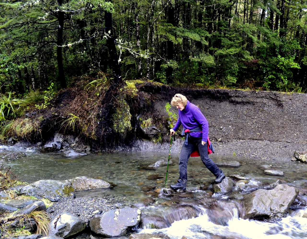
Finally, a steep slope led down to the fast-flowing creek. At first it was not obvious where the track continued but it quickly became clear that to reach Ryde Falls the river had to be crossed.
On the far bank there is a primitive campground with a pit toilet. A short path took us to the bottom of Ryde Falls. The slipping and sliding to reach them had been worth it. The river tumbled through the forest in several tiers, the bottom being a beautiful curtain of white.
We lunched at the falls and then squelched back to our car.
– Andrew Lowton

34 years of inspiring New Zealanders to explore the outdoors. Don’t miss out — subscribe today.

Questions? Contact us


