


- Time
- 3-4hr paddling, 90min walking
- Grade
- Easy/Moderate
- Access
- Park at St Heliers Bay, Kohimarama Beach, Mission Bay or Okahu Bay (10-20min from Auckland City)
- Map
- BA32
Browns Island Recreation Reserve, Hauraki Gulf Marine Park
A kayak’s a wonderful thing. It allows you to explore places that are inaccessible by foot; whether it’s a secluded beach, curiously shaped cliffs or even a deserted island.
I’d always wanted to visit Browns Island (Motukorea) since I realised how tantalisingly close it is to the mainland. From some angles it looks as if you could leap across. The reality is, of course, tougher than that, but reaching it by kayak and a few hours exploration is achievable and makes a fantastic day out.
Alistair and I decided to team up in a double kayak. The most popular starting point for a paddle to the island is from St Heliers Bay, from where it takes around 35-60min. We started from Okahu Bay, closer to the city, so we could enjoy passing several bays before crossing the channel.
A prevailing wind meant that, although the water was choppy, we made quick progress. The sandy bays all looked inviting, particularly Kohimarama, on which there was no-one but a pair of newly-weds having their wedding photos taken with us waving in the background.
After St Heliers the coastline becomes rockier before you reach a nudist beach consisting entirely of sunbathing middle aged men.
We rounded Achilles Point, now out of sight of St Heliers Bay, and began the crossing of the Tamaki River mouth to the island. Rain threatened and the wind picked up.
The wind aided our aching arms and after little more than an hour on the water we beached the kayak next to an old landing block on the north-west of the island. A better spot, as we discovered later, would have been the much larger beach to the south – a far easier place from which to re-launch once the tide’s out.
We had a bite to eat before walking clockwise around the circumference of Motukorea. It was a Wednesday in December and we were the only ones there. It feels very special to have an entire island to yourself and remarkable to be able to do this so close to Auckland.
No-one lives on Motukorea and you’re not allowed to camp there. But it’s clear this place has been inhabited for most of the last 800 years. There are few trees, several pa sites and evidence of European settlement too.
The walk took us around a cliff to the lovely Crater Bay – a fantastic place to have all to ourselves. From there, a rough path takes you to the cliff top before heading south. Alternatively, when it’s not high tide and you don’t mind wading, you can clamber around the cliffs and walk along a rock ledge which continues until you reach the long sandy beaches to the south of the island.
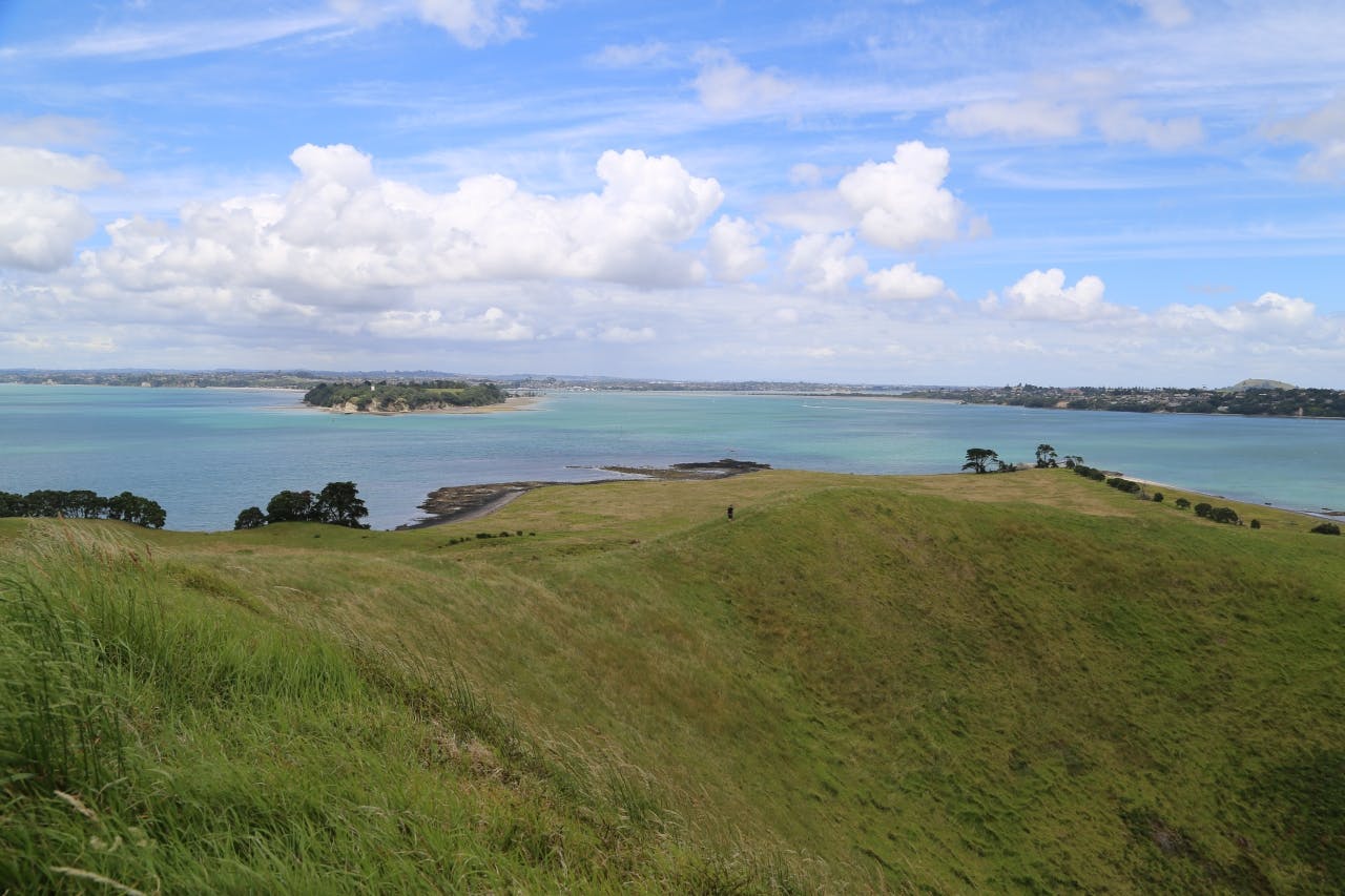
When we’d completed a circuit of the island, we headed to the summit. The long, bushy grass is easy to become entangled in and the walk up the hill was far more difficult than we imagined. It would have been easier to climb from Crater Bay, where a path leads right to the top.
Fortunately, the summit’s only 68m so it wasn’t long before we enjoyed panoramic views of Auckland City, Rangitoto Island, Motuihe Island and the deep crater below. The last volcanic eruption here happened 10,000 years ago and, standing on top without another soul in sight, it felt like having your very own Mt Eden.
We headed back to the kayak via an old dry stone wall and a beautiful little pond with a flowering pohutukawa tree at one end.
The wind had picked up, making for a bumpy ride back and by the time we reached Okahu Bay, wind battered and with aching arms, we were more than ready for a beer at Mission Bay.
– Matthew Pike
