Train travel has a romantic aura that usually doesn’t survive a scrutiny of the costs and the timetable. It hasn’t always been like this – once the railways provided not only transport but also unofficial accommodation to pioneering climbers. The great John Pascoe once said, “Our debt to the railways was incalculable”.
Recently I too was indebted to the railways when I drove to Arthur’s Pass from Christchurch for a traverse of Mt Bealey, Lyell and Avalanche Peaks; I used the station car park – it’s perfectly placed for such a trip.
As I left the station a light southerly was all that remained of the previous day’s front. This chilled the air and drove away any residual cloud from the tops. Walking south to the start of the Mt Bealey Track I had tantalising glimpses of the ridge between Mt Bealey and Lyell Peak. Although only a scant 3km away on the map, the ridge was also a substantial 1100m higher.
Once over Rough Creek, I turned into the bush and lost sight of my objective. The track through the beech forest does not meander and I was quickly into my work. The myriad of tree roots provide a staircase to the bushline, so although the gradient is steep, walking was efficient and, in the cool morning air, felt fast.
The bush line transitioned into subalpine plants abruptly at 1350m; away from the trees I was exposed to the wind and cold. But the joy of moving freely towards the ridge, stark against the blue morning sky, forbade stopping for even a moment. Above the bushline, the gradient eased and there were no route markings other than a path trodden by those who had gone before me. The path was bordered by low alpine plants; those that can survive where the beech can’t. Before long they too gave up their attempt to colonise the mountainside and I was left to pick my way through shattered rock.
A departing train sounded 700m below. In a romantic reverie I conjured a group of fellow outdoor devotees disembarking for a perfect day in the mountains. Most likely it was a freight train carrying West Coast coking coal destined for the steel furnaces of Asia. At 1600m, the gradient steepened to gain the lower peak of Mt Bealey; from there a narrow ridge led to the 1836m summit proper, 600m away.
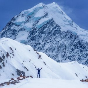
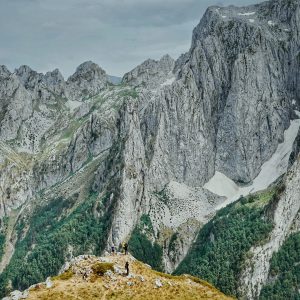
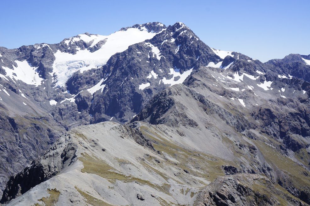
Looking north from Mt Bealey, I clearly saw my route over the three peaks that outline the headwaters of Rough Creek. Initially, the ridge rose and fell beneath my feet like the spiny back of some prehistoric creature until it reached Lyell Peak, 1828m. It then became more benign; broadening and levelling out before the final 200m to the summit of 1833m Avalanche Peak. It was a straightforward traverse, not difficult at all, and took just 90-minutes to reach the summit of Avalanche Peak.
This was an excellent place for lunch; a point reinforced by the presence of 15 other individuals who, like me, were replacing kilojoules burnt up during the ascent from the township 1096m below. After a solitary morning it was both a shock and heartening to encounter so many people actively enjoying the mountains.
There were two options to descend, either the Avalanche Peak Track that ascends directly and brutally from the township, or the gentler Scott’s Track. I chose the latter, and would have taken it too, had I not missed the turn off soon after dropping off the summit. Consequently my fate was a very steep and sometimes rocky descent. I consoled myself that I would reach SH73 700m closer to my car.
Back at the car my obligation to the railways came to an end. Pity, it would have been nice to have extended it to a cup of tea in a Crown Lynn tea cup – that’s something you don’t get in a private motor car.
– George Moran

34 years of inspiring New Zealanders to explore the outdoors. Don’t miss out — subscribe today.

Questions? Contact us