Mount Cargill Walk, Dunedin
At 676m, Mt Cargill is one of the hills that dominates Dunedin’s skyline. The track up it, begins by meandering through a popular picnic area before crossing Lindsay Creek and starting to gain height with a vengeance.
The initial section passes through a pine plantation, and is crisscrossed with death-defying but popular mountain bike tracks. As we ascended, the flora changed and pines were replaced with native forest, with broadleaf or kapuka prominent. This is the species which gives Cargill its Maori name, Kapukataumahaka, which refers to the snaring of pigeons as they ate kapuka berries.
As the surrounding forest became subalpine in nature, Mt Cargill appeared, capped with its imposing television transmitter tower. We still had quite some height to gain, but at least the gradient was easing. After 45min, we found ourselves at a track junction in a saddle. We went right, heading for the Organ Pipes, a collection of basalt columns of volcanic origin.
Five minutes on, a sign indicated a detour up a rough track to Buttars Peak. This is a side trip that I can’t resist. The peak – more a raised rocky outcrop some 200m across – is of similar volcanic origin to the better known Organ Pipes. To the west is Mt Cargill (676m), which was shrouded in mist on the day we visited. On a clear day, there are great views to be had in all directions.
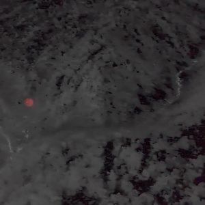
I recall a bone-chilling visit to Buttars Peak on assignment with Wilderness’s roving editor Shaun Barnett. It was pre-dawn on a bitterly cold July morning. Artistic requirements dictated that I took a precarious pose atop a rock outcrop, braced against the fierce, biting nor’easter while Shaun huddled in a sheltered nook working magic with his camera. The resulting photos were great, but I was glad when we got moving again. On another occasion, I sat here on a search and rescue training evening, acting as a checkpoint as I waited for teams to arrive. It was a cloudy night, but from time to time a gap would appear and a shaft of moonlight would highlight a section of the landscape.
Returning to the main track, we descended towards the slopes of Mt Holmes (575m), dropping down some slippery boardwalk sections to reach the Organ Pipes. I’m sure they’ve got smaller over the years, with the large mass of rubble at their base growing correspondingly larger. Erosion, earthquakes and vandalism take their toll over time.
Returning the way we came, we skirted the flanks of Buttars Peak. At the junction, we eschewed the ascent to Mt Cargill as the top was now fogged in. On a good day, it’s a sharp 20 minute climb up some enormous steps to join the A H Read Track, which is named after the publisher, perhaps best known for his length of the country walk at the age of 85. He used to ascend Mt Cargill on his birthday each year.
It was a quick and straightforward return to Bethunes’s Gully. Anne-Marie had commented on the silent bush on the way up, so it was pleasing to encounter tuis chortling and the swoosh of low flying kereru overhead as we descended.
– David Barnes