Moki-Rerekapa Loop, Moki Conservation Areas
The Forgotten World highway snakes its way from Taumaranui to Stratford through the Tangarakau Gorge. This is backblocks New Zealand, and the perfect place to lose yourself for a weekend.
A good option is to take your bike or boots and head for the splendid isolation of the Moki-Rerekapa Loop. Previously known as the ‘Mythical Moki’, this trail in the wilds of Taranaki is a big adventure. The two tracks enable you to complete a circuit of 45km on your mountain bike, or 31km if you perambulate and utilise vehicles along the roads between entry and exit points. Since the tracks are some 12km apart at the western end but only 3 km at the eastern end, we decided to walk the Moki from west to east, and return via the Rerekapa. However, we needed to arrange to have a car waiting for us when we came out.
Both routes are easy enough to follow, but fairly remote, rugged in parts, and likely to have some debris on them. In the wet, the mud of the farm roads can be sticky and overgrowth may keep you drenched. But elevation only once exceeds 300m.
The Moki Track (18km) traverses the Moki Conservation Area, generally following the south bank of the upper Waitara River and joining the eastern and western ends of the unformed Moki Road, which was originally a pack trail from Uruti to Tahora.
The track began as a surveyed road alignment to service the rehabilitation farms of soldiers after the First World War. Accordingly it follows generally easy grades, and is levelled along most of its length – work done by wheelbarrows, picks, and shovels as early as 1910. Three farms were established and the remains of two homesteads can be seen near the eastern end. Land that was cleared of bush is now regenerating.
The track begins with 3.5km of gravel road and 4WD track culminating in a short but cool stock tunnel cut through a papa cliff. Shortly after, the forest, which contains good stands of tawa, kamahi and rimu, is entered. The surrounding terrain was rough and we were glad of the suspension bridges which cross five of the deeper chasms. A dozen or so wooden bridges also show DOC’s commitment to the track, but there appears to be little regular maintenance done on it. More farmland and a final airstrip led us the eastern end. Turning left onto Mangapapa Road, the DOC camping ground was reached fairly quickly, but its somewhat small size, and shaded aspect, made the adjacent rest area (with toilets and barbecue) a much more attractive place to stay overnight. Display boards gave information about past milling in the area, accompanied by rusting relics.
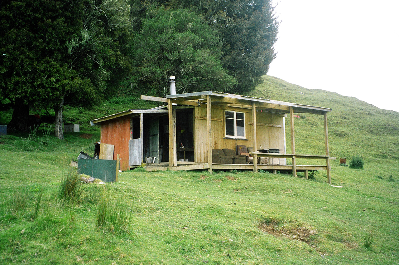
The Rerekapa Track (12km) began 400m north of the picnic area. The Moki Forest here has been logged but not cleared. A quaint DOC hut, complete with heated bath, ushered us on to the Irwin farm. We followed the fence line past dilapidated buildings to a former homestead site and the 10m-high Rerekapa Falls. Beyond the boundary fence, the track wound its way to the headwaters of the Waitara River and Rerekapa Hut. A short while after we climbed through undisturbed tawa and kamahi forest to a low saddle from where we skirted the base of a ridge and headed down to cross Blackett Creek. Large orange blazes guided us through open paddocks to Kiwi Road and our waiting car.
If you want to truly ‘get away from it all’ experience, the Moki-Rerekapa is a great choice. You’re unlikely to encounter other trampers or riders – indeed, its very remoteness is one of its strongest attractions.
– Phillip Donnell