Image of the March 2012 Wilderness Magazine Cover Read more from the
March 2012 Issue
Home / Articles / Wild Trips

Wander up the Waimak

Good snow conditions, heading towards the col. Photo: Christy McKessar
Time
9-11 hours
Grade
Moderate
Access
From SH73, turn off opposite the Klondyke Shelter. Follow the gravel road 1km to a small parking area at the end
Map
Topo50 BV20
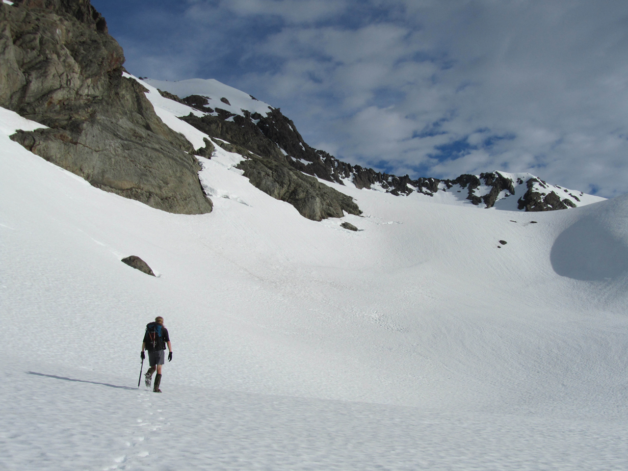
Waimakariri Col, Arthur’s Pass National Park

After an early morning departure from Christchurch, we arrived at Klondyke Corner with blue skies and a light morning breeze. It was the third trip of what has become an annual event with old school friends. Our party of four was planning a crossing of Waimakariri Col, a diverse route consisting of river flats, beech forest, waterfalls, alpine basins, rugged scree slopes and spectacular views.

We set out up the true left of the Waimakariri River, the moderate water level allowing us to cross the intermittent braids without difficulty. Although frequently described as a ‘hard slog’, we made quick progress, enjoying the views up the wide valley towards the Shaler Range.

Carrington Hut was reached in perfect time for lunch, and we wasted no time in removing wet socks and boots, and turning the sunny deck into a pleasant lunch stop. The hut, originally built in 1929, was named after keen tramper Gerald Carrington who sadly drowned in the Waimakariri during the early stages of the hut’s construction.

From Carrington Hut, we continued up the Waimakariri on the true right, the route alternating between tracked beech forest and open riverbed. Taking our time, we enjoyed the sun and scenery, and were delighted to see the flowering Mt Cook buttercup in its full glory. Being a mid-week trip, we were surprised to see three other small parties making their way back from the Waimakariri Falls Hut, and wondered if, in fact, we may not have the six-bunk hut to ourselves. As the gradient increased, we climbed up towards the lower of the two major falls, stopping at the viewpoint to glimpse them, as they were otherwise obscured from sight by bluffs.

Just before scrambling up to the tarn-spotted tussock basin of the Waimakariri Falls Hut, the track crossed a short swingbridge, and we arrived at the hut to find we had it to ourselves after all. The basin captured the afternoon sun, and the remainder of the day was spent relaxing, exploring, and catching up, before preparing the pièce de résistance of our dinner: freshly prepared guacamole to accompany our otherwise standard fare of nachos. Anticipating our early start, we retired while it was still light outside and were serenaded to sleep by the sound of the waterfall as it tumbled over the lip beside the hut to the gorge 80m below.

We were up before first light and soon donned crampons and ice axes. The freezing temperature gave us incentive to press on as the first rays of sun crept onto the summit of Mt Murchison, the park’s highest peak. Despite the icy crust, some sections still involved step-plugging as we made our way towards Waimakariri Col.

Following the route guide, we made our crossing to the west of Pt1845, below Mt Armstrong Glacier, rather than across the actual col itself. We were rewarded with a breathtaking view of snow-capped peaks poking their heads out of the fogshrouded valley. With the view came a feeling of trepidation, as we knew our route out involved descending into that same fog.

From here, a thick covering of snow made downhill travel easy and we glissaded to our hearts’ content down the steep basin. As the snow thinned out, we packed away crampons and axes and began the long sidle across scree slopes, scrub and tussock, high above the true left of the Rolleston River. It didn’t take long to reach the fog, thick enough that we couldn’t see from one cairn to the next, making navigation difficult. We made the decision to take a break, hoping that the sun would clear it away. After an hour with minimal change we decided to press on, continuing our sidle and eventually dropping below the level of fog.

At the northern end of the slope, we descended down some scree into the riverbed, before picking up a marked track downstream, on the opposite side of the river. Despite it being a rough track, it felt like bliss after the terrain of the previous few hours. When the track ended, we were back in the riverbed, boulder hopping down the last section to the rail bridge and gravel road.

We reached SH73 with wide smiles on our faces, despite the long, somewhat arduous day. But knowing the memories we would keep of this beautiful trip, it only made it seem more worthwhile. And we had yet one challenge to face: hitching a ride, sodden boots and all, back to the car.

– Christy McKessar