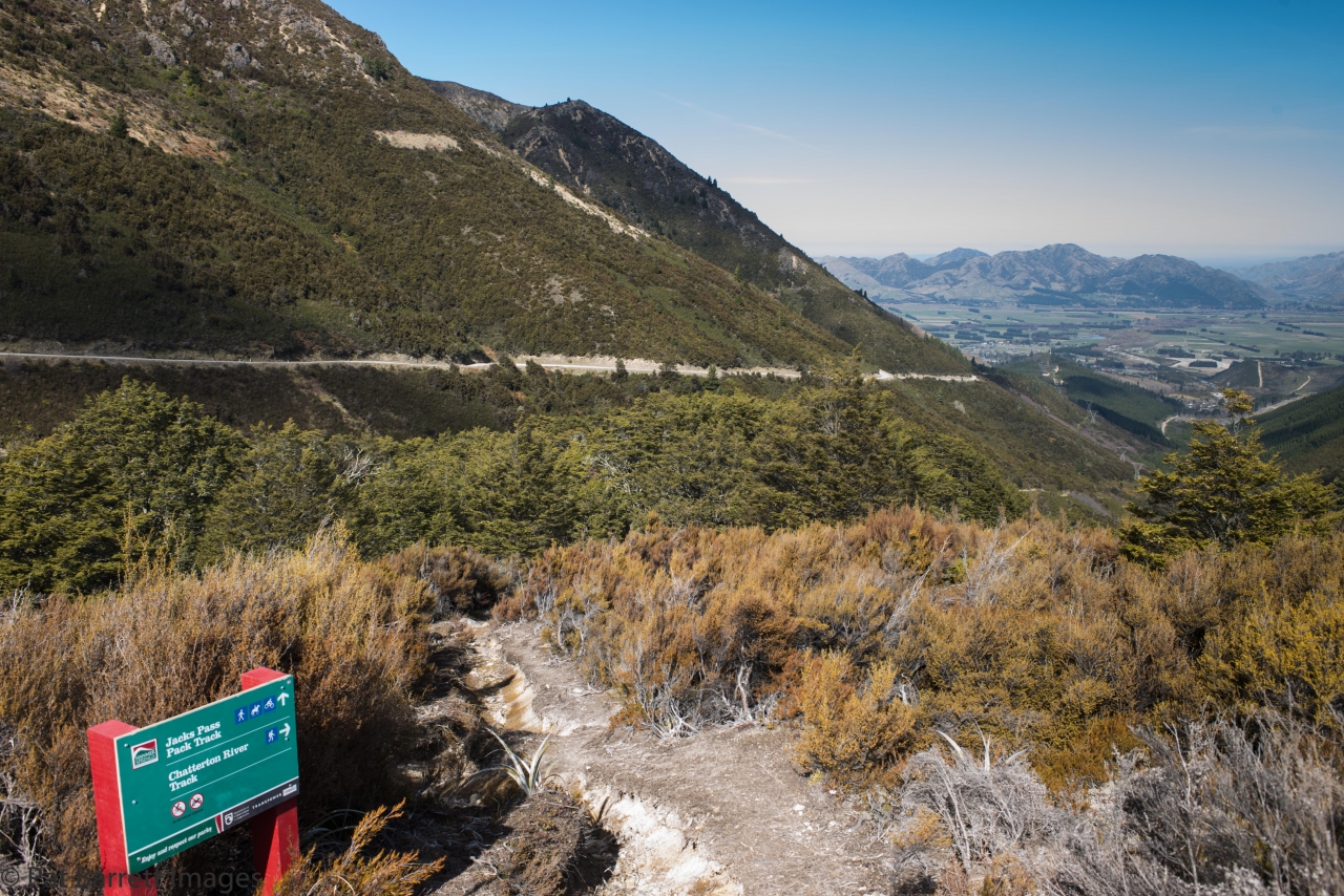
Mt Isobel via Chatterton River Track, Hanmer Forest Park
Mt Isobel dominates every angle of Hanmer Springs and is arguably Canterbury’s most climbed mountain. There are several routes to the summit with Chattertons Track to Jacks Pass offering an interesting short forest walk not often on the radar of those who visit the mountain retreat..
This river trail, beginning not far north of the motor camp in the Chatterton Valley, is an easy introduction to what could be termed a tramper’s track, yet still with enough aids, like footbridges over some of the stream crossings, and a well marked trail winding into the upper valley.
The first section of the track is through scrubby vegetation, but as you penetrate deeper into the valley, native forest begins to predominate and the river takes on a more scenic aspect, particularly as you climb the higher flanks of the valley further up the hill. At these points, the forest is occasionally rolled back and a view can be obtained of the complete catchment and distant Hanmer Plain. The valley also begins to take on a sense of isolation and seclusion, aspects you don’t find in the more popular tracks of Hanmer Forest, making this track something special among the diverse range of walks on offer here.
At the upper end of the track, the route climbs the south face of Jacks Pass via a steep rib where it again passes into open country with views of the craggy bluffs sprouting from the south side of Dumblane, 1303m.
Sheltered gullies packed with communities of native ferns can be seen and walked through, as the track makes the final climb out of the forest zone into the sub-alpine environment of Jacks Pass, where there’s evidence of the drying effect of the nor’wester. The wind, which regularly howls through the pass, sucks moisture from the forest leaving a parched and desert-like soil and vegetation.
Jacks Pass, 860m, is flanked by Mt Isobel, 1342m, and Mt Dumblane and through it runs the Clarence Valley Road which leads to St James Conservation Park and Molesworth Station. Maukuratawhai, 1615m – a massive triangular-shaped peak – dominates the view to the north, along with its attendant summits at the southern extreme of the Crimea Range. Looking south is the by-now familiar view down Chatterton River to Hanmer Springs, while all around, on the pass, is a mixture of vegetation types taking advantage of either sun or shade, shelter or exposure. The resulting patchwork of colour and texture is fascinating.
From the pass, the summit of Mt Isobel is relatively easily reached. The track above Jacks Pass is home to numerous species of subalpine plants and hebes. The combination of native flora and spectacular views make this aspect of the mountain very attractive and worth exploring in its own right. Above the pass, the route winds up and over several small knobs, where there are more grand views, to reach the Mt Isobel Track junction. From here, there is a spectacular walk east along the crest climbing slowly to the summit. The view from the peak offers an extensive panorama of the Hanmer Basin, Waiau Plain, Organ and Hanmer ranges, and on into the Clarence Valley.
I returned down the Mt Isobel Track to Hanmer Springs and Clarence Valley Road to my car at the motor camp.